|
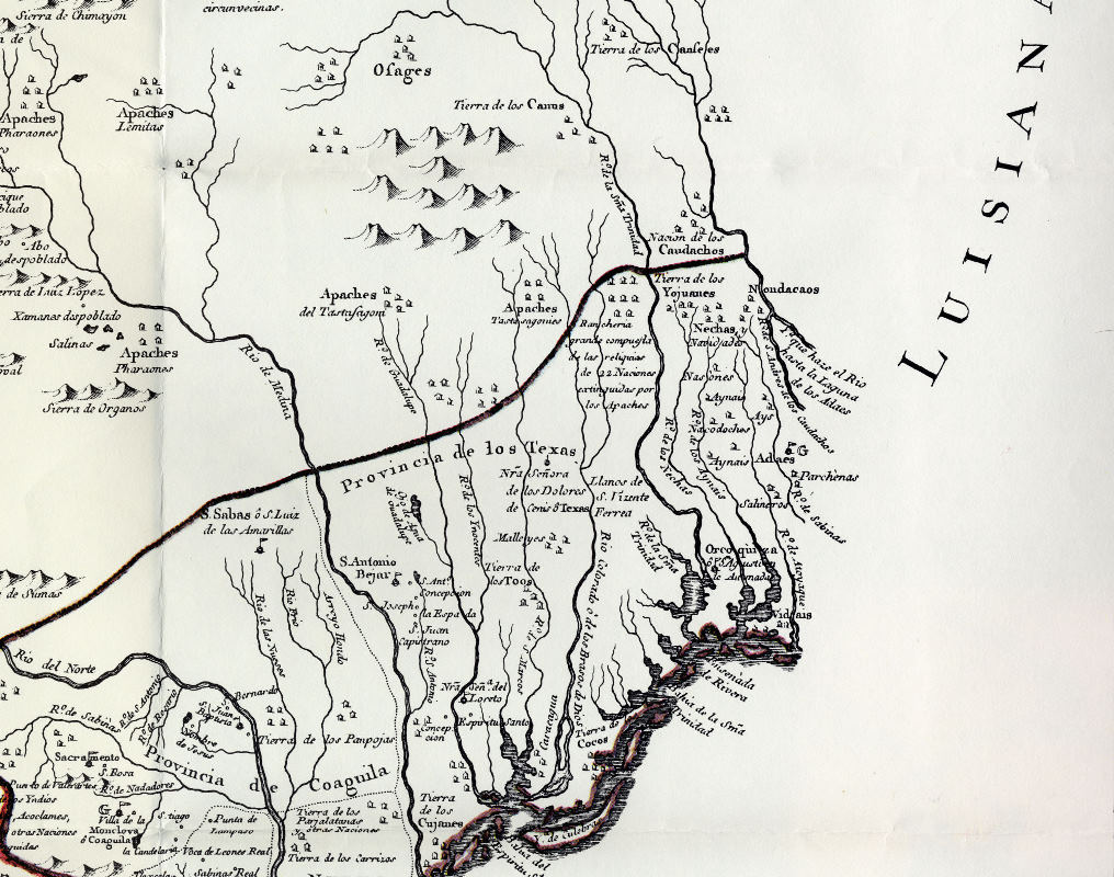
| Inset of 1768 map of Provincia de los Texas, showing locations of Spanish presidios and missions. In this cropped version, the proximity of Native groups of the upper coast is illustrated with Tierra de los Cocos (Karankawas) shown near the mouth of the Colorado River, the Orcoquiza (Akokisa) near the Neches, and the Bidai (Vidais) shown at the edge of the map near the border of Louisiana. “Nuevo Mapa Geographico de la America Septentrional” by Joseph Antonio de Alzate y Ramirez. |