|
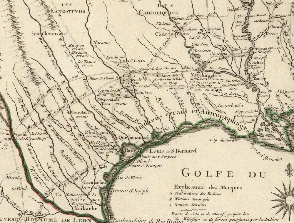
| Portion of a 1718 map of the eastern two-thirds of North America by Guillaume Delisle (also spelled de L'Isle and Lisle) depicts the location of the Ais (spelled Ainais) Indians in the approximate location where the Spanish built Mission Dolores along the route that became known as the Camino Real. This French map is one of the most accurate of the day. Map source: David Rumsey Map Collection. To see the full map and learn more about it see 18th-Century maps section of the Los Adaes exhibit. |