|
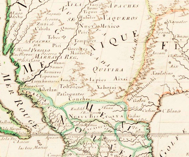
| This section of a 1669 edition of Amťrique Septentrionale, French cartographer Nicolas Sanson's famed 1650 map of the New World, shows how little Europeans knew about most of North America at the time. The Spanish mining town of Santa BŠrbara in today's north-central Mexico is shown. To the north of this neither the Rio Bravo (Rio Grande) or Río Conchos are depicted. Four native groups are shown that the Spanish had encountered in the La Junta region, including the Conchos, Patarabueyes, Tobosos, and Jumanos (French spelling somewhat different). Map Source: www.lib.virginia.edu/small/exhibits/lewis_clark/ |