|
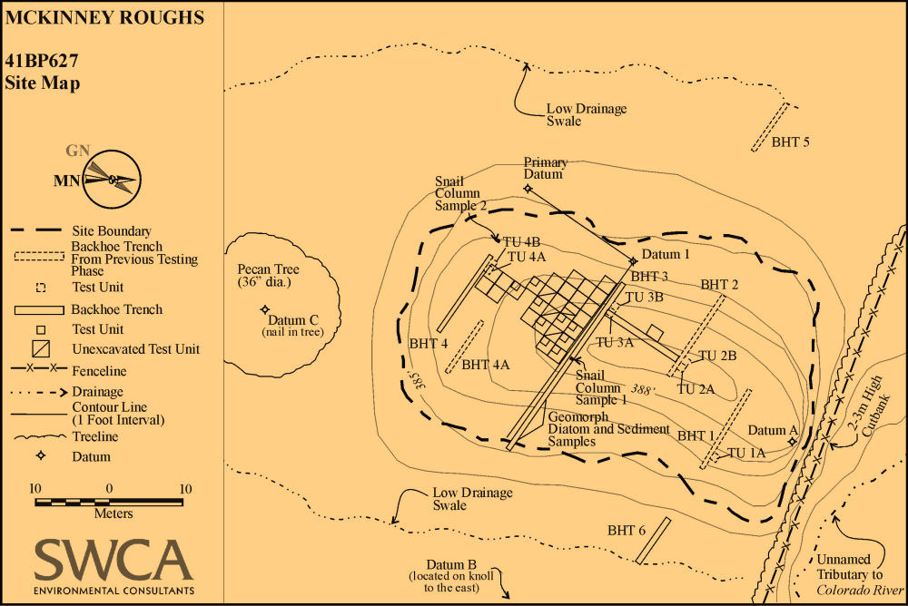
| Plan map of testing and data recovery excavations at McKinney Roughs, showing locations of backhoe trenches (BHT), test units (TU), and various samples. The circular contour lines denote the topography of the site, in this case, the knoll on which the site was situated. |