|
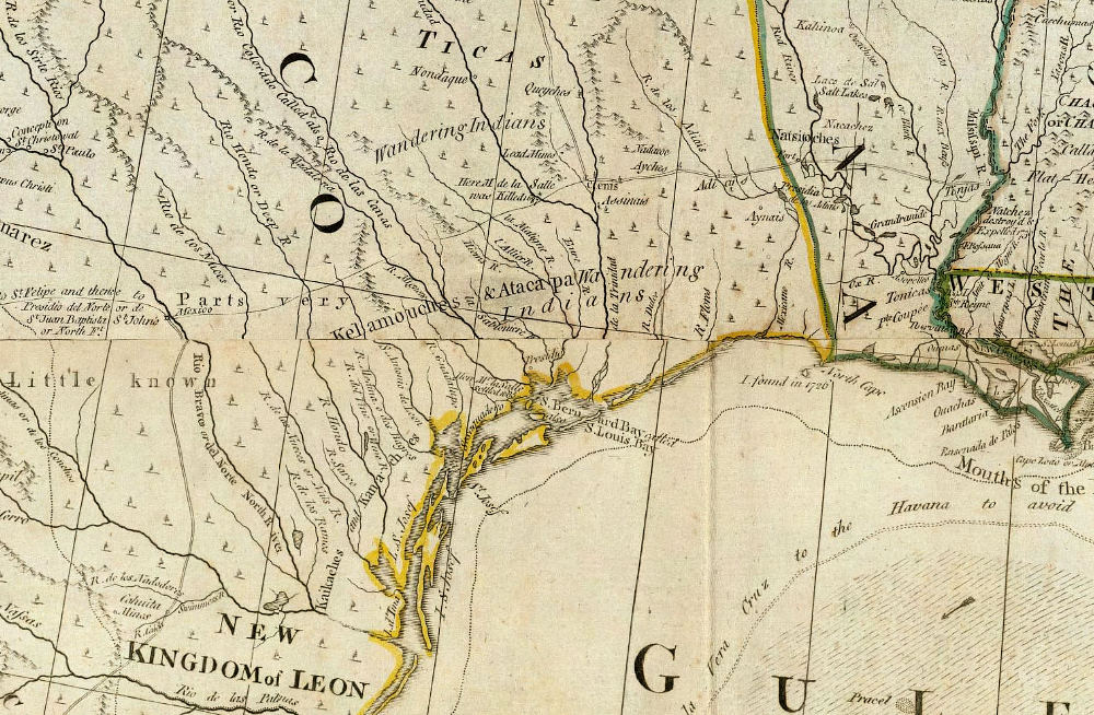
| Detail from 1776 map by British cartographer and publisher Thomas Jefferys. Most of what the British knew about New Spain came from maps, charts, and sketches captured from Spanish warships by the British Armada. Although the geography is distorted and the map was already outdated in many regards when it was printed, it does name the Atacapa as “Wandering Indians” in southeast Texas. Source: David Rumsey Map Collection. |