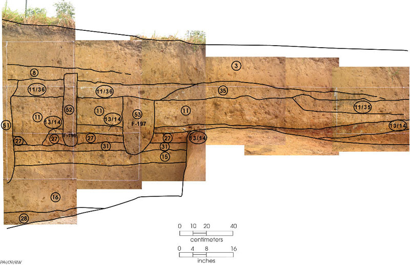
In this photograph, we’re moving out to where the mound is not very tall. We can still see the natural ground (Zone 16) at the bottom on the left side, but it is not visible on the right side because the trench was shallower there. Zones 15, 27, and 31 are the first layers of dirt the Caddo put down to make the mound. They may have put a special building, either a temple or a house for a religious or political leader, on what was then a very low mound and then dismantled it, but it is hard to know for sure because they removed most of these layers when they erected the building to the west (Zones 12, 13, and 14). Zone 13/14 is a burned surface outside this building and its adjacent low ridge. We surmise that the Caddo used this low outdoor platform for activities connected with what went on inside the nearby building. Zones 52 and 53 (F-198 and F-197) are a posthole and perhaps a pit that were dug from higher, later surfaces as the mound grew.