Back
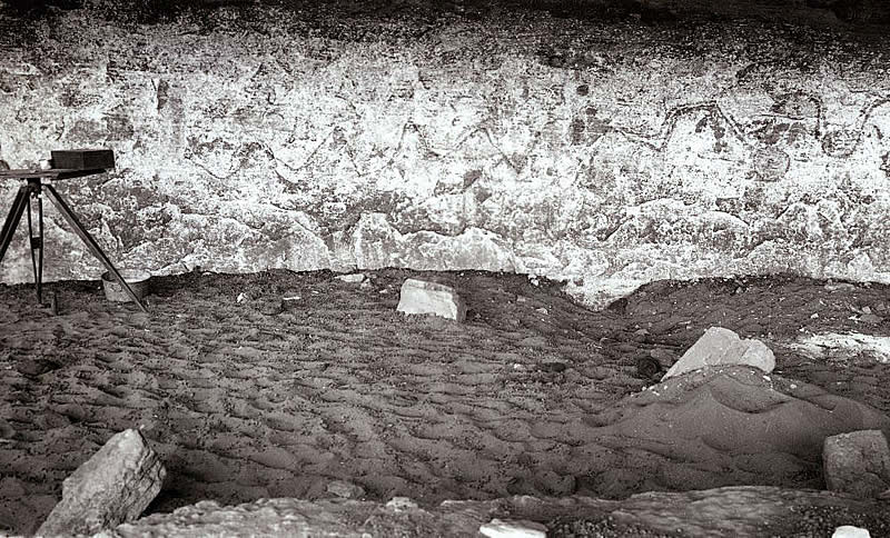
Upper end of Lehmann Shelter prior to excavation. The plane table and alidade on the far left were used for mapping the shelter, one of the first steps of any excavation project. Some of the faded pictographs are visible in the shelter wall. 1936 photograph, TARL archives.
Back