Delineating the House Foundation
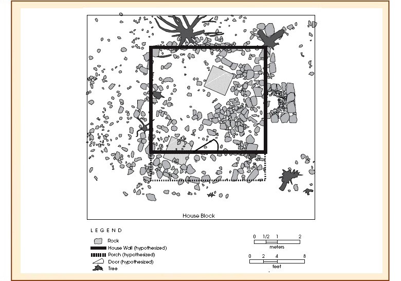
There were many large foundation stones that formed a roughly square pattern delineating the footprint of the old house. This map shows the patterning of large stones that allowed archeologists to hypothesize the overall size of the house and the locations of the walls. Based on the layout of the large rocks, we speculated that the Williams house was a single room dwelling measuring approximately 16x15 ft, for an interior space of 240 square feet. We also hypothesized that a porch area had been present all along the south wall, based on the wide zone of large rocks and the artifacts found in the southern rows of units.
It is notable that the typical size for single-pen log cabins in Texas, according to historian Terry Jordan, was 16x16 ft. These one-room dwellings seldom had partitions in them, but single-pen cabins often had lofts forming a short second floor where kids would sleep. Imagine the scene in 1895, when Ransom and Sarah lived in the cabin with at least seven kids and the two youngest were only 6 and 2 years old.
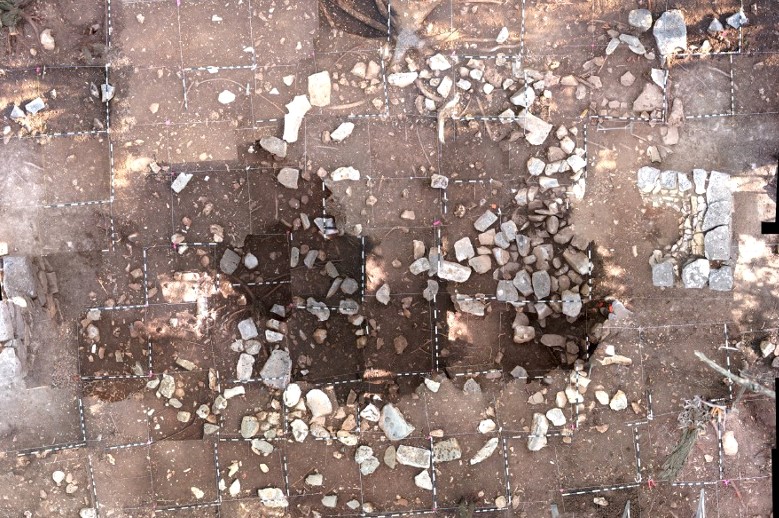
The map of the large rocks in the house block was not created using the traditional method of hand-mapping each of the stones within each 1x1-m unit. Rather, that map was created by exposing all of the stones and leaving them in place, and then taking a direct overhead digital photograph of each 1x1-m unit from a height of about 8 ft. A computer program was then used to stitch the 90 separate images together into one large composite image, shown here. From this image, an outline of each rock was traced on the computer to create the complete map of the large rocks in the house block show above. This method produced a much more accurate map than could have been done by hand mapping.