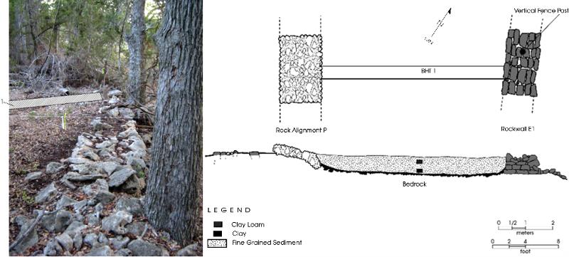
This line drawing and photograph depict the livestock pond within the corral complex. The drawing shows the plan and profile of Backhoe Trench 1, which was dug in this location because the presence of a filled-in pond was suspected. The photograph is looking north along Rock Wall E1, with the location of Backhoe Trench 1 shown.
The east end of Backhoe Trench 1 abutted Rock Wall E1, which effectively served as a dam for the pond. The west end of the trench ended at a concentration of limestone and chert cobbles called Rock Alignment P. Most of the trench fill was fine black clay that was notable because it contained no rocks or stones of any kind. This undoubtedly represents fine-grained upland sediment that washed into the open and eventually filled it in completely. The stones in Rock Alignment P are the natural cobbles that were found when the pond was originally dug by Williams, and he apparently piled them in an arc-shaped band around the west and north edges of the shallow pit.
There is no stream or spring on the 45-acre property. Lacking any natural water source, it would have been critical for Ransom Williams to dig a small livestock pond to trap rainfall runoff before it flowed off his property. It is likely that Williams planned the location of this pond and the livestock fences carefully before he started construction.