|
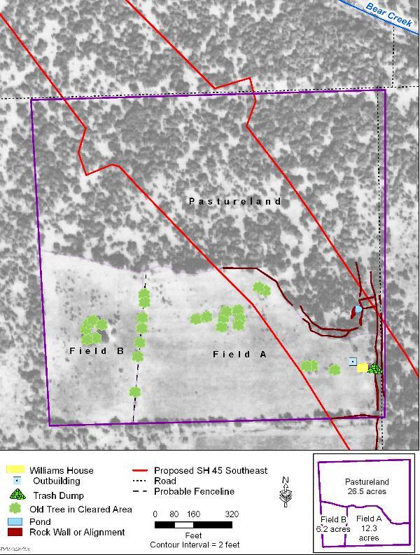
| The 45-acre Williams farmstead with key cultural features mapped on top of the 1937 aerial photograph background. The map shows that the southern half of Williams property consisted of 18.5 acres of cultivated land, divided into two fields. The northern part of the property was 26.5 acres of wooded pastureland, with the livestock pond and corral complex located in the southeast corner of the wooded area. Topographically, the location made perfect sense to incorporate the maximum drainage area for channeling rainfall into the livestock pond. The house location was judiciously selected because it was on the east side of the cultivated fields, where the family could watch over the fields and plant a garden nearby, but it was still fairly close to the corral complex and the livestock pond. |