|
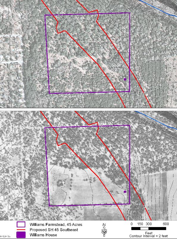
| Comparison of the Williams farmstead property in 2005 (top) and 1937 aerial images with topographic lines added. Note the housing development toward the west in the more recent photo, and the cultivated fields in photo taken some 65 years earlier. The 2005 photograph is from the National Agricultural Imagery Program, and the 1937 photograph is from Tobin International, Inc. |