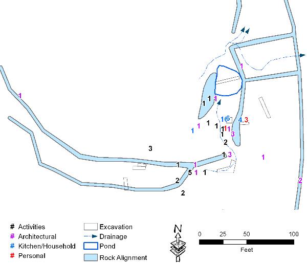
This image is a close-up map of the corral complex and it depicts the surface drainage patterns and the locations of surface-collected and metal-detected artifacts. The detailed mapping provided topographic evidence showing that the rock walls facilitated the drainage of water off the upland fields. The landscape analysis also shows that the livestock pond was dug in the best place to catch the maximum amount of natural runoff coming from the largest possible surface area.
Of 113 surface-collected and metal-detected artifacts found in the corral complex, only 64 could be assigned to functional classes and specific identifications. The Activities specimens include wagon hardware, horse harness parts, and hand tools (a pocketknife and fragments of 12-inch draw knife blade). Many iron barrel hoops were found, and these are presumably from water storage barrels that would have been transported regularly to and from Bear Creek on wagons. The Architectural artifacts are dominated by barbed wire fragments that were undoubtedly associated with remnants of the old wood post fences that had been added to the corral complex. Only two cut nails were found, and these were probably used before the turn of the century. Collectively, the Activities and Architectural artifacts are typical of the kinds of objects commonly used in areas where livestock was kept.