|
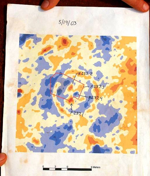
| Color printout of geophysical data centered on the suspected circular building (F237) with four internal roof supports and a hearth in the middle. This was used by the field crew in May, 2003 to guide excavations. The red-outline shows the excavation area, while the labeled internal features are designated F237.1, F237.2, etc. (The hearth is F237.4.) Photo by Steve Black. |