|
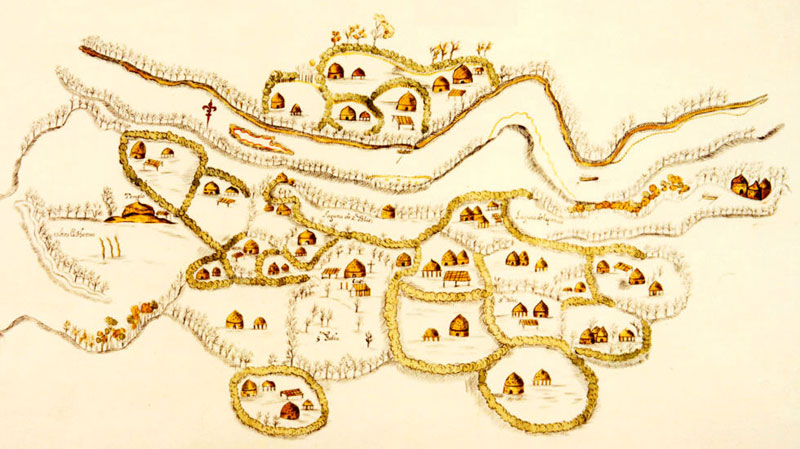
| Map of Upper Nasoni settlement on the Red River, produced by the Spanish expedition of 1691-1692, led by Terán del Rio. This village was part of the Cadohadacho alliance. The map shows that the community consisted of small farmsteads or extended family compounds, each depicted as being surrounded by rows of trees or bushes. On the left is a mound with a "templo" on top. The settlement shown is believed to have stretched along several miles of the Red River. Original (uncolored) map in the Archivo General de Indias, Seville. |