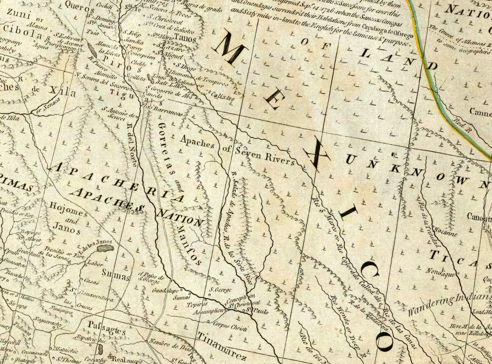
Trans-Pecos portion of 1776 map by British cartographer and publisher Thomas Jefferys reflects the inevitable geographic knowledge and publishing time lag of the day. Much of what the British knew about New Spain came from maps, charts, and sketches captured from Spanish warships as well as from published French maps. Although the geography and rivers are much less accurately depicted than the Alzate y Ramírez 1768 map, many more Indian nations are shown. Notice that the Apacheria (Apache-dominated territory) is shown spanning the Rio Grade (R. del Norte), the large size of the lettering showing the growing threat of the mounded raiders to the northern frontier of New Spain. Map source: David Rumsey Collection.