|
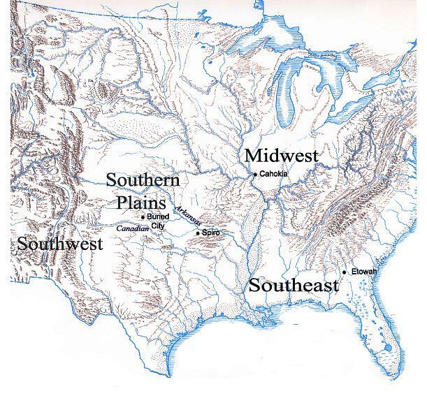
| Map showing location of the Southern Plains relative to the Southwest, the Midwest, and the Southeast. All of these regions had distinctive prehistoric cultural patterns. Early 20th-Century archeologists saw both parallels and differences between the regions. They speculated that the "most advanced" cultural elements such as earthen mound construction, agriculture, and sophisticated pottery may have been derived from the "high" cultures of ancient Mexico and then spread across North America. The map also shows the location of the Arkansas and Canadian River drainage systems and that of select sites mentioned in the text. Graphic by Justin Hays; base map by Erwin Raisz. |