|
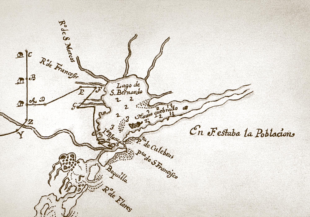
| Inset of circa 1689 map showing La Belle shipwreck ("Navío Quebrado, or broken ship) in what was then known as San Bernardo Bay (now Matagorda Bay). This and other historic documents helped guide 20th-century archeologists to the location of La Belle. Drawn by Carlos de Sigüenza y Góngora, the map shows discoveries made by the De León expedition, one of nearly a dozen major expeditions mounted by the Spanish by land and sea to find the French "intruder,"La Salle. Enlarge to see full map and location of French settlement, Fort St. Louis. Image courtesy of the Center for American History, University of Texas at Austin. |