|
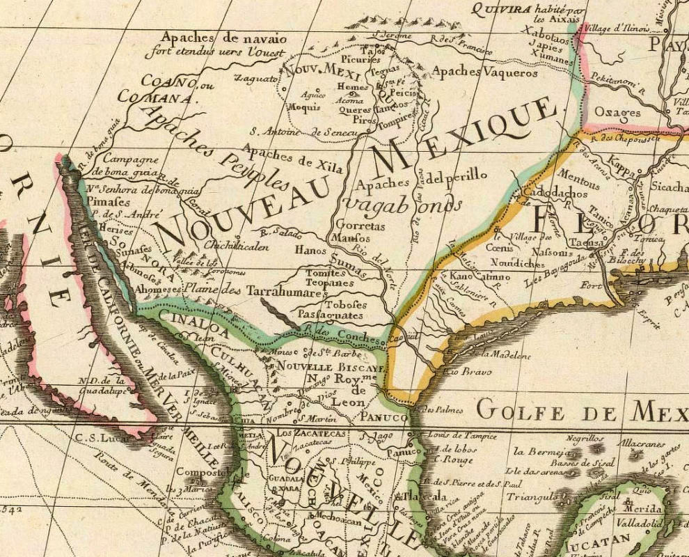
| Section of a 1700 map by French cartographer Guillaume Delisle (also spelled de L'Isle and Lisle) shows the gradually improving geographic knowledge of New Spain. Delise based his map on reports and maps from both French and Spanish sources. The Rio Grande (Rio del Norte) is depicted as is the Río Conchos, but their confluence is shown much too far to the southeast with the latter flowing in the wrong direction. The actual Conchos is probably depicted just below the Indian group name “Sumas,” but it is not labeled. Other Indian nations shown in northern Mexico include the Patarabueye, Tobosos, and the Tarahumara. Map Source: David Rumsey Map Collection. |