|
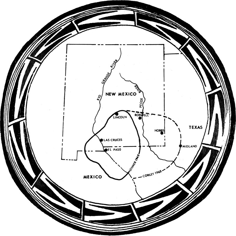
| This map shows the core area of the Jornada Mogollon as defined by archeologist Donald J. Lehmer in 1948. The dashed line shows the area sometimes known as the "Eastern Jornada" where other Mogollon-related pithouse villages and small pueblos are found that share many similarities with the La Junta villages. The map’s decorative border is adapted from an El Paso Polychrome bowl rim design. Courtesy of Pat Beckett. |