|
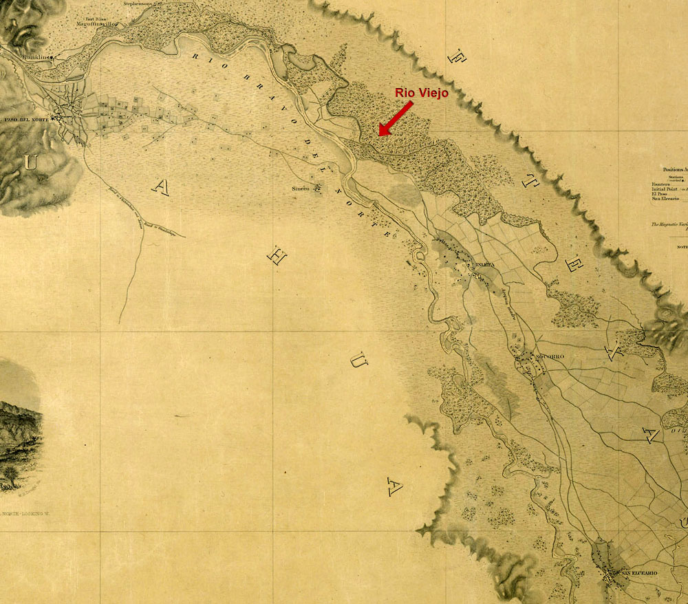
| Inset of boundary map between the United States and Mexico, reflecting changes under the Treaty of Dec. 30, 1853, as surveyed by William H. Emory, U.S. Commissioner in 1855. The movement of the Rio Grande to a new channel south of its original course (denoted as Old River or Rio Viejo) effectively brought the towns and missions of Ysleta, Socorro, and San Elizario into Texas and the United States. Map courtesy of National Archives. See larger version and full map. |