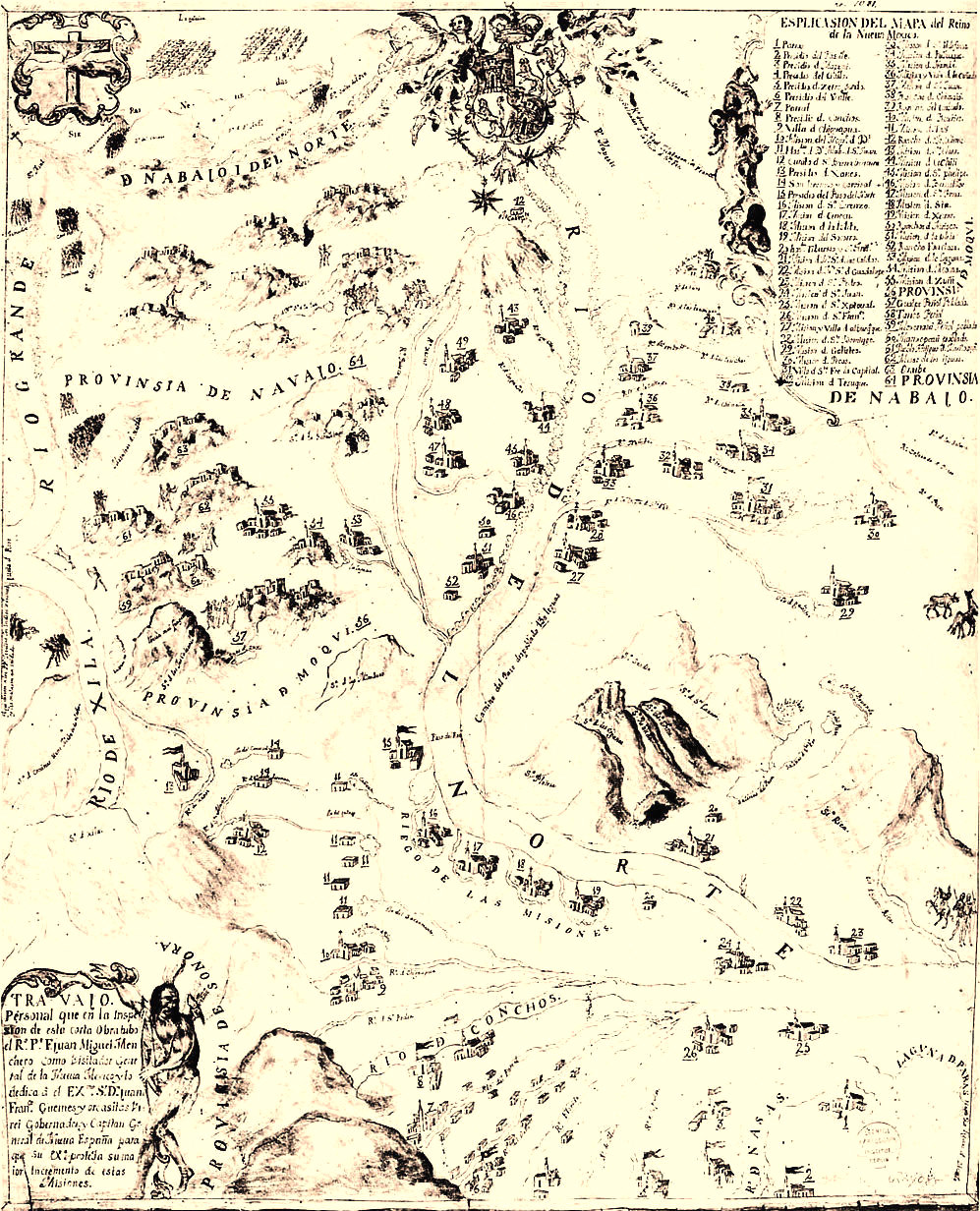
Inset from ca. 1740s map of New Mexico showing missions, presidios, and settlements along the Rio del Norte and El Paso valley (the label, Riego de las Missiones, refers to the irrigation canals emanating from the river). Shown are San Lorenzo (17); Ysleta del Sur (18); Socorro del Sur (19); Santa Maria de las Caldas (21) as well as the Presidio del Paso del Norte (15). The small structure shown as 20 may be Hacienda de los Tiburcios which was later the site of the Presidio and settlement of San Elizario. The map was drawn by Fray Juan Miguel Menchero following an inspection tour of the province during the 1740s.
Close Window