 |
|
|
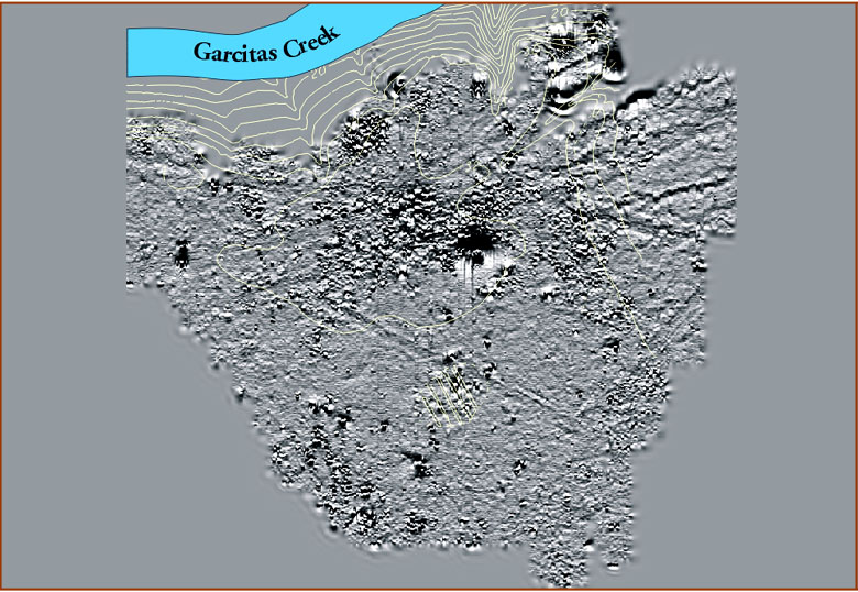
| This magnetometer map serves as the base for subsequent maps shown in this section. Here it is shown overlaid with a topographic relief map of the site. The yellow lines denote changes in elevation in the natural terrain, including the bluff overlooking the creek as well as the highest point on the site. Both Spanish and French structural traces were found in this high area. The magnetic ring in the central part of the map relates to a circular alignment of presidio structures around a plaza, shown as a relatively clean area on the map. The dark depression in this area is a modern feature, and the gray line across it is a modern ranch road. Graphic courtesy of THC. | |
|
|