X Back
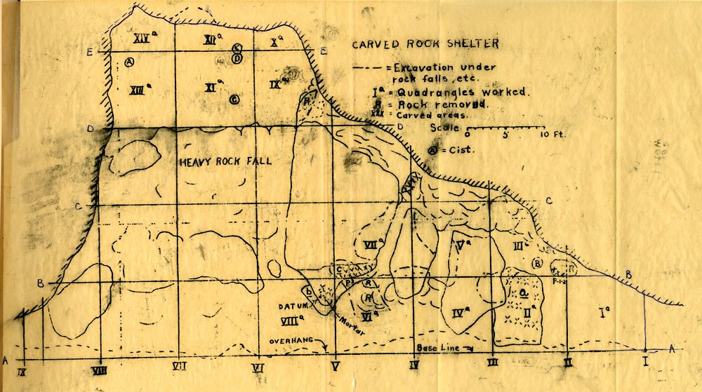
Map of the excavation plan of Carved Rock Shelter, hand-drawn by Victor Smith. He divided the shelter into 10ft˛ “quadrangles,” of which he excavated only the most promising, based on an earlier surface survey. The circled letters indicate the location of storage pits and the X’s indicate areas with rock carving.
X Back