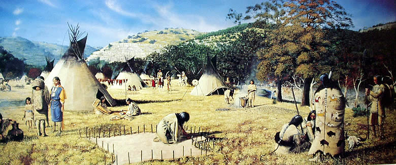
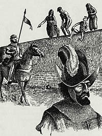
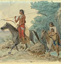
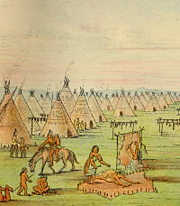
Apache Encampment in the Texas Hill Country by
George Nelson. The Lipan Apache were among several Plains tribes
pushed southward as pressure for land and resources mounted across
the western frontier. Image courtesy of the artist and the Institute
of Texan Cultures, University of Texas at San Antonio.
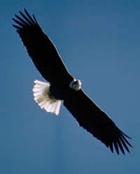
A bald eagle soars high above the
ground as it searches for prey. The eagle was revered
by many tribes, with the feathers a prized possession
used to adorn weapons or clothing of warriors and spiritual
leaders.
|
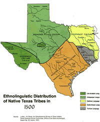
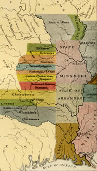
Approximate distribution of native
Texas tribes at the time of first contact with European
explorers in the early 1500s. Click to enlarge.
|
|
Spain applied the first destructive forces. Thousands
of the early native peoples did not survive the process
the Spanish called "reduction."
|
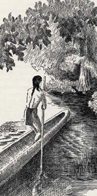
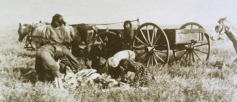
An Atakapan man skillfully maneuvers
his dugout canoe through an inland waterway. Though
few in number at the time of European contact, the Atakapans
occupied a wide swath of territory along the southeastern
Texas and Louisiana coast. While the more inland Atakapan
groups may have practiced farming like their Caddo neighbors,
the coastal groups drew heavily on marine resources.
Drawing by Hal Story (Newcomb 1961), courtesy of University
of Texas Press. Click to enlarge.
|
|
Long before the United States Army set foot
in Texas, disaster stalked the aboriginal peoples who lived
beyond the Anglo frontier. European-borne disease, intertribal
conflict, and diminishing resources had fatally weakened some
of the bands not yet obliterated. Indigenous cultures were
being crushed by forces coming from all directions.
The boundaries of modern Texas encompass vastly
different ecosystems and—on the eve of Spanish intrusion—each
region was home to different cultures. Among the major groupings
were the Caddoan cultures of the eastern forests, the Atakapan
and Karankawan people of the Gulf coast, the Coahuiltecan-speakers
of the southern Rio Grande plain, the Jumano of the middle
Rio Grande and central plateaus, and the Apachean people of
the High Plains.
Others would appear on the scene. The Tonkawa
and Wichita would migrate from the north under pressure. The
Comanche and Kiowa would push their way onto the southern
Plains a century after the early Spanish explorations. The
Cherokee and Kickapoo would come from the southeast as refugees
in the early 1800s.
The Spanish colonial efforts brought the first
destructive forces. Thousands of the early native peoples
did not survive the process the Spanish called "reduction."
Some were missionized or kidnapped into slavery in the silver
mines of central Mexico. Others were able to escape and to
be absorbed by other tribes. In the end, the Spanish reduced
these peoples more by disease than by religious conversion.
The sicknesses brought by Spanish missionaries
and French traders devastated entire villages. Outbreaks of
smallpox among the Coahuiltecans were widespread both north
and south of the Rio Grande in the winter of 1674-1675, wiped
out most of the Rio Grande mission population in 1706, and—along
with a measles epidemic—almost depopulated the San Antonio
missions in 1739. Unknown diseases were estimated to have
killed 3,000 among the Caddoan tribes in 1691, and additional
numbers in 1718. Mission Atakapans were stricken twice in
the 1750s. Karankawas suffered a "devastating scourge"
of measles and/or smallpox in 1766.
Some tribes were broken up by raiding Apaches,
who came to dominate the Plains by the end of the 1600s. The
earliest encounter between Spaniards and Apache groups had
occurred in 1541, in either the northeastern portion of modern
New Mexico or the panhandle of modern Texas. Francisco Vasqez
de Coronado gave the name "Querecho" to the people
he met there. A later exploration led by Vicente de Saldivar
Mendoza in 1599 encountered bands and villages ("rancherias")
of people that Mendoza termed "vaqueros." These
people were bison hunters, and as the Spanish had no concept
of bison other than as cattle, they characterized the woolly
animals as "vacas."
By the time the Spanish began to establish settlements
in the upper Rio Grande valley, the native puebloans had a
brisk trade going with the Plains people. The vaqueros brought
buffalo robes, meat, and tallow in exchange for cloth, pottery,
maize, and small green stones. But the Spanish tried to control
the trade, and by the mid-1600s were making captives of the
Plains Indians for use as slaves in the mines of Mexico. Thus
began a long period of hostility between the Spanish and the
Plains Apache.
The Spanish categorized the Apache of New Mexico
into western and eastern branches. The easterners included
bands that had become closely associated with the Pueblo communities
such as Pecos and Taos, as well as bands who lived farther
out on the Plains. Historians believe the Plains people included
the groupings that later became known as "Kiowa Apache
and "Lipan Apache." Both were displaced by the people
the Spanish called "Comanche."
|
Jumano Indians standing atop the
walls of their pueblo watch the arrival of Spanish explorers.
According to explorer Hernán Gallegos, who crossed
the Texas Trans-Pecos and middle Rio Grande region in
1581, the early farmers greeted them with "great
merriment." Drawing by Hal Story (Newcomb 1961),
courtesy University of Texas Press.
|
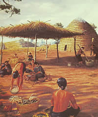
The Caddo of the East Texas forests
lived in beehive-shaped huts in expansive villages and
farming hamlets. These complex tribes were devastated
by European diseases in the 1700s before they were moved
to a Brazos River reservation and finally into Indian
Territory. Inset of painting by George Nelson, courtesy
of the Institute for Texan Cultures, the University
of Texas at San Antonio. Click to enlarge.
|
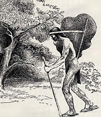
Coalhuiltecan carrying a burden.
The south Texas Indians subsisted as nomadic hunters
and gatherers in one of the harshest areas of the state
prior to being "missionized" by the Spanish.
Drawing by Hal Story (Newcomb 1961), courtesy of University
of Texas Press.
|
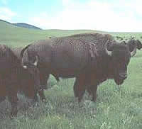
Buffalo on the Plains. The Spanish,
having no knowledge of the shaggy beasts, thought them
to be cattle, and called them "vacas." From
this the term, "vaquero," was derived.
|
|
|
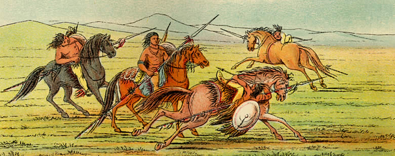
Comanche feats of horsemanship. Frontier artist
George Catlin, traveling with an expedition of U.S. Dragoons across
Indian Territory in the 1830s, visited several encampments of Comanches
and observed a variety of their activities. The Indians' skill at
horsemanship, from capturing and breaking the wild mustangs to harnessing
them toward their needs—for hunting, hauling their camp equipment,
and making war—was a source of amazement to Catlin. Read
his observations about their riding skills. |
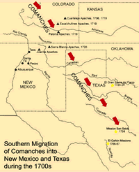
Paths of the Comanche into Texas
during the 1700s. Adapted from Betty 2002.
|
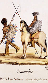
Comanches of West Texas in war regalia.
The Comanches are a Shoshonean people who, in the 1700s,
migrated to Texas from the area that is now Colorado.
Painting by Lino Sánchez y Tapia, circa 1830s.
Courtesy of the Gilcrease Museum, Tulsa.
|
Comanche chief "Ee-shah-ko-nee"
(the bow and quiver). From Catlin 1926. Click to enlarge.
|
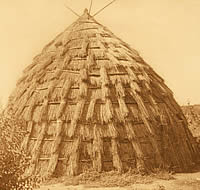
Wichita
grass house. Photo by Edwards S. Curtis circa 1927. |
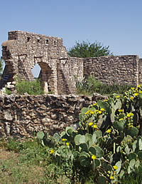
Ruins of Presidio San Sabá,
the Spanish fort constructed to protect the nearby mission
and its Indian refugees in the Texas Hill Country. Both
the presidio and the mission efforts failed. In 1758,
a band of Comanche, Tonkawa, and Wichita sacked and
burned the mission that had provided short-lived refuge
for the Lipan Apache.
|
|
The Comanche are a Shoshonean people who migrated
from the north to the southeastern plains of modern Colorado.
The name, "Comanche," is believed to be the Spanish
derivative of a Ute word meaning "someone who wants to
fight with me all the time." The first Spanish sighting
of Comanches in New Mexico occurred in 1705. Less than 15
years passed before the newcomers began to unsettle New Mexico's
northeastern frontier with attacks against the pueblos and
Apache rancherias. The Comanche then embarked on a complicated
50-year pattern of alternately raiding the Spanish and trading
with them, but their attitude toward the Plains Apache was
unremittingly hostile.
By the mid-1700s, the Comanche had shattered
the Apache presence in eastern New Mexico. Some villagers
left the Plains and withdrew to the relative security of the
pueblos. Others retreated to the east in the face of the Comanche
onslaught. In 1724, Comanches were reported to have defeated
a force of Plains Apaches in a nine-day battle somewhere in
northwestern Texas called El Gran Sierra del Fierro.
Comanche movement onto the southern Plains was
in a generally southeastern direction throughout the 1700s.
The deeper the migration moved into Texas, the more it pressured
the Lipan, who occupied the Edwards Plateau. The Lipan adjustments
brought them into contact with the Wichita and Tonkawa in
the vicinity of the Cross Timbers to the east.
The Spanish had discovered Wichita villages
in 1541, then again during Juan de Oñate's expedition
in 1601. The explorers found many large settlements dispersed
along rivers and streams in an area encompassing the south-central
portion of modern Kansas and the north-central portion of
modern Oklahoma. These settlements began to be moved southward,
beyond the reach of raiding Osage Indians, who in the early
1700s were being supplied with guns by French traders.
Oñate's expedition also had encountered
the Tonkawa, in either the region of the modern Oklahoma panhandle
or the south-central portion of modern Kansas. There appear
to have been two groups of Tonkawa speakers by the late 1600s,
one located along and north of the Red River in modern Oklahoma
and the other along and between the Brazos and Navasota rivers
in Texas. By the mid-1700s, some Tonkawa had begun to congregate
at a large settlement, known as the "Rancheria Grande,"
on the San Gabriel River of central Texas.
The Rancheria Grande was a haven for a number
of disparate aboriginal groups driven from their homelands.
In 1748, the Spanish established a mission and presidio on
the San Gabriel to protect the Rancheria Grande refugees from
Lipan raids, but Spanish protection proved illusory, and the
mission was abandoned in 1756.
The Tonkawa then allied themselves with the
Wichita, which in turn brought them into a short-lived alliance
with the Comanche with whom the Wichita traded and shared
a hostility toward the Plains Apache. In 1758, a force of
Comanche, Tonkawa, Wichita, and representatives of other tribal
groups attacked a Spanish mission established for the Lipan
on the San Saba River.
To replace the San Saba mission, the Spanish
established two others for the Lipan in the El Canon area
of the upper Nueces River west of San Antonio. These immediately
fell prey to Comanche raiding parties. The wedge of Comanche
advance split the Lipan. Some, who became known as "upper"
Lipan, would gravitate toward the southwest, into the range
of their Mescalero Apache kinsmen. The "lower,"
or "southern," Lipan moved south and east, to the
fringes of the Edwards Plateau and beyond.
Meanwhile, Wichita groups moved from above the
Red River into the middle Brazos and upper Trinity River valleys.
The Wichitas' ever-deeper intrusion into Tonkawa territory
ended the brief period of amicable relations between the two
tribes. The Tonkawa slid southward in response, and with their
former Lipan enemies formed a new trade relationship with
southeastern tribes and the French in Louisiana.
The Comanche extended their control of the southern
Plains—soon to be called "Comancheria" by the
Spanish—onto and beyond the Edwards Plateau by the end
of the 1700s. They secured their western flank and profitable
trade relationships in 1786 by entering into a truce with
the Spanish in New Mexico. About 1800, they absorbed a threat
coming from their northeast by entering into an historic truce
with the Kiowa, another tribe of Plains raiders.
|
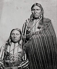
Comanche braves. Photo, circa 1867-1874,
courtesy of the Center for American History (#01355),
The University of Texas at Austin.
|
|
In the early 1700s, the Comanche embarked on a complicated
50-year pattern of alternately raiding the Spanish and
trading with them, but their attitude toward the Plains
Apache was unremittingly hostile.
|
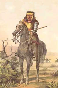
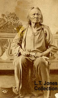
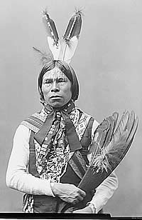
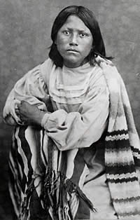
Lipan Apache warrior, drawn ca. 1858
during a U.S. Mexican border survey.
|
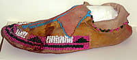
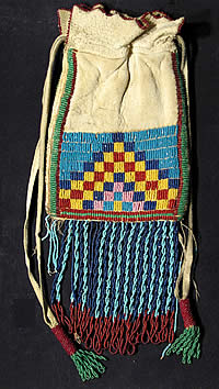
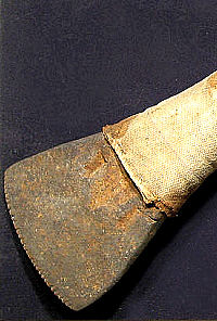
Tonkawa beaded moccasin from Fort
Griffin area, north-central Texas. Courtesy Fort Griffin
SHS. Photo by Lester Galbreath.
|
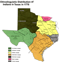
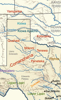
Approximate distribution of Indian
groups in Texas, circa 1776. Click to enlarge.
|
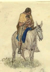
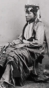
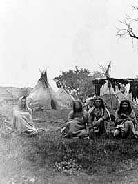
Plains Indian woman on muleback,
circa 1850s. Artist Friedrich Richard Petri painted
a variety of people and scenes in the area of his Fredericksburg
home in the Texas Hill Country. His drawings of Indians
in the area document not only their costume and habits
but their amicable relationships with some of the settlers.
Click to see full image. Courtesy Texas Memorial Museum.
|
|
|
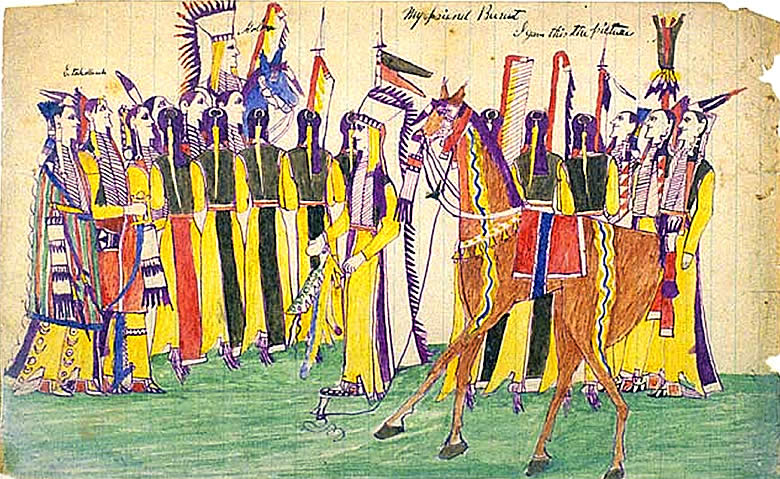
Kiowa painting of Koba (Wild Horse) wearing feathered
headdress on horseback with group of men including Etahdeleuh (Boy
Hunting), carrying lances. Watercolor, 1875, Fort Marion Prison.
Image courtesy National Anthropological Archives, Smithsonian Institution
(INV 08547626 NAA MS 39C).
|
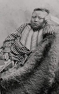
Kiowa boy, wearing bone breastplate
and striped cotton clothing. Photo circa 1867-1874,
courtesy of the Center for American History, Caldwell
Collection (#10182). Click to see full image.
|
Comanche encampment. The circa 1867-1874
photo is identified as Quah-ah-da Comanche camp, possibly
that of famed Comanche chief, Quanah Parker. Courtesy
of the Center for American History, Caldwell Collection
(00478), The University of Texas at Austin. Click to
see full image.
|
Aproximate areas of Indian groups
in Texas during the nineteenth century. Clcik to enlarge.
|
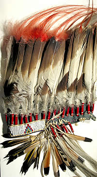
Eagle feather warrior headdress,
Plains Indian. Courtesy Panhandle Plains Historical
Museum Collection. Photo by Jeff Indeck.
|
|
|

Site of the circa 18,000-acre Comanche
Reservation established on the Clear Fork of the Brazos,
north-central Texas, in 1855. About 450 Penateka, or
southern Comanches settled there and were fairly successful
at farming, in spite of droughts. But tribal discord,
continued hunting and raiding, and inadequate protection
(from Anglo settlers) by U.S. troops, among other problems,
doomed the reservation effort, and the Comanches were
removed to Indian Territory in 1859.
|
|
The attacks by soldiers and rangers had been demoralizing,
but what made the losses critical was that they compounded
the devastation wrought by disease.
|
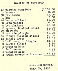
Invoice of property belonging to
the "several tribes" (Caddos, Wacos, and others),
at the time of their removal from the Brazos Reservation
in north Texas to the Wichita Agency, Indian Territory,
1859. Note the prevalence of farm equipment. Invoice
prepared by Robert S. Neighbors, agent. Transcript of
document from Noel 1924.
|
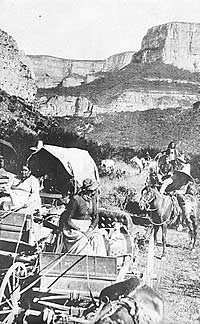
Natives migrating to Mexico in wagons.
The travelers shown are thought to be Kickapoo, ca.
1907. Courtesy National Anthropological Archives, Smithsonian
Institution (NEG 00741 A). Click to enlarge.
|
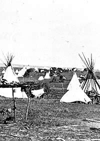
Kiowa camp, ca. 1867-1874. Photograph
courtesy of the Center for American History, Frank Caldwell
Collection (#10187), The University of Texas at Austin.
|
|
The Kiowa are believed to have migrated from
the Yellowstone River region of modern Wyoming or Montana
under easterly pressure from the Cheyenne and Sioux. They
were accompanied onto the southern Plains by the Kiowa Apache,
a group linguistically related to the Lipan of Texas and Apache
of New Mexico, but who had earlier migrated to the north and
attached themselves politically to larger and stronger tribes.
As the Kiowa moved south, they continued to
be pressed from the east—in this case by the Pawnee and
Osage—and probably encountered the Comanche near the
Arkansas River in modern Kansas. Elements of the two tribes
initially dueled over this portion of the buffalo range before
forging an alliance that would exist for more than a century.
Interactions among the diverse peoples of Spanish Texas became
increasingly skewed by forces east of the Mississippi River.
The English colonists of the mid-Atlantic seaboard had displaced
the tribes along and on either side of the Appalachian mountain
range and forced some of them into the "Northwest Territory,"
the area drained by the Ohio River and embracing much of the
modern states of Ohio, Indiana, and Illinois. This migration
had forced the Osage to abandon the Ohio valley for the prairies
of modern Kansas and Oklahoma. In the early 1800s, they were
joined there by several of the tribes that had elbowed them
out of the old Northwest Territory—Delaware, Kickapoo,
Potawatomi, and Shawnee among them—as those tribes were
again displaced by whites. Now, however, the eviction notices
were being served by the new United States of America.
Similar pressure on the southeastern tribes
caused many Cherokees to move from the southern Appalachia
hills into western Arkansas. Others followed the Alabama and
Coushatta tribes into Texas, invited along with Anglo-American
colonists during the waning days of Spanish rule.
In 1825, U.S. President James Monroe suggested
the idea of moving all of the Indians out of the eastern United
States to "vacant" lands west of the Mississippi.
The region between the Missouri River and the Red River became
envisioned in the white mind as the "Indian Territory"
that could be used to relocate all of the tribes removed from
the east. The southeastern tribes—Cherokee, Chickasaw,
Choctaw, Creek, and Seminole—joined the lately arrived,
old Northwest tribes as interlopers on the lands historically
occupied by the Wichita north of the Red River.
The fringes of the southern Plains soon became
crowded. The "removed" tribes spread out, impinged
on each other, and filtered south into Mexican Texas. Some
took up residence among the Caddo villages of the eastern
Texas pine forests. Others gravitated to the Wichita villages
farther west, such as those of the Waco and Tawakoni along
the Brazos River valley. The Lipan and Tonkawa also found
themselves with new neighbors to their south, where they encountered
the Anglo-American colonists moving up the Brazos, Colorado,
and Guadalupe River valleys from the Gulf Coast.
The Americans became successors to the raid-and-trade
relationship the Lipan and Tonkawa had conducted with the
Louisiana French. By the mid-1830s, Anglo-Texan settlers were
joining the Tonkawa in attacks on Wichita and Comanche villages.
The Anglos most likely found the Comanche at the edge of the
Cross Timbers of northern central Texas. The Tonkawa called
these Comanche "penetixka," and they probably were
of the division of Comanches that would become the best-known
to the Anglo-Texans.
The Anglos separated the Comanche divisions
into "southern," "middle," and "northern"
groupings. At least 13 major and minor tribal divisions were
known to, or remembered by, the Comanche who survived into
the late 1800s. The later Anglo accounts emphasize seven divisions.
The Penateka were the most numerous and sometimes were called
"southern Comanches" by contemporary white men.
The Nokoni, Tanima, and Tenewa would be grouped together as
the "middle" Comanche. The Kotsoteka, Quahadi, and
Yamparika would be considered "northern."
Stephen F. Austin secured relatively peaceful relationships
with the Tonkawa and Lipan while his colonists drove the Karankawa
into virtual extinction. When Texas independence was declared
in 1836, Sam Houston was dispatched to make treaties with
the Cherokee and other immigrant tribes on the northern frontier.
Houston succeeded and, although the Texas Congress would reject
many of his efforts, the Republic of Texas attempted to maintain
peace with most of the tribes throughout Houston's first term
as president.
Houston's successor, Mirabeau B. Lamar, dramatically
changed Texas Indian policy. Most of the immigrant tribes
of eastern Texas were driven out of the state—only the
Alabama and Coushatta were allowed to remain—and the
Caddo and Wichita retreated up the Brazos River. The Penateka
suffered heavy losses to disease and battles with white soldiers,
militiamen, and rangers during the early 1840s, when Lipan
and Tonkawa were enthusiastic scouts and warriors for the
Anglos in their raids on Comanche villages. By the time Houston
resumed the presidency in 1841, the Penateka had withdrawn
from the Cross Timbers and Edwards Plateau.
The Texas government returned to Houston's
earlier Indian policies during the remainder of the Republic
period. These efforts included the establishment of trading
houses at which even Comanches could exchange hides for manufactured
goods. Extensive negotiations were conducted and several treaties
were concluded. But the agreements were always one-sided:
the Indians would return any captives and stolen livestock
and would not come into white settlements except for authorized
trading. Although the Penateka demanded an identifiable boundary
to mark Comanche lands that whites could not enter, none was
ever agreed to by the government.
Annexation to the United States in 1845 brought
Texas theoretically under the protection of the U.S. Army,
which in 1848 began to build forts along the frontier of white
settlement. By the early 1850s, the U.S. government gave up
on the national policy of trying to "remove" Indians
beyond the reach of white migration, and in its place substituted
the idea of confining the Indians on reservations that whites
could simply bypass on their way west.
The U.S. government owned no land in
Texas, and had to await the state legislature's authorization
of two reservations on the Brazos River in 1854. One, the
"Brazos Reserve," was located near the Army's Fort
Belknap and housed about 2,000 remnants of the Caddoan and
Wichita groups, Tonkawa, and Delaware. The other, on the Clear
Fork of the Brazos (the "Upper Reserve"), accommodated
as many as 450 Penateka Comanche. Residents of both reservations
were instructed to take up farming. Those of the Brazos Reserve
had some success, and also furnished scouts and warrior allies
for the Army and Texas rangers.
Local white opposition forced the removal of
the reservation residents to the "Indian Territory."
There, some became pawns in the white man's Civil War, as
both Union and Confederate emissaries attempted to enlist
them in the conflict. In 1862, about half of the 300 Tonkawa
were massacred by members of other tribes, some of whom were
Union allies. The survivors sought refuge near Fort Belknap,
and a substantial number served in the Texans' frontier defense
organization for the remainder of the war.
The Civil War period brought something of a
retrenchment on the western Texas frontier. Mexico became
a refuge for migrating bands of Kickapoo, Lipan, and Seminole
who shunned the reservations in Indian Territory. Comanches
and Kiowas continued to travel their historic trails between
the High Plains and the Rio Grande. The early 1860s were comparatively
quiet along the frontier line, perhaps due to the Comanches
and Kiowas skirting the edge of white settlement. But military
patrols began to lapse as the Civil War reached its height,
the Indians became emboldened, and the whites began to abandon
the state's westernmost counties as raids increased.
But time was running out for the Plains tribes.
The Penateka had declined rapidly in the years before the
war, and the status of the "middle" Comanches was
increasingly precarious. The Tenewa had become all but extinct
as an identifiable division. Even the northern Comanche bands
had found that their villages were not beyond the reach of
the white man's raiding parties.
The attacks by soldiers and rangers had been
demoralizing, but what made the losses critical was that they
compounded the devastation wrought by disease. An 1816 smallpox
epidemic had killed an estimated 4,000 Comanche, along with
significant numbers of Kiowa and Kiowa Apache. A recurrence
of the disease in the winter of 1839-1840 killed large numbers
in each tribe. A cholera epidemic in 1849 took even greater
numbers than had been lost to smallpox. The Plains tribes
were again struck by "terrible ravages" of smallpox
in 1861.
Perhaps most ominous of all was the often erratic
availability of resources. The bison—or buffalo—had
been a staple of Plains life since prehistoric times, providing
food, clothing, shelter, and utensils. The spread of Spanish
horses from the New Mexico settlements onto the Great Plains
had changed the character of the aboriginal bison culture.
Hunters no longer had to rely on herds wandering into their
vicinity so that they could steer the animals into a trap.
Once mounted, hunters and their families became pursuers.
Mobility—the ability to follow the buffalo in any and
all seasons—became the prerequisite to prosperity. Horses
provided that mobility, but the same horse that carried a
hunter after the buffalo also carried him into contact with
competing hunters from other tribes.
|
"United States Indian Frontier
in 1840, Showing the Positions of the Tribes that have
been removed west of the Mississippi," by frontier
artist George Catlin. While not all tribes are shown,
the map reflects the relative positions of the southeastern
groups who were relocated to "vacant" lands
by order of President James Monroe in 1825. Map from
Catlin 1926.
|
Kiowa Apache man and wife, Fort Sill, Indian Territory.
Photo courtesy of Lawrence Jones, III. View
large image.
|
Plains Indian family emerging from
woods. As Anglo settlers moved up the Brazos, Colorado,
and Guadalupe River valleys, they came into increasing
contact with Indian groups. Fredericksburg artist Freidrich
Richard Petri enjoyed an amicable relationship with
many. Painting ca. 1850s, courtesy of the Texas Memorial
Museum.
|
Comanche woman with child in cradleboard,
Fort Sill, Indian Territory. Photo ca. 1872-1875, courtesy
of Lawrence Jones III. View
large image. |
Plains Indian beaded leather pouch.
Courtesy Panhandle Plains Historical Museum Collection.
Photo by Jeff Indeck.
|
Kiowa brave. Tow-An-Kee, son of Lone
Wolf. Killed in Texas in 1873. Photo, ca. 1867-1874,
courtesy of the Center for American History, Caldwell
Collection (#03962), The University of Texas at Austin.
|
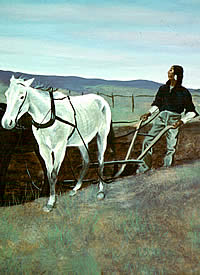
On reservations in Texas and later
in Indian Territory, Indians tried their hand at farming,
with moderate success. Inset of painting by Nola Davis,
modeled after Twilight of the Indian by Frederick Remington.
Courtesy of Texas Parks and Wildlife Department, Fort
Richardson SHS.
|
Kickapoo Chief, Babe Shkit, ca. 1894-1907.
National Archives.
|
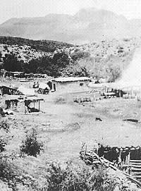
Kickapoo camp and corrals, possibly
in Mexico.
|
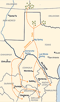
Comanche trails across Texas into
Mexico. Adapted from Weber 1985.
|
|
Mobility—the ability to follow the buffalo
in any and all seasons—became the prerequisite
to prosperity. Horses provided that mobility, but the
same horse that carried a hunter after the buffalo also
carried him into contact with competing hunters from
other tribes.
|
|
|
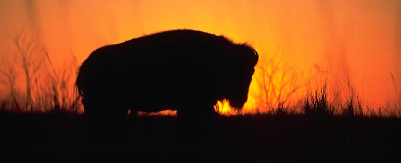
Buffalo silhouetted against a Texas sunset. Photo
courtesy Texas Parks and Wildlife Department.
|
"Making Medicine." Kiowa
drawing by Mopope, reflecting importance of buffalo
to the Indian. Painting courtesy of the National Anthropological
Archives, Smithsonian Institution (#INV 090656600 NAA
MS 7536).
|
Topin Tone-oneo, daughter of Kicking
Bird. The only one of the great Kiowa chief's children
to survive him, she was with the first group of students
sent to Carlisle Indian School in 1879. Courtesy of
the Center for American History (#CN 01362), University
of Texas at Austin.
|
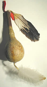
Plains Indian gourd rattle. The
dried gourds were filled with small pebbles that produced
a rattling noise when the object was shaken. Courtesy
Panhandle Plains Historical Museum Collection. Photo
by Jeff Indeck.
|
"In the Great Camanchee Village"
near the Texas panhandle, circa 1840s, by frontier artist
George Catlin. The scene, he notes, records but a small
part of the extensive village. The "wigwam of the
chief" is in foreground, and women are drying meat
and working buffalo hides nearby. From Catlin 1926.
Click to see full image.
|
|
By the early 1800s, Comanche and Kiowa, Arapaho
and southern Cheyenne, and Osage and Pawnee began bumping
into each other on the buffalo range of modern Kansas and
Oklahoma. After varying periods of conflict, truces were arranged
and reduced the bloodshed, but also circumscribed each tribe's
hunting territory. For the Comanche and Kiowa, the upshot
was that their primary range became the region south of the
Arkansas River, between the Sangre de Cristo and Sacramento
mountain ranges on the west and the Cross Timbers on the east.
This was excellent bison-hunting country, as
far as it went. Winters were relatively mild and the bison
had roamed as far south as the Rio Grande in historic times.
But the southern range was also fragile, subject to extremes
of heat and drought that scorched the grasses and dried up
the water courses. In such conditions, the bison could leave
the range altogether, as they appear to have done in the late
1780s, when for three successive years the Comanche had to
go into the New Mexico pueblos and towns to beg for corn.
Tree ring data appear to validate Kiowa calendars
that indicate long periods of diminished rainfall between
1845 and 1875. The calendars note several summers of drought
or dust during those years, and corresponding times of "little
buffalo" or "no buffalo ." Only twice after
1840 do the calendars include the observation, "many
buffalo."
Within their restricted hunting territory,
the Comanche and Kiowa also had to contend with transgressors,
the New Mexican ciboleros who ventured onto the plains to
hunt for bison. Although early Spanish expeditions had engaged
in acts of wholesale slaughter—one foray with the Jumano
Indians in 1683 killed about 8,000 animals along the Concho
River of Texas—the ciboleros appear not to have become
an important phenomenon until the 1800s. One account in the
1830s estimated that the New Mexicans were killing a minimum
of 10,000 to 12,000 bison annually. Their activities angered
the Cheyenne, who drove them off their hunting grounds in
the 1850s. This in turn brought them into confrontations with
the Comanche and Kiowa after the Civil War, when they were
reported to be having such a significant effect on the bison
herds on the Llano Estacado that Army commanders in New Mexico
considered banning their hunts.
The uncertain political status of Texas and
the other former Confederate states at war's end offered perhaps
the last best hope for the Plains tribes to maintain their
traditional way of life. In the fall of 1865, several Comanche
and Kiowa leaders entered into what became known as the Treaty
of the Little Arkansas River. Representatives of the government
of the United States pledged to set aside a huge reserve that
comprised most of the western half of modern Oklahoma, all
of the Texas panhandle, and the remainder of the Llano Estacado
east of the Texas-New Mexico border.
The Texas portion of the reserve had
been land that few white men had wanted to cross, much less
own, but it had also been state land, outside the control
of the U.S. government. Within two years the government reneged
on the treaty, obtained the signatures of Comanche and Kiowa
leaders on the new Treaty of Medicine Lodge Creek, and reduced
the reserve to only six per cent of its original size. All
that remained was a corner of the designated "Indian
Territory." The substantial portion of the bison range
that would at least in theory have been off limits to whites
was left open to the commercial slaughter that touched off
the Red River War of 1874-1875.
The last of the independent Comanche, Kiowa,
and Kiowa Apache surrendered to reservation life in 1875.
Some of the Lipan and Mescalero bands held out in northern
Mexico until the early 1880s, when Mexican and U.S. Army forces
drove them onto reservations or into extinction. The 1890
Census showed 1,598 Comanche at the Fort Sill reservation,
which they shared with 1,140 Kiowa and 326 Kiowa Apache. The
Fort Stanton reservation in New Mexico had 473 Mescalero and
40 Lipan. Few individuals from the once-great forest and prairie
village groups had survived in Indian Territory, 536 of the
East Texas Caddo and 358 of the Wichita.
|
Plains Indian fleshing tool with
serrated metal edge, used for butchering large game.
Courtesy Panhandle Plains Historical Museum Collection.
Photo by Jeff Indeck.
|
Four Apache Indians huddle in foreground
of what is identified as an Arapoho hunting camp, ca.
1867-1874. Note meat hanging over drying racks. During
the 1860s and 1870s, Indians competed not only with
other tribes for buffalo but with Anglo hunters who
swarmed over the Plains taking adavntage of the lucrative
hide market. Photo courtesy of the Center for American
History, Caldwell Collection (#CN 10189), The University
of Texas at Austin. Click to view full image.
|
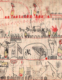
Rich in imagery, a page from a circa
1890s Kiowa diary, drawn on a soldier's target practice
book, indicates sweeping changes on the frontier. Note
soldiers, wagon trains, flags, and Longhorn cattle dominating
the scene with few tipis and other Indian symbols. Silver
Horn Kiowa drawing, courtesy National Anthropological
Archives, Smithsonian Institution (NAA INV 09063724).
Click for full image.
|
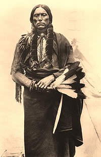
Quanah Parker, Quahahda Comanche
chief. Quanah's band would be the last of the Comanche
to submit to white dominion.
|
|
|
Beef issue. Kiowa women cut up government-issued
beef. Photo, circa 1892, courtesy of the National Anthropological
Archives, Smithsonian Institution (NEG 1454 A).
|
Indians at Fort Marion. Indians of
various tribes who were captured in the Texas Red River
Wars and other Indian battles of the late 19th century
were imprisoned at this Florida military fort. Photo
ca. 1860s-1930s, courtesy the National Anthropological
Archives, Smithsonian Institution (Lot 90-1 INV 09854500).
|
|
The Anglo-Texans' beleaguered former Indian
allies did not fare even that well. The small Tonkawa village
that grew up near Fort Griffin in the 1870s took in a small
Lipan band before the post closed in 1881. In 1890, only 56
Tonkawa had survived the tribe's second removal from Texas.
They were joined in Indian Territory by 20 Lipan.
The U.S. government adopted a new Indian policy in 1887, one
calculated to destroy the remaining tribal organizations.
The Dawes Act—also known as the "allotment"
or "severalty" act—provided for the breakup
of the reservations, with each head of a reservation family
being allotted 160 acres, each single adult 80 acres, and
each minor 40 acres.
The former Texas Indian tribes reached the end
of a long and deadly road at the beginning of the 20th Century.
The impact of the Dawes Act is amply illustrated by the allotment
of the Comanche-Kiowa reservation lands in 1901. About 440,000
acres were allotted to the 2,759 individual members of the
Comanche, Kiowa, and Kiowa Apache tribes, and about 550,000
acres were reserved for tribal use. The remaining 2 million
acres of the nearly 3 million-acre reservation were opened
to white settlement.
In 1906, the secretary of the interior sold
all but about 70,000 acres of the pasture that had been set
aside for the common use of the Comanche, Kiowa, and Kiowa
Apache. They had still been fearsome warriors in 1867, when
they met the U.S. peace commissioners at Medicine Lodge Creek
and bargained for the best future they could convince the
government to let them keep.
Forty years later, they had 17 per cent of it.
|
Tonkawa Chief Campo. In spite of
performing valued service as scouts for the U.S. Army
at Fort Griffin, the Tonkawa were removed to Indian
Territory after the post closed. View
large image. |
Pupils at Carlisle Indian school,
Pennsylvania. Established in 1879 by Richard Pratt,
the school attempted to assimilate Indian children into
the "white man's world" through education
and financial support. Among its students were four
of Comanche chief Quanah Parker's children and those
of others involved in the Texas Indian Wars.
|
|
|
Credits & Sources
The Passing of the Indian Era was written
by Steve Dial, Contributing Editor to Texas Beyond History
(see Frontier Forts Supporters
and Contributors).
Read more about historic Indian groups, including Kiowa and Apache, in the Texas Beyond History exhibits, Native Peoples of the Texas Plateaus and Canyonlands http://www.texasbeyondhistory.net/plateaus/peoples/index.html
Print Sources
Betty, Gerald
2002 Comanche Society Before the Reservation, Texas A&M
University Press, College
Station.
Catlin, George
1926 North American Indians, Vol. II. John Grant, Edinburgh.
Ewers, John C.
1997 "The Influence of Epidemics on the Indian Populations
and Cultures of Texas," in John C. Ewers, Plains Indian
History and Culture, University of Oklahoma Press, Norman.
Flores, Dan
1991 "Bison Ecology and Bison Diplomacy: The Southern Plains
from 1800 to 1850,"
The Journal of American History, Vol. 78, Issue 2 (September,
1991).
Foster, Morris W. and Martha McCollough
2001 "Plains Apache" in Handbook of North American
Indians, Raymond J. DeMallie, ed., Smithsonian Institution,
Washington.
Himmel, Kelly F.
1999 The Conquest of the Karankawas and the Tonkawas, 1821-1859,
Texas A&M Universsity Press, College Station.
Kavanagh, Thomas W.
2001 "Comanche" in Handbook of North American Indians,
Vol 13, Raymond J. DeMallie, ed., Smithsonian Institution, Washington.
Kenner, Charles L.
1969 The Comanchero Frontier: A History of New Mexican-Plains
Indian Relations,
University of Oklahoma Press, Norman, 1994 paperback edition.
Koch, Lena Clara
1922 "The Federal Indian Policy in Texas, 1845-1860,"
M.A. Thesis, University of Texas. Published in Southwestern Historical
Quarterly XXVIII, XXIX, Texas State Historical Association,
Austin.
Levy, Jerrold E.
2001 "Kiowa" in Handbook of North American Indians,
Vol. 13, Raymond J. DeMallie, ed., Smithsonian Institution, Washington.
Marks, Paula Mitchell
1998 In a Barren Land: American Indian Dispossession and Survival,
William Morrow and Company, New York.
Mayhall, Mildred P.
1939 The Indians of Texas: The Atakapa, the Karnakawa, the Tonkawa. Doctoral Thesis, The University of Texas at Austin.
Newcomb, W.W., Jr.
1961 The Indians of Texas from Prehistoric to Modern Times,
University of Texas Press, Austin, 1984 paperback edition.
1978 German Artist on the Texas Frontier: Friedrich
Richard Petri. University of Texas Press. Austin.
2001 "Wichita" in Handbook of North American
Indians, Vol. 13, Raymond J. DeMallie, ed., Smithsonian Institution,
Washington.
Noel, Virginia Pink
1924 The United States Indian Reservations in Texas 1854-1859.
Master's thesis, The University of Texas at Austin. Copy on file,
TARL Library.
Opler, Morris E.
2001 "Lipan Apache" in Handbook of North American Indians,
Vol. 13, Raymond J. DeMallie, ed., Smithsonian Institution, Washington.
Smith, David Paul
1992 Frontier Defense in the Civil War: Texas' Rangers and Rebels,
Texas A&M University Press.
Wade, Maria F.
2003 The Native Americans of the Texas Edwards Plateau, 1582-1799,
University of Texas Press, Austin.
Wallace, Ernest, and E. Adamson Hoebel
1952 The Comanches: Lords of the South Plains, University
of Oklahoma Press paperback edition 1986.
Weber, David J.
1982 The Mexican Frontier, 1821-1846: The American Southwest
Under Mexico. University of New Mexico Press, Albuquerque.
Links
http://www.texasindians.com/
Well-constructed site with numerous pages about different Indian
groups, teachers and kids activities, and links to many other sites.
http://www.tpwd.state.tx.us/edu/indian/isplash.htm
A good site for kids with information and activities from the Texas
Parks and Wildlife Department.
http://www.comanchelodge.com/
Interesting site that has the text of several important
treaties, including Camp Holmes, Tehuacana, Little Arkansas, and
Medicine Lodge, and the names and divisional affiliations of the
signatories, when known.
http://members.tripod.com/~PHILKON/links12apache.html
Extensive list of links to Apache websites.
http://www.tshaonline.org/handbook/online/
Handbook of Texas Online. Suggested search topics:
Apache Indians
Atakapan Indians
Caddo Indians
Cherokee Indians
Coahuiltecan Indans
Comanche Indians
Delaware Indians
Jumano Indians
Kickapoo Indians
Kiowa Apache Indians
Kiowa Indians
Seminole Indians
Tawakoni Indians
Wichita Indians
|