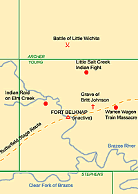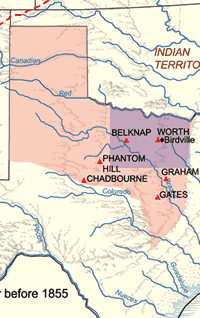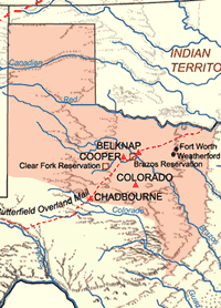
Prairie-plains frontier after 1855.
|
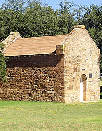
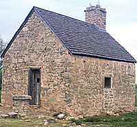
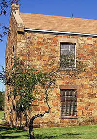
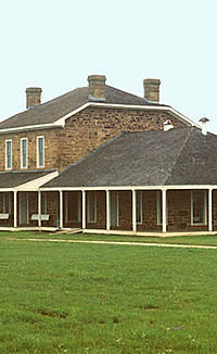
Powder magazine at Fort Belknap.
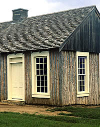
A powder magazine, or armory, was usually one of the
first, and most secure, structures erected at a frontier
army post. The magazine at Fort Belknap would have stored
the post's powder, lead, and other munitions. It is
the only original structure remaining at the fort site.
|
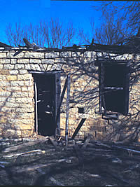
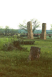
Ruins of house at Camp Cooper. The
post, established in 1856, was situated on a bend of
the Clear Fork near the heart of the Upper Reserve.
The site is now on private land. Photo by Bob Stiba.
|
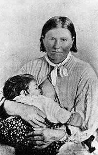
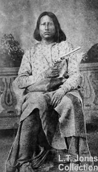
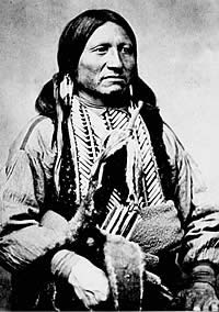
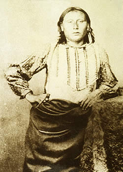
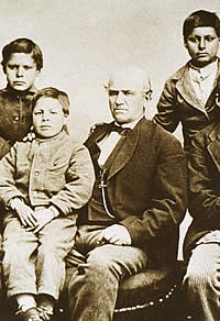
Cynthia Ann Parker with daughter,
Prairie Flower, circa 1860-1870. Parker, who had been
kidnapped by Comanches in the 1836, went on to adopt
Indian ways, marrying an Indian warrior and bearing
two sons, one of whom was future chief Quanah. Photo
courtesy Denver Public Library, Western History Collection.
|
|
Texas authorities were so anxious to have the Indians
gone that, in the abruptness of their departure, they
were forced to leave most of their possessions behind.
It would not be the last time the Tonkawa were so rewarded
for their fealty to Texans.
|
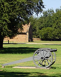
Cannon at Fort Belknap. Although
they were used infrequently during the Plains Indian
wars, artillery could usually be found at a frontier
Army post. Civilians obtained home-made cannon for their
private forts, to be used in the event of Indian attack.
The little guns produced smoke and noise, but seldom
any casualties.
|
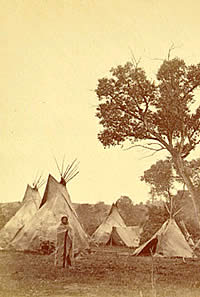
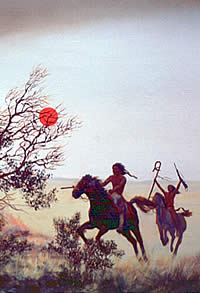
Comanche camp. Camps such as this
were targeted by the Army using a strategic policy of
striking the non-reservation Indians where they lived
in Indian Territory. Women and children were frequent
casualties of the aggressive campaigns.Photo by William
Soule, courtesy of Wichita State University.
|
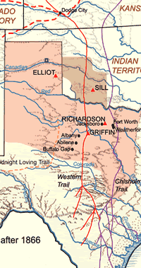
Forts, roads and trails after 1866
in the Prairie-Plains region.
|
|
None of these posts—those of the new "second
line" any more than those of the earlier "first
line"—inconvenienced the Comanche and the Kiowa
in the slightest degree. During the years 1848-1855, only
two engagements with Indians were fought by troops from any
of these posts. One of those was an Indian attack on soldiers
at Fort Chadbourne. Phantom Hill, with poor wood and worse
water, was soon abandoned by the army. Fort Belknap was relegated
to guarding the reservations the state had established for
some of its Indians.
After years of prodding by U.S. officials, the
Texas legislature in 1854 authorized the creation of two reservations,
one on the Brazos River below Fort Belknap, and the other,
the "Upper Reserve," on the Clear Fork. The Brazos
Reservation housed some 1,000 Anadarko, Caddo,Tawakoni,Tonkawa,
and Waco Indians. The Upper Reserve was able to attract only
about 450 of the Penateka Comanche—"Honey Eaters"—who
had ranged mostly south of the Brazos River. The job of the
army was to keep these Indians on their reservations, and
to keep white settlers away from them.
The forts in the region soon took on a new role,
however. The arrival of the army's 2nd Cavalry late in 1855
presaged a dramatic change in military strategy. Its commanding
officer was Colonel Albert Sidney Johnston, a veteran of several
Indian campaigns and a former secretary of war of the Republic
of Texas. Lieutenant Colonel Robert E. Lee was second in command.
The companies of the 2nd Cavalry were dispersed
along a line that mimicked the "second line" of
forts, but generally placed the horse soldiers closer to established
settlements where grain for the regiment's animals was more
available. Lee, who was effectively in command for much of
the regiment's tour in Texas, took station at Camp Cooper,
established in 1856 on the Clear Fork near the heart of the
Upper Reserve. Most of the "second line" forts then
became bivouac, rendezvous, and supply points for the wide-ranging
troopers as they scouted for Indian trails, intercepting and
pursuing the raiders they could find.
Another strategic change was a policy of striking
the non-reservation Indians where they lived-in the Indian
Territory north of the Red River. The most ambitious of these
campaigns followed a Texas ranger model. In the spring of
1858, veteran Indian fighter John S. "Rip" Ford
received a gubernatorial appointment as "senior captain
commanding Texas frontier." With a hundred or so rangers,
and about an equal number of Brazos reservation Indians led
by agent Shapley Ross, Ford struck the Canadian River camp
of the Kotsoteka chief Iron Jacket in the Antelope Hills of
the Indian Territory. Iron Jacket and 75 other Comanche were
killed by the combined attack force, which lost two killed
and three wounded. An additional 18 Indians were captured,
mostly women and children, as well as about 300 horses. The
village and its contents were destroyed.
Four months after Ford's return, a force of
2nd Cavalry under senior Captain Earl Van Dorn moved into
the Indian Territory with a detachment of the 1st Infantry
and 60 Indian auxiliaries from the Brazos agency. The Indians
were led by the agent's 20-year-old son, Lawrence S. "Sul"
Ross. They spied a large number of Comanche-—Buffalo
Hump and his Penateka band—camped near a Wichita village
in the valley of Rush Creek. Van Dorn struck the Comanche
camp at dawn. The fight lasted for more than an hour, and
when the surviving Comanches fled, they left 56 warriors and
two women dead on the field. Van Dorn lost one officer and
four enlisted men killed. He, Ross, and nine enlisted men
were seriously wounded.
In the Spring of 1859, Van Dorn again led a
force beyond the Red River, this time attacking a Kotsoteka
village on Crooked Creek, in modern Kansas. Two enlisted men
died and 10 were wounded, along with two officers and two
Indian scouts. None of the Comanches escaped; 50 were killed,
50 were wounded, and 37 (32 of them women) were captured.
The army's aggressiveness did not stop Comanches
from raiding in Texas, nor their Kiowa allies. But on the
eve of the Civil War, the army and Texas rangers were trading
the Indians blow for blow. In mid-December of 1860, a company
of rangers under "Sul" Ross combined with a detachment
of the 2nd Cavalry to attack a Comanche camp on the Pease
River. The captured villagers included Cynthia Ann Parker
and her daughter. Ross reported that Peta Nocona was among
the 14 Comanche dead. Although his son, Quanah, later disputed
that assertion, evidence suggests that Peta died at or about
that time, perhaps from wounds received in that battle.
One of the last large undertakings of the 2nd
Cavalry was to assist in the removal of the Texas reservation
Indians to the Indian Territory. Almost from the beginning,
white settlers had coveted the reservation lands. Raids by
northern Comanche and Kiowa, as well as white thievery, were
blamed on the reservation Indians. The bands living on the
Brazos Reserve—the Tonkawa especially—were doubly
wronged, as they probably were innocent of most charges and
had served as valued scouts and warriors with the rangers
and the army.
Attacks on the reservation Indians increased
nonetheless, and in 1859 agent Robert Neighbors succeeded
in obtaining new lands for them north of the Red River. The
2nd Cavalry's Major George Thomas led an army escort that
accompanied the Indians on their journey. Texas authorities
were so anxious to have the Indians gone that, in the abruptness
of their departure, they were forced to leave most of their
possessions behind. It would not be the last time the Tonkawa
were so rewarded for their fealty to Texans.
Secession and the Civil War threw frontier settlers back onto
their own resources and methods. The state's efforts—establishment
of the Frontier Regiment of full-time soldiers and, later,
the militia-style Frontier Organization—were significant,
but they were not nearly enough to protect the settlers from
the newly emboldened Indian raiders. At war's end, settlement
clung tenuously to the outlying counties. With state-financed
defenses prohibited during the Reconstruction period, the
frontier began to depopulate and dissolve.
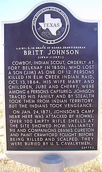
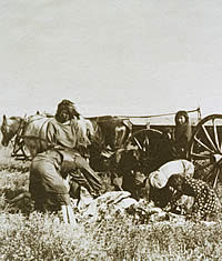
The October, 1864, Elm Creek Raid in Young
County was typical of the trauma of those years. A force of
Kiowa and Comanche estimated at 700 warriors struck a string
of farmsteads along Elm Creek near its confluence with the
Brazos River above Fort Belknap . Eleven settlers—men,
women, and children, black and white—were killed, and
seven women and children, including the wife and two of the
children of black frontiersman Britton Johnson, were carried
away. Eleven houses were sacked or burned. The raiders eluded
pursuit and returned to the Indian Territory.
Johnson would make four trips into the Comancheria
to recover what remained of his family (the Indians had killed
his oldest son during the raid). All the white captives but
one also would be returned. Other frontier folk would not
be so courageous, skillful, resolute, or lucky as Johnson.
A compilation of reports from several—but not all—frontier
counties showed 163 settlers killed by Indians, 24 wounded,
and 43 carried off from the summer of 1865 through the summer
of 1867.
Although returning to Texas en masse in mid-1865,
the U.S. Army was slow to either recognize or respond to the
frontier situation. Mounted troops did not return to the upper
Brazos area until 1866, with modest detachments of the 6th
Cavalry posted at civilian settlements at Jacksboro, Weatherford,
and Waco.
|
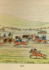
Plains Indian Camp. The horse changed
the way of life of the Comanche, and came to be one
of the defining cultural attributes of the southern
Plains Indians. Painting by Nola Davis,
Texas Parks and Wildlife Department.
|
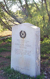
Site of the Upper Reserve, one of
two Texas Indian reservations intended to control Indians
on the northern Texas plains. The reservation was populated
chiefly by Comanches. Photo by Susan Dial.
|
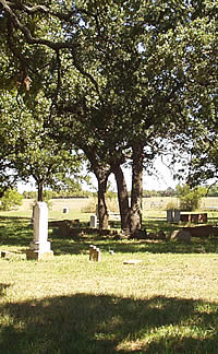
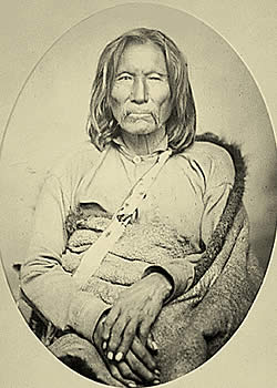
Robert Neighbors' gravesite in cemetery
near Fort Belknap. Frontiersman, soldier, and Indian
agent, Neighbors faithfully served the Republic of Texas
and the U.S. government during the 1840s-1850s.
|
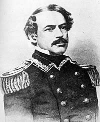
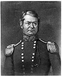
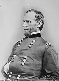
Lt. Col. Robert E. Lee, commander
of Camp Cooper on the Clear Fork of the Brazos.
|
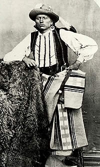
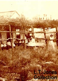
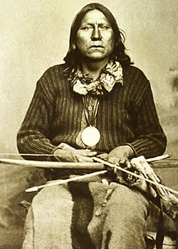
Johnson, chief of Tonkawa scouts
under Ranald Mackenzie in north Texas. Although the
skills of the Tonkawa scouts were greatly valued by
the Army, the tribe was ultimately betrayed by the United
States. Photo courtesy of Lawrence Jones, III. View
large image. |
Beef issue. Food, clothing, and other supplies were
used as inducements to attract Plains Indians to leave
their semi-nomadic lifestyle and move to reservations.
The women and children in this 1892 photograph are
butchering a cow or steer obtained during a reservation
"beef issue." Photo courtesy of NAA-SI.
|
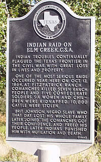
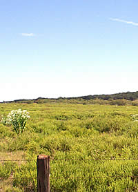
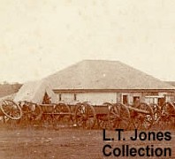
Site of the Elm Creek raid in 1864
in which 12 people were killed and 6 women and children
kidnapped by Comanches.
|
|
Saturday Aug 5/65. The weather is hot and dreary.
Times are hard and bad. Indians thick and plenty trying
to brake (sic) our country. I heard they had robed (sic)
Ike Nickersons house the other day over on hubbard’s
creek. If we don’t get protection shortly and the
Indians continue to do as they have been doing for a
month back the country will certainly brake up.
-Excerpt from Diary of Susan E. Newcomb, Fort Davis,
Stephens County, Texas, 1865.
|
|