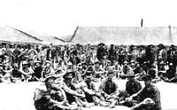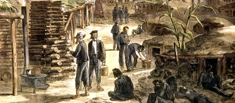
A period drawing (colorized) of Camp Ford, as featured in Harpers Magazine. Image courtesy of Alston Thoms. |
||||||||
|
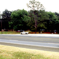
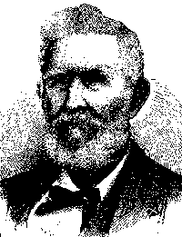
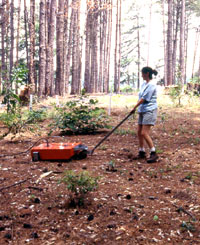
In the Piney Woods of East Texas, a lone historical marker on a busy highway denotes the site of a ramshackle stockade where, during the last years of the Civil War, some 6000 Union prisoners, Confederate guards, and African-American slaves lived, worked, and variously made their mark on the history of the area. In 1997, when archeologists from Texas A&M set about to explore Camp Ford, only the faint impressions of trenches, drainage ditches and berms, along with a few pieces of rotting wood, were visible on the ground surface. But by using a battery of archeological and historical research techniques, they were able to uncover Camp Ford and begin to tell its little-known story. What they learned will be used in creating an interpretive center and display for visitors at the site of Camp Ford. Located in Smith County near Tyler, Texas, Camp Ford was closely tied to support operations for Confederate forces west of the Mississippi River during the Civil War. This part of Northeast Texas became a military-industrial complex for the Confederacy's Trans-Mississippi Department, serving as both a headquarters area and a critical manufacturing center for guns, ammunition, and other war supplies. The camp was named for John Salmon "Rip"
Ford, the colorful lawyer-doctor-ranger who served briefly as state
conscript commander charged with the responsibility for enlisting
and training soldiers for the Confederacy. Initially, the camp was
home to new recruits and draftees for Texas regiments. By the middle
of the war, its character had begun to change dramatically, and
it became the largest camp for Union prisoners of war west of the
Mississippi. (See Timeline for a chronology of key events at Camp
Ford and in other states during the Civil War). This change coincided with the decline of the military fortunes of the Confederacy. With the fall of New Orleans and Vicksburg, Mississippi, to Union land and naval forces, the Trans-Mississippi Department became isolated from the rest of the South. Texas increasingly had to look after its defenses and its supplies as best it could. Attempted Union invasions along the Texas coast and up the Red River from Louisiana brought the war closer to home. And it brought more prisoners to Camp Ford. The U.S. soldiers imprisoned at the camp were not the only newcomers brought to the area by the war. As large portions of Arkansas, Louisiana, and Missouri came under the control of U.S. forces, the region became a destination for civilian refugees, white and black. In these respects, Camp Ford serves as a microcosm of the war as it was experienced "behind the lines." |
|
||||||