
Searching for Clues
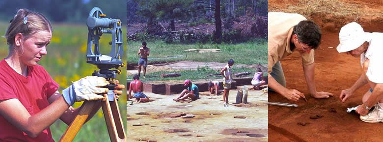
Archeologists have many ways to study the traces of the Caddo past. When they excavate a site, they carefully dig through layers and layers of dirt and debris, going back perhaps hundreds, if not thousands, of years in time. Usually, the deeper they dig, the older the deposits and the farther back in time they go.
Just like people today, the Caddo people left behind lots of trash: bits of food (bone, corn cobs, etc.), broken pieces of pottery, fragments of tools, jewelry, and countless other things. These items (artifacts) help us understand a great deal about how the Caddo lived.
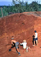
But there is lots more to study than artifacts. Archeologists also study much larger clues, such as patterns and stains in the dirt that may be the remains of hearths, storage pits, houses, and temples. Studying the tall Caddo mounds requires months and months of intensive labor.
Solve the Pattern Problem
A High-Tech Peek at the Past
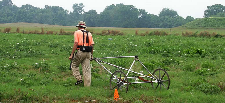
Archeologists today have found a way to "look" underground without ever lifting a shovel! Using geophysical (geo = earth) survey technology they wheel a special instrument back and forth over a large area. Each time they reach one side of the search area, they move the instrument over another three feet or so and go back the other way. They repeat this trip many times before the whole area is covered. The instrument detects small changes in the magnetic field of the earth, changes caused by holes dug and fires built over 800 years ago!
The instrument collects this data (information), which is then downloaded into a laptop and later transfered to a larger and more powerful desktop computer back in Austin. Using a series of specialized software programs, the analyst creates a special computer-generated "map" of the entire area. Archeologist will use this map to "see" beneath the ground. By studying the patterns, they can understand the size and layout of the village that once stood here.
This special map (below) covers just a small section of Caddoan Mounds State Historic Site, an ancient ritual center with mounds and traces of a large village. Over the years, archeologists have excavated small parts of the huge site. But unless they dig everywhere (which would take decades), they have no way of knowing just how big the ancient village was. The new geophysical survey technology allows them to explore the whole area, including traces of houses and other buildings. As you can see, there are several obvious patterns on the map. Can you guess what they may represent?
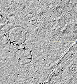
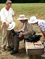
Go ahead, try your hand at being a high-tech archeologist! We won't know if your guesses are correct until more tests are done at the site. (That means clearing off the grass and looking for stains and remains of wooden posts in the ground, like the archeologists are doing in the photo at top right.) Like many other sciences, archeology requires slow, careful, and detailed analysis. But there 's a lot that can be learned by adding up all the clues.