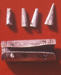
Sliver trade goods from 18th and
19th century Caddo sites. Courtesy Tim Perttula.
|
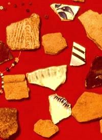
At historic Caddo sites, Caddo-made
pottery is often found mixed with trade wares from Europe.
Courtesy Tim Perttula.
|
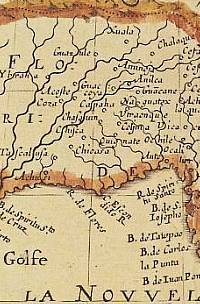
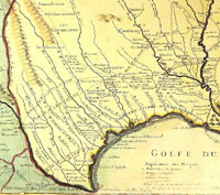
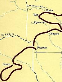
1650 French map by Nicolas Sanson
D'Abbeville entitled "Amérique Septentrionale."
Caddo groups including the Nacguatex are shown 400-500
miles east of their actual locations, reflecting the
poor knowledge of North American geography at that time.
Click to view larger image and a more detailed view.
|
Attractive but very inaccurate 1705
French map by Nicolas de Fer entitled "Les Costes
aux Environs de la Riviere de Misisipi." Click
to view larger image and a more detailed view.
|
:
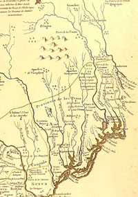
1718 map by Guillaume Delisle entitled
"Carte de la Louisiane et du cours du Mississipi."
This map benefited from the latest accounts of French
explorers and trading missions and fairly accurately
shows the physical and cultural geography of the Caddo
Homeland. Click to view larger image and a more detailed
view.
|
1768 Spanish map by Mexican-born
cleric and leading scientist José Antonio de
Alzate y Ramírez entitled "Nuevo Mapa Geografico
de la America Septentrional." This map shows relative
placements of Caddo groups fairly well, but the rivers
are not depicted accurately. French maps at the time
were greatly superior. Click to view larger image and
a more detailed view.
|
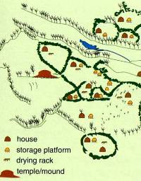
Redrawn version of the Terán
map of the Cadohadacho settlement (Upper Nasoni) on
the Red River in 1691. Note features identified in the
legend. From Sabo, 1992, courtesy Arkansas Archeological
Survey.
|
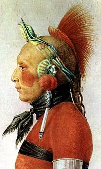
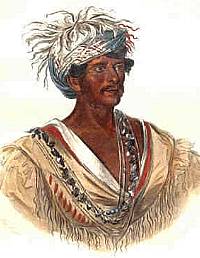
Osage warrior as depicted by the
French artist Julien Fevret de Saint-Memin in the early
1800s. Well-armed by the French, the Osage were bitter
enemies of the Cadohadacho groups.
|
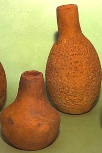
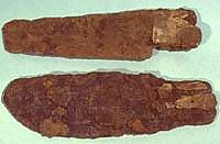
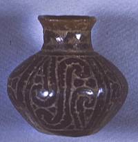
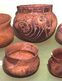
Caddo-made earthenware bottles from
Allen phase, historic Caddo sites, about A.D. 1650-1750.
TARL archives.
|
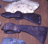
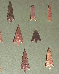
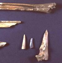
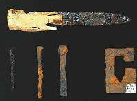
Beginning in the 18th century, iron
axe and hatchet heads made in Europe for North American
trade were highly sought-after by the Caddo and other
Indian groups. These examples were found by looters
in historic Caddo graves in the vicinity of Titus County.
|
|
|
| Like
the ripples of skipped stones on a pond, spreading and
deflecting off of one another, the impacts of Old World
intruders reverberated all across North America. |
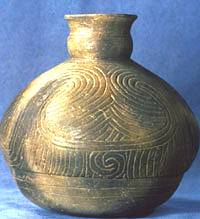
Keno Trailed, Glendora variant bottle
from the Cedar Grove site in southwest Arkansas, probably
made between 1700-1750. Courtesy Picture of Records.
|
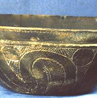
Natchitoches Engraved, Lester Bend
variant, bowl from the Cedar Grove site in southwest
Arkansas, made about 1650. Courtesy Picture of Records.
|
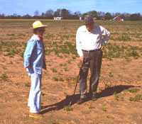
Archeologists Kathleen Gilmore and
R. King Harris at the Roseborough Lake site.
|
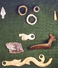
Metal artifacts of dating to the
18th- and 19th-centuries found at the Roseborough Lake
site by King Harris. TARL archives.
|
Tiny Nacogdoches Engraved bottle
from Caddo burial at Rosenborough Lake excavated by
King Harris. TARL archives.
|
Caddo pottery from Roseborough Lake
found by King Harris. TARL archives.
|
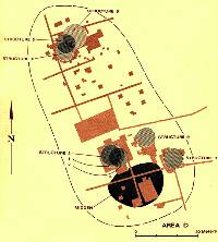
Schematic layout of the Allen phase
Caddo hamlet at the Deshazo site. Most of the houses
stood on either side of an open plaza. On the opposite
side of the creek was a single "special structure"
and a small cemetery. TARL archives.
|
|
In the last decade, Caddo archeologists and
ethnohistorians have studied anew the contact between Europeans
and Caddo peoples seeking to better understand how contact
changed Caddo societies. Part of this renewed ethnohistoric
and archeological interest has focused on reconstructing the
precise routes of Spanish and French explorers and colonists,
especially that of Hernando de Soto. At the same time, Caddo
researchers have been reconsidering the socio-political character
and ethnic identity of prehistoric and early historic Native
American groups.
In June, 1542, the De Soto entrada, led by Luis
de Moscoso, entered into the Caddo world and over the
next seven months passed through Caddo lands in present-day
Arkansas and Texas. Perhaps not far behind were the Old World
epidemic diseases. While Europeans would not tread again on
Caddo lands for 144 years, the Caddo world continued to feel
the impact of the spreading European colonization. Like the
ripples of skipped stones on a pond, spreading and deflecting
off of one another, the impacts of Old World intruders reverberated
all across North America.
Yet, despite close scrutiny of archeological,
bioarcheological, and historical data, no real consensus as
been reached on the precise effects of De Soto's first intrusion
on the Caddo world. The interwoven and still unsettled questions
include: How did Caddo populations change through time and
across the homeland? When did epidemic diseases enter the
Caddo area? When did post-contact population declines occur?
And, what were the cultural impacts of those declines on Caddo
societies and communities?
One thing is clear, the all-too-easily (and
often) told story: "when the evil Spanish (and somewhat
less evil French) came, the Caddo world was quickly ruined,"
is not true. The consequences of European colonization were
ultimately catastrophic for Caddo peoples, but these unfolded
in fits and starts over several centuries. Indeed, the story's
twists and complications do not fit within a simple plot.
When La Salle's expedition arrived among the
Hasinai groups in 1686, most Caddo peoples lived primarily
in relatively small groups on the Red River and in East Texas.
Over the next century and a half Europeans laid claim to their
lands and loyalties, and the Caddo found themselves wedged
between the outer edges of the French and Spanish empires.
Epidemic upon epidemic ravaged Caddo populations—possibly
by as much as 95 percentage between 1691 and 1816. Yet, European impact
was not all disastrous. The Caddo were situated perfectly to
participate in the French fur trade, and they traded guns,
horses, and other essential items to Indian groups and Europeans.
In the process they developed new trade and economic networks,
and acquired new European goods and ornaments. The resulting
economic symbiosis between the Caddo groups and Europeans
was the key to the political success, resilience, and strength
of the Caddo tribes through much of the colonial era.
Caddo Territory
Over a century passed after De Soto's failed
entrada before the Spanish again took notice of the Caddo,
This time the Spanish came from the opposite direction, the
southwest. In the mid-1600s, Spanish priests learned about
the Caddo at La Junta de los Ríos (the confluence of
the Rio Grande and Rio Conchos), some 550 miles west of the
nearest Caddo village. Jumano Indians, famed as long-distance
travelers and traders, told the Spanish about the "Great
Kingdom of the Tejas," a populous and well-governed
people. The term "Tejas" referred mainly to the
Hasinai groups of east Texas, but the characterization applied
equally well to the greater Caddo world.
Before the initial European contact, in the
early 1500s, the Hasinai Caddo groups lived in permanent communities
throughout the upper Neches and Angelina river basins. They
are represented archeologically by sites belonging to the
Frankston phase (ca. 1400-1600) and Allen (ca. 1600-1800)
phases of what archeologists call the Anderson Cluster. Although
occasional Hasinai Caddo groups or bands lived west of the
Neches and Trinity rivers in historic times, they usually
did not go beyond that boundary, "unless going to war,"
according to Henrí Joutel, the chronicler of the La
Salle expedition. The Hasinai groups continued to live in
the upper Neches and Angelina river basins until they were
driven out of East Texas by the leaders of the Republic of
Texas after 1836.
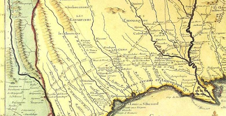
European maps of the late 1500s to the mid-1600s
located Caddo and Caddo-allied groups such as the Naguatex,
Nisoone (Nasoni), Lacane, Ays, Xualatino (or Soacatino) and
Guasco on a western tributary of a drainage labeled Rio de
Leon or Rio de Spiritu (Espiritu) Santo, the Mississippi River,
but it is clear from similarities between 1572 and 1656 maps
that geographic knowledge of the territory of the interior-living
Caddo and other Texas tribes had not changed over that period.
It was not until Europeans (principally La Salle's group)
ventured again into the Caddo area in the 1680s, that the
territory of the various Caddo tribes, their non-Caddo allies,
and their enemies became better understood.
Delisle's map of 1703 places a series of related Caddo groups
along a considerable stretch of a western tributary of the
Mississippi River, obviously the Red River. Beginning on the
lower Red River with the Nachitoches [Natchitoches] and proceeding
up river, other Caddo groups included the Nakasa (one of the
enemies of the Kadohadacho in 1687, according to Joutel),
Yatache [Yatasi], Natsoos [Nanatsoho], Cadodaquiro [Cadohadacho],
the [upper] Nachitoches, and the Nassonis [upper Nasoni].
Upstream from them on the Red River were the Canouaouana and
Chaquanhe tribes, apparently enemies of the Cadohadacho, again
according to Joutel.
The westernmost Caddo groups were shown by Delisle
(1703) living on and near the Rio aux Cenis (probably the
Neches River), Cenis (or Senys) being the French name for
the Hasinai Caddo. Other than the mistake of having the Rio
aux Cenis running into the Red River, Delisle's map shows
that the French had a good understanding of the locations
of the various Hasinai Caddo groups, from the Inahe [Hainai]
to the east (on the Angelina river), the Nadaco and Nassonis
[lower Nasoni] to the north and west, and a series of Cenis
(Hasinai) communities along the western boundaries of their
territory. No Caddo communities are depicted west of the Trinity
River (Rio Baho), with the closest non-Caddo communities living
between the Trinity and Brazos (La Maligne R.) rivers. On
the Brazos River lived the Canohatino tribe, one of the enemies
of the Hasinai Caddo. That tribe felt the brunt of a French-Caddo
attack in 1687 where more than 40 Canohatino were massacred
by the joint armed forces.
By the 1750s, the Europeans (especially the
French) possessed a much better perception of the location
of the Hasinai Caddo groups and related Caddo tribes in east
Texas and western Louisiana. This is not surprising considering
that, reportedly, there was a French trader living at each
of the major Caddo settlements, even those in the province
of Texas (which was claimed by Spain). In a 1757 French map,
Caddo groups are dispersed from east of the Sabine River (Rio
Zavinas), near the Spanish presidio at Los Adaes, to just
west of the Neches River (Rio de Nechas), with Spanish missions
in their midst at Nacoudoches [Mission Nuestra Senora de los
Nacogdoches] and de los Hays [Mission Nuestra Senora Dolores
de Ais].
Between the 1750s and the 1780s, the Tawakoni,
Yscani, and Kichai tribes, affiliated Wichita-speaking tribes,
had moved south (from Kansas and Oklahoma) and settled in
large villages along the margins of the Post Oak Savanna,
in traditional Caddo hunting territory. The Hasinai Caddo
tribes and the Wichita groups became strong allies, and the
Caddo leaders were of great assistance in concluding formal
and peaceful relations between the Wichita-speaking tribes
and the Spanish in 1771-1772, and again between the Caddo,
the Wichita-speaking tribes, and the Republic of Texas in
1843. The Bidai tribe, also allies to the Hasinai, lived to
their south along the Trinity and Neches-Angelina rivers.
Because of the outbreak of epidemics at the
Spanish settlement of Nacogdoches in the late 1770s to early
1780s, the Nadaco Caddo moved north along the Caddo Trace
(a major trade path/road probably in existence for hundreds
of years) to resettle on the Sabine River, where they remained
until the establishment of the Republic of Texas. The Cadohadacho
groups, with populations also diminished by epidemics, by
this time had coalesced into one village for protection against
the Osage, and relocated by 1795 along a small tributary feeding
into Caddo Lake, a natural lake formed by the Great Raft along
the Red River valley. Most of the Cadohadacho remained in
the Caddo Lake area until 1842, while others had moved into
Indian Territory (Oklahoma) shortly after 1836, or had settled
in the upper Trinity River drainage.
The Hasinai Caddo groups—the Nacogdoche,
the Hasinai, and Nabedache—remained in their east Texas
homelands, living in the early 1800s outside of the Spanish
settlement of Nacogdoches, west to the Neches River, and north
of the El Camino Real. Anglo settlement had pushed immigrant
Indians from the Southeastern U.S., including the Biloxi,
Alabama, Coushatta, Choctaw, and Cherokee, into the Caddo
Homeland. These groups began to settle within traditional
Caddo territory, both north and south of Nacogdoches, as well
as along the Red River north and east of Caddo Lake. The Alabama
and Coushatta people asked for, and received, the permission
of the Cadohadacho caddi to resettle along the Red
River, and they became strong allies of the Caddo peoples.
This was not the case with the Choctaw, as conflicts began
between them and the Hasinai Caddo groups over hunting territories
almost immediately after the Choctaw moved into East Texas.
Later, however, the Choctaw allied with the Caddo peoples
and the Cherokee in war parties against the Osage.
Between about 1836 and 1842, the Hasinai, Nadaco,
and Cadohadacho tribes had all been forcibly pushed out of
East Texas, some moving into Indian Territory, while others
moved west into the upper Brazos River drainage. This was
the final and bitter end to the Caddo settlement of their
traditional homelands. Though the Caddo groups made a successful
agricultural living for a few short years in the hard but
seemingly fertile lands of the Brazos River valley, they were
never secure from Anglo-American encroachments, even when
settled on the Brazos Reserve in 1855. They were compelled
in 1859, according to John R. Swanton, noted ethnologist at
the Smithsonian Institution, "to abandon their homes,
the fruit of their labors, and the graves of their kindred,"
and were removed to the Washita River valley in Indian Territory.
Learn more about later Caddo history in Caddo
Voices.
Interaction with Friends and Strangers
No Caddo community, town, or mound center was
ever fortified, and there is little evidence in the archeological
record for warfare or violent conflict between the Caddos
and other peoples. That is, evidence of individuals dying
from wounds inflicted from an arrowhead, scalping, or forms
of mutilation after death are rare indeed, and seemingly very
rare when compared to contemporaneous Indian groups in the
Southern Plains and Southeast U.S. [Admittedly, the prevailing
poor preservation of bone in the typically acidic soils of
the Caddo Homeland lessens the chance that such evidence would
be spotted.] The Caddo circumstance is also quite a contrast
with the densely packed societies living in the Mississippi
Valley and interior Southeast, where heavily populated towns
were palisaded and where political and economic dominance
was asserted through warfare. Prehistoric and historic Caddo
settlement patterns are characteristically dispersed and lack
any hint of a defensive posture.
This is not to say that Caddo peoples can be
regarded as peaceful and non-aggressive. Indeed, French and
Spanish documents of the 17th and 18th centuries clearly show
that the Hasinai and the Cadohadacho had many enemies, some
of long-standing like the Chickasaw, Lipan Apache, and Osage.
Relations with many of their other enemies probably alternated
over the years between alliances and hostility, depending
upon the needs of the moment, particularly the willingness
to trade and confront common enemies. All this was to change
with the appearance and adoption of the horse and gun among
the Caddo and their Southern Plains neighbors.
By the 1680s, non-agricultural groups (such
as the various Apache bands) to the west and southwest of
the Hasinai Caddo tribes had horses in numbers, but lacked
guns, which the Caddo peoples began to obtain (if sometimes
only periodically) in trade with the French fur traders. The
Hasinai Caddo peoples also had horses obtained through trading
with their allies on the prairies and plains of east-central
and southern Texas (where herds of wild mustangs now roamed)
and through raiding on their enemies. The Caddo groups were
well placed at the juncture of the Horse Frontier and
the Gun Frontier. As of about 1716, the Hasinai and
the Cadohadacho territories marked, respectively, the frontier
of horses moving eastward, and of muskets moving westward
in trade.
Access to desirable goods such as guns and horses
contributed strongly to the maintenance and expansion of Caddo
social and political power relationships with their Native
American neighbors, allies, and enemies. Horses and guns allowed
the Caddos to increase their bison hunting in the prairies
and plains well west and southwest of their territory. This
probably exacerbated existing animosities with peoples to
the west, but did not prevent Caddos from establishing new
hunting territories and new settlements astride Indian and
European trade routes. It also assured the Caddo peoples of
continued trade with the Europeans and an active role in arranging
political and economic measures between other Native Americans
and the Europeans that directly affected their well-being.
Fighting between the Caddo and their enemies
mainly consisted of hit-and-run raids upon an enemy, aimed
at capturing or killing a few foe and snatching booty, rather
than battles with large numbers of casualties on either side.
This enmity did not prevent the Caddo peoples from hunting
and trading regularly west of the Trinity River both before
and after they had the horse. The Hasinai Caddo peoples were
quite familiar with these regions, giving Fray Mazanet in
1691 their names for each of the streams from the Nabedache
village on San Pedro Creek (just west of the Neches River)
200 miles to the southwest in the San Antonio area. Once they
acquired horses, Caddo hunters expanded their forays into
portions of north, central, and south Texas to obtain deer
and bison hides for trade with the French.
For the Cadohadacho tribes, on the other hand,
according to Joutel in 1687, "most of the hostile tribes
are to the east...and have no horses; it is only those towards
the west which have any." The hostile tribes to the east
(especially the Osage) had plentiful supplies of guns obtained
from both French and British sources, and they aggressively
raided Caddo villages and seized Caddo slaves, horses, and
furs.
This disparity in supplies of the coveted horses
and guns led to a profitable trade for the Caddo peoples,
either in direct exchange or acting as middlemen. But over
the long-run, the trade bounty did not serve to better protect
them against the Osage and Chickasaw, who ceaselessly raided
the Caddo for slaves from the late 1600s to the early 1700s.
Shortly thereafter, the Caddo became involved in the thriving
traffic in Apache slaves, an outcome of the Southern Plains
warfare between the Comanche and Apache that began in the
early 1700s. The Caddo traded Apache children for European
goods at the French and Spanish markets at Natchitoches and
Los Adaes. By the 1760s, the Osage were expanding their hunting
and trapping territory to obtain more furs, however, and their
depredations against the Caddo changed to a war of conquest.
Over a period of about 80 years, the Osage succeeded in reducing
the Kadohadacho tribes from five villages to only one. This
reduction forced the Cadohadacho, along with the Yatasi, to
move far down the Red River, closer to the European post and
fort at Natchitoches, abandoning the Great Bend area, in a
desperate attempt to escape the aggressive expansion of the
Osage tribe.
Caddo Responses
European epidemic diseases among the Caddo peoples
resulted in regional population declines (certainly noticeable
after 1691), group movements, and the eventual coming together
of once-separate Caddo bands. It has been estimated that Caddo
populations plummeted by as much as 75 percentage between 1687 and 1790
due to epidemics. Population declines and settlement changes
appear to have been more substantial along the major rivers,
as seen by the complete abandonment of the Ouachita and Little
rivers by 1700, and the Arkansas River earlier in the 1600s,
but there was no major abandonment of east Texas by the Hasinai
Caddo in historic times. The view here is that the strong
Kadohadacho, Hasinai, and Natchitoches alliances ("confederacies")
that were formed in the early 1700s were a direct result of
regional population decline, village abandonment, and group
coalescence.
While the establishment of the Spanish missions
in the southern part of the Caddo homeland failed to convert
Caddo peoples into Christianity and to resettle Caddo communities
around the missions, some Caddo apparently chose mission life
rather than remain in east Texas. After the east Texas missions
failed in the early 1730s, a few Tejas (Hasinai) individuals
were enrolled at missions San Jose and Valero [also known
as the Alamo] in San Antonio in the mid to late 1700s. The
vast majority, however, stayed put in the homeland.
The Caddos' participation in the fur trade (mainly
deer and buffalo hides) had important consequences for them,
as well as for their European partners in the trading system.
Through the fur trade, the Caddo acquired and accumulated
large quantities of desirable European goods, which they in
turn kept for their own use or exchanged with other Indian
groups for furs and horses, all the while exploiting existing
trade networks to their advantage. Trade success also allowed
the Caddo to expand their hunting activities into new territories,
and/or reoccupy abandoned river valleys (such as the upper
Sabine River basin after about 1740) for the same purposes.
The Caddo's participation in the European frontier economy
was recognized and rewarded by the French and Spanish governments
through programs of annual gifts and presents. Such programs
reflect the existence of political and economic commitments
between the Caddo peoples and the Europeans. These all had
considerable economic, military, and social prestige to the
Caddo peoples in their dealings with other Indian groups.
George Sabo's ethnohistorical studies of late
17th and early 18th century Caddo societies in East Texas
have shown how the Caddo drew Europeans into their world by
including them in sacred and secular rituals and ceremonies.
This inclusion gave the Caddo the means to absorb and manipulate
Europeans. In effect, the Caddo made foreigners in their midst
part of the tribe and created intricate social relationships
with them following the same basic principles that ordered
and shaped Caddo societies. This helps explain why Caddo rituals
and greetings seemed excessive to Europeans and why discussions
of these exchanges seem to dominate much of the Spanish and
French archival documents. Similar interactions are sadly
missing from the observations and records of the Americans,
strongly hinting that the Caddo by the 1810s were unable to
exploit existing American trade and military relationships
in the same way they had the Spanish and the French.
Even in the late 18th and early 19th century,
Caddo political leaders were still recognized as politically
astute and masterful mediators and alliance-builders between
European and Anglo-American explorers and colonists, as well
as with Native American groups such as the Comanche, Wichita,
and Apache tribes. Among the most influential Caddo leaders
were the caddices (or caddis) Tinhiouen (from ca. 1760-1789)
and Dehahuit (from ca. 1800-1833) of the Kadohadacho, and
Iesh or Jose Maria (from about 1842 to 1862) of the Anadarko
or Nadaco tribe.
As their world was transformed from the outside,
Caddo ritual beliefs and political practices changed on the
inside as well. For instance, Father Gaspar Jose de Solís
noted in 1768 among the Nabedache, the westernmost of the
Hasinai Caddo tribes, that a Caddo women called Santa Adiva
was the principal authority, instead of the xinesi
and caddi, hereditary male leaders. Such a change was
likely related to epidemics that had decimated Hasinai villages
after the coming of the missionaries, as well as to the Spanish
policy of presenting the staff of leadership to an elected
leader, rather than following the then unbroken hereditary
chain.
In the larger context of Caddo society, however,
the hereditary chain of Caddo leadership—strong, peace-
and alliance-building caddis—seems to have continued
unbroken among the Hasinai and Kadohadacho; this ultimately
was the source of their strength. From European and American
accounts, it is clear that the Caddo political leaders played
important and influential roles in shaping the major political
decisions of the day to favor the Caddo peoples, decisions
that affected other Native American groups and Europeans,
and in arranging and bringing to fruition alliances (even
though temporary) between the Caddo, powerful Native American
groups like the Comanche and Wichita tribes, and European
nations.
Waves of Anglo-American immigrants after about
1815 established permanent, ever-expanding settlements in
the region. It was the Caddos' misfortune to have been living
on choice and fertile farmlands desired by the Anglo-Americans.
In a few short years, they were dispossessed of their traditional
homelands by the U.S. and Texas governments, their lands and
goods swindled from them by U.S. Federal Indian agents in
the Caddo Treaty of 1835, and eventually they were forced
in 1859 to relocate from the Brazos Reserve in Texas to the
Wichita Agency in western Oklahoma (then Indian Territory).
Shortly thereafter, they were caught up in the Union and Confederate
struggle for the Indian Territory during the Civil War, and
with little trust for either the rebel or federal governments,
the Caddo tribe abandoned their lands in Indian Territory
for lands in Kansas.
Historic Caddo Archeology
Finding, recognizing, and positively identifying
Caddo archeological sites dating after A.D. 1680, even famous
ones mentioned repeatedly in historical documents, has often
proven hard to do. Most of the archeological research done
on "historic-era" Caddo sites has involved sites
and site components dating to the protohistoric era, that
part of the Late Caddo period from 1542 to about 1680. Items
of European manufacture are extremely rare in sites dating
to this period, as could be expected because the Caddo did
not have sustained contact with Europeans until after 1686.
But it is surprising that early 18th-century Caddo sites may
have little or no definitive evidence of European contact.
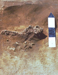
For instance, a well-studied Late Caddo farmstead
called the Cedar Grove site in Lafayette County, Arkansas,
is thought to date to A.D. 1650-1750 because of close matches
between its Caddo pottery and that found elsewhere of known
age (a technique known as "cross-dating"). Yet,
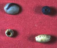
apart from two bone "beads" found in a grave, there
is not a single item from among the thousands of artifacts
recovered at the site that could be of European manufacture.
(A recent study suggested the bone "beads" were
more likely to be children's toys by by the Caddo.) Still,
the ceramic evidence strongly suggested the site dated to
early historic times. To confirm their strong suspicions,
the archeologists who analyzed the Cedar Grove site tried
radiocarbon dating, archeomagnetic dating, and thermoluminescent
dating. All three yielded frustratingly imprecise or inaccurate
age estimates. Still, cross-dating the site's large ceramic
collection shows pretty convincingly that the site spans the
late 17th and early 18th centuries.
Other historic Caddo sites have been located
by matching up places mentioned in historic documents with
archeological sites. But this too can be an exercise in frustration.
Early maps and travel logs were imprecise, even in distinctive
river valleys such as that of the Red River. The Red River
has meandered throughout its history, carving new channels
and abandoning old ones when major floods strike. Today the
river continues to change its course from time to time despite
the best efforts of the U.S. Army Corps of Engineers. Early
maps can help identify where and when the river has changed,
but topographically accurate maps were not made in the region
prior to the late 19th century. And it is not just the river's
swinging course. Historic and modern land use practices, especially
farming, but also the construction of roads, bridges, and
levees, have severely altered the lay of the land.
A good example of the challenge of precisely
locating and identifying known sites important to Caddo history
is case of the Roseborough Lake site in Bowie County,
Texas. This site overlooks an oxbow lake (abandoned channel)
in the Red River Valley about four miles upstream from the
Hatchel-Mitchell-Moores site complex (the upper Nasoni village
visited and depicted in the Terán map). The Roseborough Lake
locality has long been known to contain abundant European
artifacts dating to the early to mid-18th century (and later).
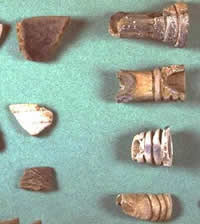
Among them are items of earthenware, porcelain, and stoneware,
as well as many kinds of metal artifacts (gun parts, knives,
nails, etc.), glass beads, and glass bottle fragments. Historic
documents indicated that Benard de La Harpe established a
French trading/military post in the vicinity in 1719. Were
La Harpe's post and the Roseborough Lake locality one and
the same, as a study published in 1973 tentatively concluded?
Or was Roseborough Lake instead the scene of the later Caddo
Post established and run by Alexis Grappe and his family in
the 1730s.
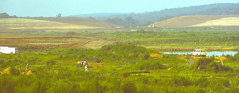
Historians and archeologists poured over old
accounts, maps, and the many European artifacts from the site
and debated these possibilities. There were other candidate
localities, including the Moore's part of the upper Nasoni
village. The matter was not decided conclusively until historical
archeologist Kathleen Gilmore from North Texas State University
brought her undergraduate students to Roseborough Lake in
1976 and carried out test excavations. Gilmore carefully compared
what she found at the site (and that found by others) with
statements in the many related documents, some of which were
contradictory or at least ambiguous. Roseborough Lake, she
concluded, must be the later Caddo Post of Alexis Grappe and
not that of La Harpe. The timing of Gilmore's fieldwork was
fortuitous. Only a few years later the property was sold to
an international soybean company headquartered, ironically,
in France. The company soon cleared the entire area and contoured
it for commercial farming, rendering the Roseborough Lake
site virtually unrecognizable.
|
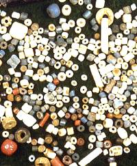
Glass trade beads from 18th- and
19th-century Caddo sites. Courtesy Tim Perttula.
|
The route of the De Soto entrada
in 1542 through the Caddo Homeland as reconstructed
by Charles Hudson. From Sabo, 1992, courtesy Arkansas
Archeological Survey.
|
Redrawn version of 1656 map by Nicolas
Sanson entitled "Le Nouvea Mexique et la Floride."
Note Caddo groups Naguatex, Nisoona, Lacane, Ayx, and
Xualatino on a western tributary of R. de Spiritu Santo.
From Perttula, 2001, courtesy Texas Archeological Society.
|
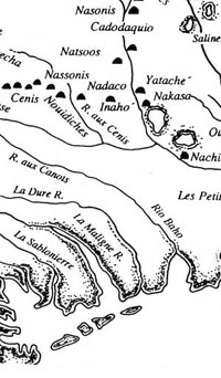
Redrawn version of 1703 map by Guillaume
Delisle entitled "Carte de Canada et du Mississippi."
Note Caddo groups on a western tributary (the Red River)
of the Mississippi River, including the Nachitoches,
Ouachita, Nakasa, Yatache, Natsoos, Cadodaquiro, Nassonis,
and Nachitoches [upper], and another series of western
Caddo groups (Inahe, Nadaco, Nassonis, Nouidiches, Cenis,
Ayeche, Nacanne, and Xayecha) around R. aux Cenis. From
Perttula, 2001, courtesy Texas Archeological Society.
|
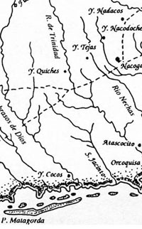
Redrawn version of 1757 map entitled
"La Province de Texas and Nueva Luciana."
Note the western Caddo and Caddo-allied groups (Adais,
Haysitos, Nacoudoches, Nechas, Nazones, and Texas) between
the Presidio de los Adaes and the Rio de Nechas. From
Perttula, 2001, courtesy Texas Archeological Society.
|
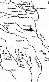
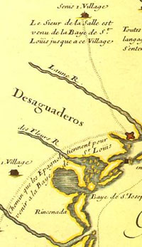
Late 18th-century Locations of the
caddo or Kadohadacho and Hasinai Tribes on the Red River
and in East Texas, the Wichita Tribes (Taovayas, Tawakoni,
Yscani, and Kichai), the Bidai, and a band of Red River
Comanche. From Carter, 1995.
|
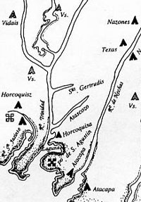
Redrawn version of 1801 map by Father
Puelles of the Provincia de Texas and Luisiana, showing
Hasinai tribes between the Sabine and Trinity rivers,
and the Kadohadacho or Caddo tribe west of the Red River
and near Caddo Lake. From Perttula, 2001, courtesy Texas
Archeological Society.
|
"Tuch-ee, Texas Cherokee"
by George Catlin. The Cherokee were one of many immigrant
Indian tribes from the Southeast that were pushed into
Texas by Anglo settlement.
|
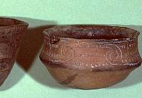
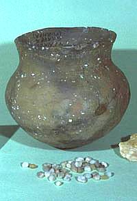
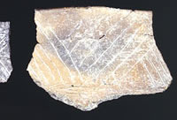
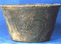
Patton Engraved pottery from the
historic Caddo Allen phase, about A.D. 1600-1800. TARL
archives.
|
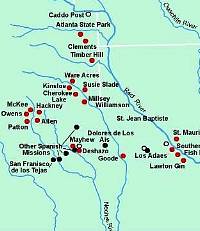
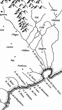
Location of some of the important
and better known Caddo and European sites dating to
the Early Historic period. Graphic by Dee Ann Story.
|
Keno Trailed, Phillips variant bowl
from the Cedar Grove site in southwest Arkansas, probably
made between 1700-1750. Courtesy Picture of Records.
|
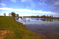
Roseborough Lake, an oxbow lake (abandoned
channel) in the Red River Valley about four miles upstream
from the Hatchel-Mitchell-Moores site complex (the upper
Nasoni village visited and depicted in the Terán
map). Bowie County, Texas. TARL archives.
|
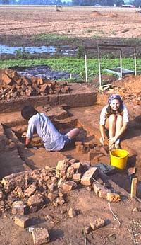
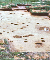
Students from North Texas State University
excavating at the Roseborough Lake site. The bricks
you see date from later occupations at the site. TARL
archives.
|
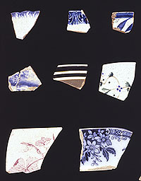
European pottery fragments dating
to the 18th- and 19th-centuries found at the Roseborough
Lake site by King Harris. TARL archives.
|
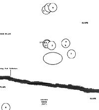
Map of the excavation units and structures
in one area of the Deshazo site. TARL Archives.
|
Two of the intersecting house patterns
at the Deshazo site, showing that some of the houses
were rebuilt in almost the same spots. Caddo houses
probably lasted 10-15 years before the wood posts rotted
and had to be replaced. TARL archives.
|
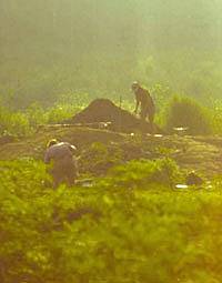
Those who excavate Caddo sites in
the middle of summer like to start soon after dawn.
Deshazo excavations in progress. TARL archives.
|
|