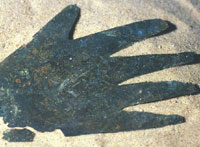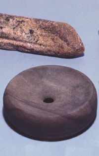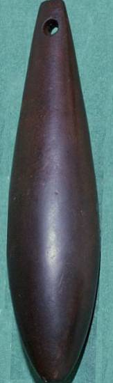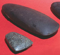
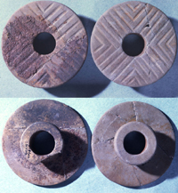
Polished stone celts such as these
were included as grave offerings in Mound C and were
also found within postholes. They were used as axes,
but some of those found as offerings are so small they
do not look like functional objects. Davis site. TARL
archives.
|
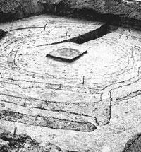
The "Ceremonial Maze"(Building
F35) as outlined by WPA excavators. View looking west
across the "wings" thought possibly to represent
those of a turkey, a special bird to the Caddo. The
orientation of the narrow extended entranceway (or "neck")
on the right (north) appears to have shifted a few degrees
during remodeling, making it look as if the entrance
was blocked. The raised ridge of baked clay on the opposite
"tail" end is the result of the intentional
burning of the structure when it was dismantled hundreds
of years ago. TARL archives.
|
Building F9 during the WPA excavation.
Over 4,600 pottery sherds, a piece of copper attached
to a cord, fragments of three clay pipes, a ceramic
ear spool, a ceramic effigy, and various stone tools
and flint flakes littered this unique semi-rounded building
at the Davis site. Some of the artifacts are visible
in this photo. TARL archives.
|
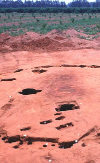
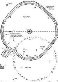
Building 125 during excavation. Thought
to be a fire temple, the intensively burned deep central
hearth had yet to be excavated when this 1970 photo
was taken, yet its location is obvious. The two large
holes nearby are where two of four large posts stood
around the hearth (the postholes have been cleared by
the excavators). TARL archives.
|
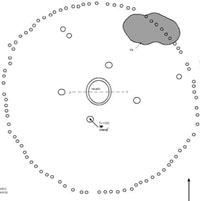
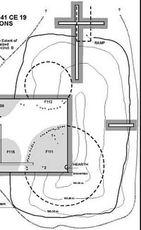
Plan map of Building 125 and cross-section
of its deep, multi-layered central hearth. Graphic by
Dee Ann Story.
|
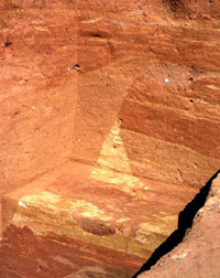
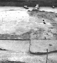
The excavation walls in the central
area of Mound C revealed a complicated sequence of cut
and fill layers. The intentional use of contrasting
soil colors by the ancient Caddo probably had symbolic
meaning. It also allowed the archeologists to unravel
the sequence of events. TARL archives.
|
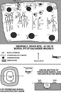
Plan map of the "log tomb" (Feature 134) so
named because of the two rows of massive log posts that
ran down the walls of the tomb and presumably supported
a low roof only about three feet above the tomb flour.
The construction of the log tomb is inferred from stains
and traces as no wood survived. On the floor of the log
tomb were eight individuals in extended positions (heads
to the north) and neatly arranged into four pairs. Graphic
by Dee Ann Story.
|
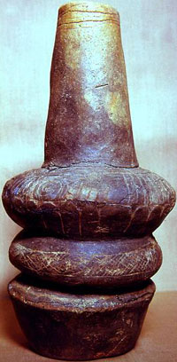
Front and back of a set of incised
stone earspools. Mound C, Davis site. TARL archives.
|
This small tomb is typical of many
of those under the outer part of Mound C. It measured
about 7 by 5.5 feet and contained a single engraved
pottery bottle as a grave offering. No bones were preserved,
probably because the burial pit was relatively shallow
(8 feet deep) and on the edge of the mound. Graphic
by Dee Ann Story.
|
|
Floor of the cane tomb. (Click to enlarge.) As can
be seen, the four individuals were arranged in extended
positions in two pairs. The pair on the right was
obviously paramount (most important) as they were
widely spaced with arms outspread (the legs were not
exposed by excavation), heads placed facing up, and
accompanied by high-status grave offerings. In contrast, the other pair of individuals was closely
spaced, with arms to the sides, had few grave offerings,
and had been arranged so that the heads faced east,
toward the paramount pair. The lesser pair (perhaps
slaves) were probably sacrificed in honor of the paramount
individuals (of whom the one on the far right was
accompanied by the greatest amount of offerings and
personal ornaments.) Graphic by Dee Ann Story. |
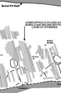
Drawing showing the layer (or coppice)
of river cane that may represent the symbolic roof of
the tomb. Graphic by Dee Ann Story.
|
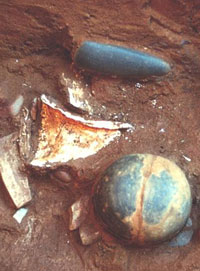
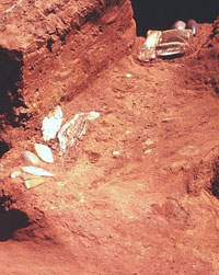
This cluster of grave offerings on
the north side of the log tomb included a celt, a marine
shell "dipper," and an upside-down ceramic
bowl. TARL archives.
|
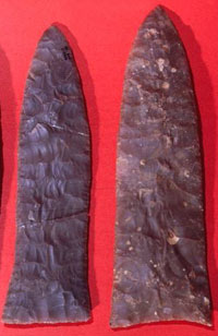
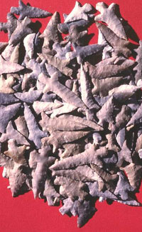
Gahagan bifaces—extremely thin
knives made of high quality flint—left as offerings
in the cane tomb. TARL archives.
|
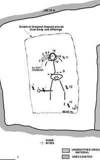
This large tomb in Mound C contained
a single young adult resting on his or her (sex not
determined) back with arms and feet spread out. Around
the waist was heavy belt made of tubular marine-shell
beads (item 9). At the right knee was a greenstone scepter.
On either side of the head were copper-covered stone
earspools apparently held in place by a pearl-beaded
band that went over the top of the head. Frank Schambach
thinks this individual is dressed and positioned as
the Bird-Man, a suggestion we find compelling. Graphic
by Dee Ann Story.
|
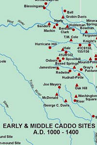
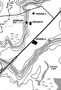
Shown here are some of the better-known
and important Early and Middle Caddo sites dating to
roughly A.D. 1000-1400. Map by Dee Ann Story.
|
|
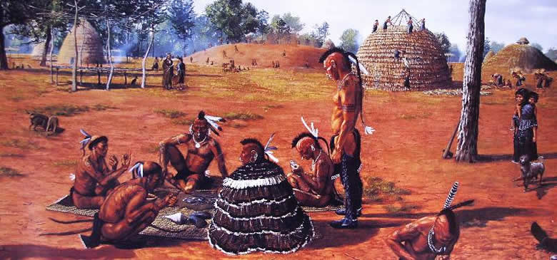
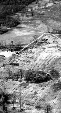
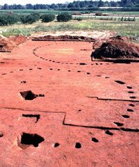
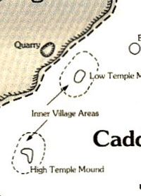
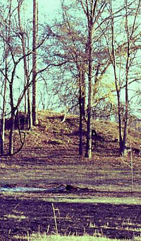
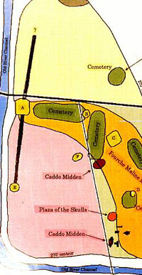
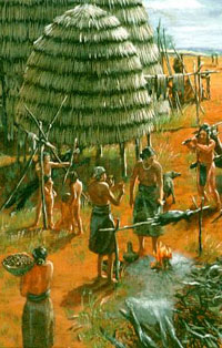
Special Buildings and their Earthen Mounds
The three earthen mounds at the Davis site are
visible reminders of the Caddo community and of the generations
of villagers for whom the site must have been the sacred center
of their world. The mounds, which were built at different
times during the site's history, served various functions,
all of them important to the life of the community. Mounds
A and B were begun as low "capping" mounds that
purposefully covered (capped) the floors of dismantled temples
and communal buildings (collectively, "special buildings").
Then the top of Mound A (and possibly that of Mound B) served
as a platform upon which new special buildings were built.
Platform or temple mounds are one of the hallmarks of Mississippian
life. Burial mounds like Mound C had been around since early
Woodland days if not before.
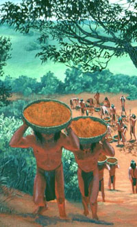
Each earthen mound at Davis was built in stages,
probably during short periods of time when the community pitched
in for the common good. The villagers dug up the soil from
areas below the low bluff that borders the wide, flat terrace
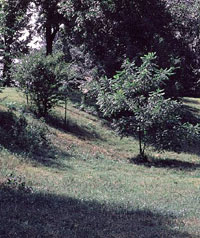
upon which the site sits. A large depression left by one of
the barrow pits where soil was removed can still be seen today
after 800 years of gradual infilling. Basketload after basketload
of soil was carried up the bluff, brought to the mound site,
and dumped. This was not a casual process, but a very deliberate
one done with care. Often the villagers selected layers of
soil having differing colors or textures for particular mound
construction layers, particularly in Mound C, the burial mound.
There, it is clear that certain colors must have be chosen
for their symbolic value. For example, a special green clay
obtained elsewhere in the Neches Valley was used to cover
certain of the shaft-like tombs that held the bodies of very
special members of the community. While we cannnot decipher
the specific meanings of the soil colors chosen a thousand
years ago, the patterning is clearly purposeful and must have
had deep symbolic value.
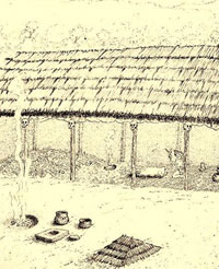
Mounds A and B mark the inner
precincts within the Davis community, a pattern than began
before the mounds were begun and one that continued for generations.
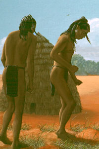
Within these precincts stood tall and often spacious beehive-shaped
wooden buildings with grass-thatched roofs that were larger
than ordinary houses. Some were probably the houses of community
leaders and their close kin. Others were temples where priests
or shamans lived and kept sacred paraphernalia and conducted
sacred rites. Still others were probably something like council
houses where men gathered on solemn occasion to plot revenge
or otherwise deal with crisis, as described by the Spanish
many centuries later. Unfortunately, the Caddo rarely left
many telltale clues as to what each building was used for.
They kept the buildings (and probably much of the village)
swept clean. And when an important building had served its
purpose, it was very carefully dismantled, its timbers yanked,
and everything above the floor was either burned on the spot
or taken elsewhere for disposal (or reuse). This is why we
use the purposefully vague term "special buildings"
to characterize these imposing and obviously important buildings.
At Davis several special buildings stand apart
from all others because they are so unusual and so complicated.
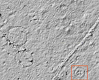
Named the Ceremonial Maze by Perry Newell
and, less prosaically, Feature 35, Building F35 was uncovered
some 11 meters (36 feet) south of Mound A. Its outline is
most curious, consisting basically of three concentric, discontinuous
wall trenches, one of which was partially offset from the
others. An apparent extended entranceway faced north and there
was a hearth in the center of the building. Strangely, the
innermost trenches and two of the exterior ones had no evidence
of posts. All the other trenches had post hole patterns or the actual remains of burned posts.
The two intersecting entranceway patterns on
the north side are enigmatic. As described by Newell, they
"gave the impression that they might form an entranceway
but the narrowness of the passageway between the posts makes
this unlikely, although possible. The idea that they might
have formed two entranceways for two successive structures
seems unlikely as … the uniformity of the whole patterns
makes it appear a single unit." (From Newell and Krieger,
1949.)
We think it more likely that two building stages
are represented and that the entranceway and perhaps other
parts of the building were remodeled (and slightly reoriented)
during its life. Regardless, Building F35 is probably some
sort of religious temple, perhaps built in the shape of a
bird. Bird-shaped buildings and mounds are known elsewhere
in the Eastern Woodlands. Use your imagination and look at
the plan map of this building. Think about a turkey, a favorite
bird of the historic and the living Caddo peoples. The entranceway
at the north is the bird's neck, its wings are spread east
and west and its tail fans out to the south. Keep in mind
that you are looking at only the foundation pattern. If this
really was a bird-effigy temple, the roof, walls, and perhaps
carved wooden sculptures would have fleshed out the design,
so to speak. You might think this notion far-fetched, but
Building F35 is most definitely a strange bird.
Newell's "Ceremonial Maze" may not
be too far off the mark. We speculate that the narrow passageways
and dividers within the room may have been used for ritual
performances with costumed dancers entering from the sides
unexpectedly at key moments. The trenches lacking posts may
have been covered with wooden planks to form foot drums. If
so, lines of performers keeping beat with their feet would
have created quite an otherworldly din within the smoky and
dimly lit confines of the interior of the bird temple. Or
the drama may have unfolded on the Mound A platform overlooking
the building, an otherworldly place from which religious practitioners/performers
emerged. Whatever the actual purpose of this building, it
is unlike any other known at the site and, for that matter,
unlike any other known in the Caddo world. It was, indeed,
a "special building."
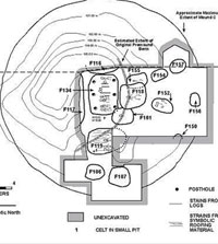
On the opposite side of Mound A was another
intriguing, if not quite as unusual, structure. Building
F9 measured about 11 meters (36 feet) across and stands
out for a number of reasons: (1) instead of being circular,
it is squared off with rounded corners (about 11 meters across;
(2) it was built with a shallow depression 14 inches deep
(other structures were built on the ground surface); (3) the
exterior wall posts were set in a trench (the posts of ordinary
houses at Davis were always set in individual holes, the wall
trench is a Mississippian technique that is uncommon in the
main Caddo Homeland, but often used in the Arkansas Basin);
(4) there were five interior posts set at regular intervals
around the circumference of the building (these may have supported
benches); (5) the floor was formed by the addition of a thin
layer of clay (prepared floors were rare at Davis); (6) the
extended entranceway was higher than the floor level; (7)
the structure was burned, yet not completely cleared away,
as was the usual practice at the site; and (8) a great many
artifacts were found within the building, most of which appeared
to have been placed there after the building was burned.
Within Building F9 were over 4,600 pottery sherds,
a piece of copper attached to a cord, fragments of three clay
pipes, a ceramic ear spool, a ceramic effigy, and various
stone tools and flint flakes. Only one other excavated Caddo
building has been found to have such an array of artifacts
near it and that is the apparent fire temple at the A.C.
Saunders site, a Late Caddo center some 57 km (35 miles) upstream
on the Neches River. While the small hearth in Building F9
does not seem to fit the notion of a fire temple, the building
was obviously something special. The purposeful depositing
of debris, including broken ritual items, suggests that is
was a conscious and presumably meaningful disposal of artifacts in the building site, perhaps following a ritual feast.
There is a better candidate for a fire temple
at the Davis site. Building 125 was uncovered about
half way between Mounds B and C. It had a simple, circular
outline about 7.4 meters (24 feet) in diameter. In the center
of the building was a deep and intensively used hearth that had
been refurbished at least twice with new clay linings. This
hearth is far more complex and intensively burned than any
other known from the site. Another unusual feature is that
four large interior posts were set at regular intervals around
the hearth, presumably to support the roof. Interestingly,
the posts were not placed on cardinal directions. This seems
to fit the early historic descriptions of the Hasinai fire
temple rather well:
The perpetual fire, the distinguishing
characteristic of the fire temple, was fed by four large,
heavy, logs arranged in cruciform pattern so that the arms
coincided with the cardinal points of the compass. In the
center of the floor, where the four logs abutted, the flame
was kept alive by feeding in small firewood from piles that
were maintained outside the structure. The ashes from the
fire were removed and were allowed to accumulate in a heap
outside. (Griffith 1954)
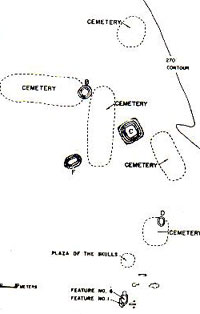
Special Cemetery
While is accurate to call Mound C a "burial
mound," it functioned as a special cemetery for certain
privileged ("elite") members of the Davis community
and others who were singled out to accompany the elite in
the afterlife. We are not sure where the ordinary villagers
were buried, but it was not here. This special cemetery was
established early in the site's history and periodically refurbished
and reused for the next 300-400 years. The mound itself was
built over the first pre-mound tomb as a flat-topped mound
resembling those built to serve as platforms for temples.
Once built, the mound was periodically enlarged and resurfaced,
never standing any taller than about 20 feet (6 meters). Although
the flat-topped appearance was maintained throughout its long
period of use, no trace of any crowning structure was detected
and it is likely that none was ever present.
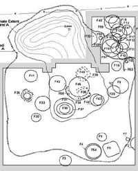
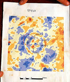
Only about a third of Mound C was excavated,
and within this area 11 burial pits were investigated in 1968-1970
by University of Texas crews led by Dee Ann Story. It is estimated
that 15-20 burial pits remain in the unexcavated part of the
mound. While most of the pits contained no more than one individual
(or, more often,had no preserved bones), three large tombs
had multiple interments (one with eight individuals and two
with four). In contrast to the pattern at the Crenshaw site,
none of the later tombs in Mound C at the Davis site significantly
intruded into earlier tombs. (This suggests a continuity of
community, a continuity that was perhaps broken at times during the
history of the Crenshaw site.)
In the center of Mound C were relatively large
and complex tombs with elaborate grave offerings. Around the
outside of the mound and surrounding the pre-mound tomb, most
of the tombs were smaller and contained far fewer grave goods.
This pattern suggests that the most important individuals
were buried in the central area with less important people
buried in the outer mound. These "less important"
individuals were still buried in a special place in relatively
large tombs and were probably not ordinary members of the
community.
We will not discuss each of the excavated tombs
at Davis. The accompanying pictures provide glimpses of some
of the variation. Instead we will briefly describe a few contrasting
examples and then summarize some of the important patterns
and unusual finds. The special cemetery at Davis began with
the construction of a single, massive log-roofed tomb containing
eight individuals and an array of fancy grave goods. This
"log tomb" (designated Feature 134) measured
about 23 by 18 feet (7 by 5.5 meters) and was dug 11 feet
(3.5 meters) into the original earth. Two parallel rows of
three large postholes ran along the north and south walls
(long axis) of the tomb and presumably supported a low roof
only about three feet above the tomb flour. The construction
of the log tomb is inferred from stains and traces as no wood
survived.
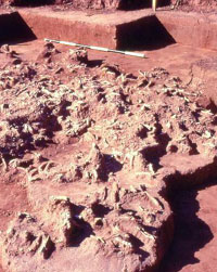
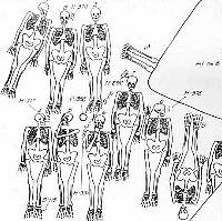
On the floor of the log tomb were eight individuals
in extended positions (heads to the north) and neatly arranged
into four pairs. The heads of the pairs at either end were
turned to face inward toward the center of the tomb. One of
the central pairs faced toward the other central pair; the
latter includes the paramount (most important) individual
to judge from the arrangement of grave goods. Because of the
very poor condition of the bone, the age and sex of the many
of the individuals is not known. Of those that could be discerned,
most were adults 20-30 years of age and most were males, but
at least one was a female and another a child of about 6 years.
Most of the offerings were placed on the north
side of the log tomb, beyond the heads of the deceased, in
clusters or piles. Among the numerous grave offerings were
conch shell drinking cups, stone ear spools, stone celts (axe
heads), wooden objects covered in thin sheets of copper, various
patches of colored mineral pigments, effigy pipes, and arrow
points. Many of these items were of exotic materials obtained
hundreds of miles away. Interestingly, there were no pottery
vessels in this first tomb. Although there are finely engraved
vessels in some of the later tombs, these are found in small
numbers that pale by comparison to the large numbers of pottery vessels
(sometimes dozens) found in elite burials at other Caddo sites,
especially those along the Red River.
The apparent paramount individual in the log
tomb at Davis had a beaded waist belt made of marine shell
(probably whelk obtained from the Gulf coast) and an exceptionally
large, beautifully made chipped-stone knife (sword, really).
This spectacular artifact is almost certainly a prized symbol
of authority and rank. It is almost 19 inches (480 mm) long,
yet just over a half-inch thick (15 mm) at its thickest point,
making it so delicate that it was broken by the weight of
the soil when the tomb roof collapsed. It is made of an almost
white exotic chert (flint) possibly obtained in the Midwest
from the Mill Creek area of southern Illinois. Other somewhat
similar, but much smaller knives were found in the clusters
of offerings on the north side of the log tomb at Davis.
When the log tomb was sealed, the extra earth
from the pit was neatly piled around it, forming a low ring-shaped
berm. The berm was constructed in a deliberate sequence of colored
earth that was the reverse of the natural stratigraphy. In
other words, the red surface soil was placed at the bottom,
then a layer of orange soil, and finally a cap of yellow soil,
the site's deepest. The roof of the tomb was covered with
a thin layer of an unusual greenish (glauconitic?) soil, then the soil removed
from the burial pit. Enough time elapsed for the tomb's roof
to decay and collapse, spilling earth into the tomb and doubtlessly
crushing some of the skeletons and delicate offerings. The
collapsed tomb was then covered over (capped) by several layers
of fill, creating the initial flat-topped mound.
At least three burial pits were dug into and
extended below the mound at this stage. Subsequently, the
first mound was enlarged and capped by more fill layers, renewing
the flat-topped mound. More burial pits were dug from the
top and sides of this mound and then it too was renewed by
a new cap. All burial pits extended into the premound soil,
suggesting that reaching the original ground surface was ritually
important. This pattern of burial use and mound capping/addition
was repeated at total of five times over a 300-400-year period.
In contrast to the log tomb, some burial pits,
particularly those dug into the outer edges of the mound were
much smaller and did not contain many offerings. For instance,
one burial pit under the south edge of Mound C (Feature 156)
measured only about 7 by 5.5 feet and contained only a single
engraved pottery bottle. No bones were preserved, probably
because the burial pit was relatively shallow (8 feet deep)
and on the edge of the mound.
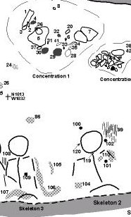
The most complicated tomb (Feature 119) was
located under the central mound. It measured about 22 by 16
feet and its floor was 16 feet beneath the mound's surface.
We can call this the "cane tomb" because
there was a layer of cane (or coppice) above the four skeletons.
(Woven cane mats or bundles of cane were probably placed on
the floors of all of the tombs.) The cane layer was the roof
or ceiling of the tomb, perhaps symbolically equivalent to
the thatched roof of a house or temple.
The four individuals buried in the cane tomb
had been arranged in extended positions in two pairs. One pair
was obviously paramount; these individuals were widely spaced
with arms outspread (the legs were not exposed by excavation),
heads placed facing up, and accompanied by high-status grave
offerings. In contrast, the other pair of individuals was
closely spaced, with arms to the sides, had few grave offerings,
and had been arranged so that the heads faced east, toward
the paramount pair.
Like the log tomb, the cane tomb had concentrations
of grave offerings on the north side of the tomb, above the
heads. There were hundreds of individual items ranging from
stream-worn pebbles (from a rattle?) and lumps of pigment
to finely engraved bottles and human effigy pipes. The artifacts
had been purposefully placed in two layers, one above and
one below the cane layer capped by a thin layer of green clay.
The paramount individuals had copper-covered wooden or stone
earspools, bone pins, a large ceremonial knife, pearl and
shell beads, traces of woven mats beneath some offerings (and
perhaps the bodies), and copper stains, one of which was once
a copper hair ornament, among other items. (Only half of the
tomb was excavated; many more offerings were probably present.)
But how do we explain the multiple skeletons?
In each tomb, the bodies were clearly interred during the
same event while the bodies were still intact, leaving us
to explain the coincidental deaths. Because of the lack of
obvious signs of warfare or disease and because the tombs
often contain individuals of different ages and different
sexes, including many young adults, we suspect that most did
not die a natural death. We suspect that the larger tombs
contain a paramount individual who died a natural death and
was accompanied by retainers or family members who were immolated
(put to death) to honor the deceased and accompany him (or
her) in the afterlife.
Such behavior is well documented in the Southeast
by archeological finds and, to a lesser degree, by early historic
accounts. In 1725, the Frenchman Le Page du Pratz witnessed
the ritual strangling of the wives, servants, and others to
accompany the deceased brother of the Great Sun, the chief
of the Natchez. Although it goes against our religious and
civil sensibilities today, other forms of human sacrifice
are well documented in prehistoric and contact period North
America as well as in Mesoamerica, most infamously among the
Aztecs (not to mention in Africa, Asia, and medieval Europe.)
In North America, slaves taken from other tribes were chosen
for sacrifice and it is possible that some or even all the
retainers in the Davis graves were slaves.
We think it more likely, however, that most of the individuals
buried in Mound C were members of the Davis community. The
repeated pattern of episodes of multiple interments can be
speculatively linked to episodes of renewal and rebuilding
at Mound A. There, evidence was found of the periodic dismantling
of special structures, followed by capping of the dismantled
buildings and the building of new structures, often of about
the same size and in the same position as the just-buried
building. Such cycles of renewal may be part of periodic ceremonies
tied to some sort of ritual or astronomical cycles or perhaps
to the deaths of paramount leaders. Unfortunately, the excavated
skeletons at Davis were poorly preserved, rendering it impossible
to make the detailed observations and comparisons that might
confirm or deny our suggestions.
Several intriguing patterns hint at the nature
and meaning of the ritual behaviors represented by the special
cemetery at Davis. The exact meanings are lost to the past,
but the repeated patterns known from the Davis site and others
are telling. One pattern is the arrangement of the skeletons
within the tombs with multiple individuals. In most cases
where the skulls were preserved, the heads of the presumed
retainers/slaves faced toward the paramount individual. The
paramount individuals had exotic artifacts obviously symbolizing
authority and high rank such as the large flint knives, stone
earspools sometimes covered in copper, shell beaded belts,
and, in two cases, polished stone staffs made of exotic greenstone
(these are often called "spuds," an unfortunate,
but memorable choice of terms). In the earlier graves most
of the offerings are piled on the north side of the tomb,
above (north of) the heads of the deceased.
Another fascinating pattern is the purposeful
selection and placement of layers of earth having certain
colors and textures. Mound C is composed of dozens of
cut and fill layers representing the digging and filling of
pits and the addition of layers capping and even repairing
the mound. Archeological trenches cut through many of these
layers and showed both how complicated the sequence of events
was and how purposeful the selection of fill was. With so
many disturbances and intrusions, one would expect the mound
fill would be jumbled and homogenized. That sometimes occurs,
but often specific layers or fills were composed only of a
certain soil with a markedly distinct color. One especially
significant earth at Davis is a green glauconitic soil that
may have been obtained from natural exposures elsewhere in
the Neches River valley (such exposures are not known to occur in
the site vicinity). A thin layer of this greenish gray soil
was placed above the high status burials and almost nowhere
else. (Newell reported finding an "altar" made of
green clay on one of the Mound A platforms, but it was poorly
documented.) The purposeful use of certain soils for certain
layers suggests that the colors and perhaps the contrasts
between colors had symbolic importance.
The very deliberate and carefully arranged patterns
represented by a single large tomb can be thought of as a
sacred scene designed to symbolize, justify, and affirm the
legitimacy, importance, and authority of the leader whose
death occasioned the tomb. Such sacred scenes may well have
embodied mythological stories such as origin myths and the
central characters in those stories. These scenes must have
reflected important Caddo icons in much the same way that
Christians use the cross and the fish, as well as biblical
characters and saints. For example, the pattern of pairs of
bodies seen in two of the tombs may relate to Caddo stories
recorded many centuries later that feature a pair of mythical
twins. According to anthropologist Robert Hall, twin-related
myths are known from many different groups in both North and
South America and may have been part of the oral tradition
of the earliest people in the New World.
Another character common to much of the Mississippian
world is often called the Bird-Man, a central icon
in the Southern Cult or Southeastern Ceremonial Complex. The
Bird-Man is usually a human figure (male) dressed in a feathered-wing
costume with a bird mask clearly representing a raptor, probably
the peregrine falcon. Variations on the Bird-Man theme are
known from many engraved shell gorgets and drinking cups,
on copper repoussé (raised relief) plates, and occasionally
on pottery or stone artifacts from Etowah, Spiro, Moundville,
and sites in eastern Tennessee, among others. In some depictions,
the human and bird elements are combined such that the figure
is neither human nor bird. Bird-Man or Man-dressed-as-Bird,
the figure usually has arms and legs akimbo, as if dancing.
Bird-Man usually looks fierce and warlike, sometimes brandishing
weapons or grasping severed human heads. Another common element
is a wide, beaded belt around the Bird-Man's waist. In sum,
the Bird-Man is probably a mythical being associated with
conflict and power, but one that was frequently personified
in ritual dance at Mississippian centers.
The Bird-Man personification may also be represented
by several of the paramount individuals in the major tombs
at the Davis site. The clearest examples come from a massive
burial pit (Feature 118) measuring (at the top) 29 by 24 feet
(9 by 7.5 meters) and dug down about 23 feet (7 meters) from
the top of Mound C. This huge tomb contained only a single
young adult (sex not determined) resting on his or her back
with arms and feet spread out. Around the waist was a heavy
belt made of tubular conch shell beads. At the right knee
was a greenstone scepter. On either side of the head were
copper-covered stone earspools apparently fastened to one
another by a pearl-beaded band that went over the top of the
head. Four clusters of 24-40 arrow points surely represent
quivers of arrows placed around the body. The arrow points
were arranged into clusters of different types of flint (chert)
including some from central Texas and others from eastern
Oklahoma. Other offerings include bits of copper, green pigment,
shell, and possible bark cloth around the skull that may represent
some sort of headdress, a pearl necklace, and a small flint
knife. Frank Schambach thinks this individual is dressed and
positioned as the Bird-Man, a suggestion we find compelling.
Individuals in several other tombs at Davis may also represent
the Bird-Man character.
While we tend to assume that the tombs and graves
in Mound C represent burial rites following the natural (or
battle) deaths of leaders, this is hard to demonstrate. Given
all the ritual patterning and the episodic nature of destruction
and renewal cycles in Mound A, it is possible that we are
wrong and that the triggering event was not the death of some
important person. An alternative possibility that we do not
rule out is that all of the individuals interred in the special
cemetery at Davis may have been sacrificed during special
ceremonies tied to either major events in the community's
history, crises (such as severe droughts), or perhaps to celestial
events (such as the alignment of Venus and Mars or a major
eclipse). In other words, the ritual/astronomical event itself
triggered death (sacrifice), not the other way around.
Demise of the Davis Community
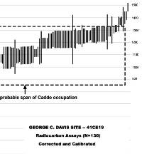
We do not know exactly when the Caddo community
who lived at the Davis site decided to move on. The community
continued into the Middle Caddo period, but was in decline
by the late13th century. The latest radiocarbon dates that
make sense suggest that some activities continued into the
14th century (early to mid-1300s), well over 450 years after
the community was established. It is clear that the abandonment
of the site was planned and orderly.
The best evidence of this is that Mounds A and
C (and probably B, although the evidence there was destroyed
by plowing) were each capped with a final layer of clay that
sealed the mounds. At Mound A, the final buildings were first
dismantled, just like earlier buildings, and then a substantial
layer of homogenous clay was added that physically capped
the mound and symbolically sealed its contents. This same
pattern has been seen at many other Caddo mound centers. When
a Caddo community abandoned a place, ordinarily they did so
with forethought and purpose.
We do not know where the community moved. One
candidate is the Washington Square site about 30 miles due
east within what is now downtown Nacogdoches, Texas. The heyday
of that site began in the mid-13th century, not long before
construction and activity at the Davis site began to wane.
Perhaps prestige and power of one ritual/political center
was eclipsed by another, as must have happened many times
in Caddo history.
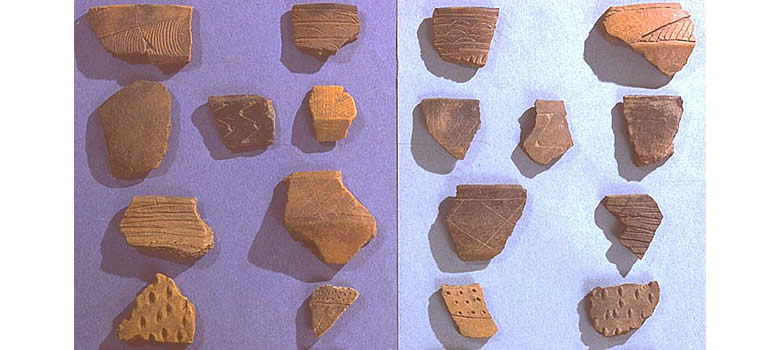
Other Early and Middle Caddo Sites
Hundreds of known Caddo sites have yielded pottery
of Early and Middle Caddo styles, which are often very similar.
Some of the better-known sites are shown on the accompanying
map. Many of the same Early Caddo patterns seen at the Davis
site and the Crenshaw site are present or suspected at many
of these sites. Ritual centers, mounds capping special buildings,
buildings built on mound platforms, special cemeteries, shaft
tombs, evidence of social ranking, use of ritual items from
distant sources, and so on. Most of the Early Caddo sites
that have seen investigation are the larger sites with mounds.
We know much less about small, non-mound sites. In the next
section we take a closer look at a small Middle Caddo village
and the continued development of Caddo society.
|
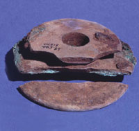
Stone earspools once covered by thin
sheets of copper. These were worn covering the ears,
held in position by cords, traces of which were found
in one instance. They are only found in tombs and other
ritual contexts and were presumably worn as status symbols.
|
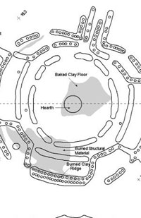
Drawing of Building F35, dubbed the
"Ceremonial Maze" by Perry Newell. The complicated
outline of this highly unusual and enigmatic structure
resembles that of an outstretched bird, perhaps a turkey
(some imagination required). We think it is a specialized
religious building within which religious performances
took place that may have featured dancers/characters
entering and exiting the scene through the narrow entranceway
and internal passages. The trenches lacking postholes
may have been covered by wooden planks to create floor
drums. Graphic by Dee Ann Story.
|
Building F9 was an unusual building
in many ways including its squared-off shape with rounded
corners, regularly spaced interior posts that may have
supported benches, and the mass of debris, including
broken ritual items, found on its floor. It looks like
the building was "ritually trashed" after
it was dismantled and burned. (Also visible is Building
F29, an earlier structure built and dismantled before
Building F9 existed.) Graphic by Dee Ann Story.
|
Partially excavated central hearth
in Building 125 (cross-sectioned posthole in background).
The intense burning that took place in this feature
is readily apparent. This hearth may have held a "perpetual
fire" like that in the Hasinai Fire Temples seen
by the Spanish in the late 1600s. TARL archives.
|
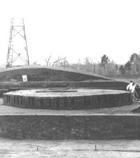
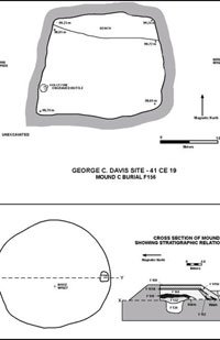
Mound C was a special cemetery for
certain privileged ("elite") members of the
Davis community. It was established early in the site's
history and periodically refurbished and reused for
the next 300-400 years. The deceased were placed into
burial pits (tombs) that were dug deeply beneath the
then-existing surface into the original ground. Once
built, the mound was periodically enlarged and resurfaced,
never standing any taller than about 20 feet (6 meters).
Graphic by Dee Ann Story.
|
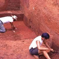
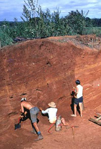
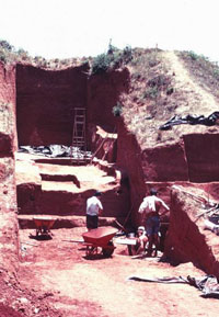
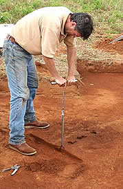
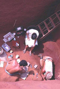
Archeologists Elton Prewitt and Dee
Ann Story clean the floor and wall of the initial excavation
pit into Mound C in 1968. Sharp trowels were used frequently
to cut fresh exposures and trace out the complicated
layers of the earth mound. Early morning and late afternoon
lighting often revealed subtle differences that could
not be seen in the glaring mid-day sun. TARL archives.
|
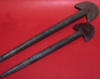
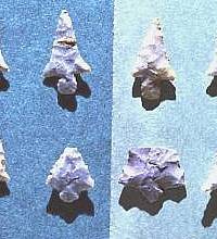
Finely made arrow points were found
in several of the Mound C tombs at the Davis site. Often
they were in tight clusters suggesting that they were
originally placed in quivers made of perishable material.
TARL archives.
|
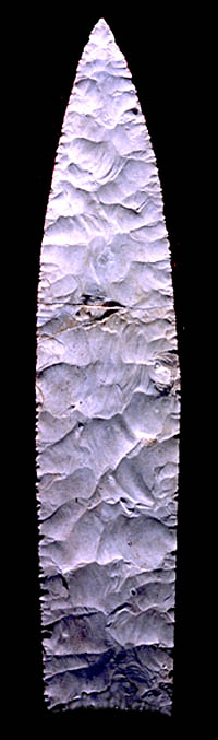
This spectacular artifact from the
log tomb at Davis is almost certainly a prized symbol
of authority and rank—a sword, really. It is almost
19" (480 mm) long, yet just over a half-inch thick
(15 mm) at its thickest point, making it so delicate
that it was broken by the weight of the soil when the
tomb roof collapsed. It is made of an almost white exotic
chert (flint) possibly obtained in the Midwest from
the Mill Creek area of southern Illinois. TARL archives.
Click to see both sides
|
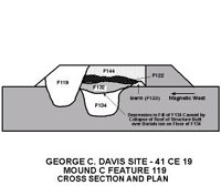
Map showing location of Feature 119,
the cane tomb, and schematic cross-section showing the
relationship of this tomb to others nearby. Notice that
none of the tombs significantly intrudes into the others.
Graphic by Dee Ann Story.
|
Cane tomb (Feature 119) during excavation,
1969. The excavation and recording of this complicated
tomb took several weeks of tedious work as each item
was carefully mapped and photographed in place before
removal. TARL archives.
|
Clusters of grave offerings along
the north wall of the "cane tomb" (Feature
119). TARL archives.
|
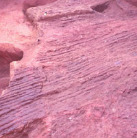
Cane impressions left by layer (or
coppice) of river cane that formed the roof of the cane
tomb. TARL archives.
|
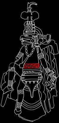
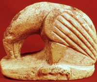
Drawing of "bird-man" depicted
on a repoussé copper plate from the Etowah site,
Georgia. In this example the bird-man seems to be a
human dancer wearing a falcon costume. A human head
appears to be dangling by its scalp from the bird-man's
left hand. The bird-man also wears a tubular shell bead
waist band ( highlighted in red), very similar to that
found in tomb F18 at the Davis site.
|
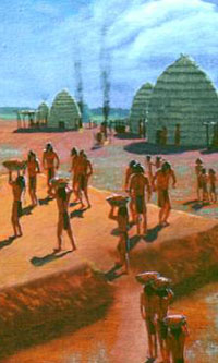
Artist's depiction of the addition
of a final layer of clay to Mound A at the end of the
life of the Caddo community at the Davis site, sometime
around A.D. 1300. The clay layers physically and, ritually
sealed the mounds and the important temples and buildings
that once stood here. Painting by Nola Davis, courtesy
Texas Parks and Wildlife Department.
|
|