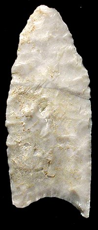
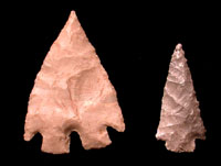
This Plainview dart point
from Bonfire Shelter dates to about 12,000 years ago.
|
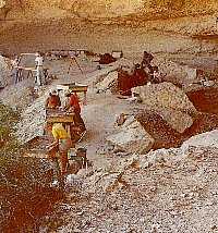
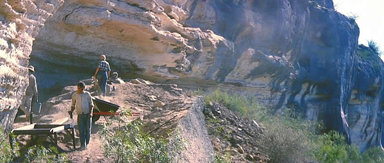
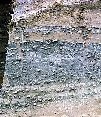
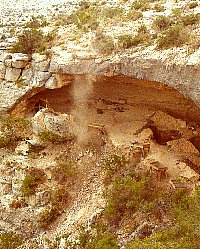
Baker Cave excavations, 1984. The
screens were placed at the edge of the rockshelter in
hopes that the updrafting winds would carry the dust
away, but at the end of the day, the archeologists were
often coated in cave dust. Photo from TARL archives.
|
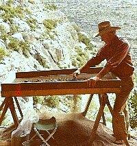
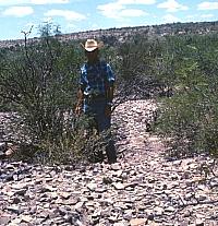
Pete Saunders found a picturesque
spot to sieve for small artifacts from the 1984 excavations
at Baker Cave. Photo from TARL archives.
|
Late Archaic dart points from the
Lower Pecos.
|
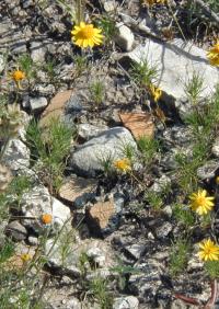
Earthenware pottery sherds from an
Infierno phase site. Photo by Steve Black.
|
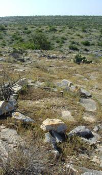
Tipi or wickiup ring at an Infierno
phase site in the Lower Pecos Canyonlands. These sites are situated
at prominent points overlooking canyons and are thought
to date after A.D. 1500, perhaps representing groups
of Plains Indians. Photo by Steve Black.
|
|
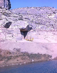
Paleoindian Period (12,500 - 7000 B.C. or
14,500-8500 RCYBP). The earliest human occupations in the
region are poorly understood. The bones of extinct Ice-Age
animals found in Bone Bed I at Bonfire Shelter are thought
to show evidence of butchering, but no stone tools were documented
from this level. (See Bonfire
Shelter exhibit.) At Cueva Quebrada ("broken cave"),
burned Pleistocene mammal bones with butchering marks were
recovered in association with 10 chipped stone flakes and
a stone adze (Clear Fork tool). Charcoal from the same context
as the burned bone yielded dates ranging between 10,500 and
12,500 B.C. (12,000 to 14,300 RCYBP) The connection between
these early dates and the tools is tenuous, and very early
human occupation (pre-11,500 B.C.) of the Lower Pecos Canyonlands remains
to be confirmed.
The presence of humans in the Lower Pecos region
is well documented by 10,000 B.C. In Bone Bed 2 at Bonfire
Shelter, extinct bison bones (possibly Bison antiquus)
were recovered along with Folsom and Plainview points. (Several possible Clovis point fragments hint that Bone Bed 2 began forming even earlier.) These
animals were stampeded over a cliff into the canyon below.
On many of the bones found in the archeological deposits,
butchering marks are clearly visible. Bison antiquus
bones were also recovered from the middle levels of Cueva
Quebrada and the lowest level of Arenosa Shelter, both of
which are roughly contemporaneous with Bone Bed 2.
Around 9,500 years ago (7500 B.C.), distinct
changes in the lifeways of Paleoindian groups are reflected
in artifact changes. Dart point styles became more localized
and diverse. Numerous Angostura and Golondrina points, typical
of the late Paleoindian period, have been recovered from the
Lower Pecos Canyonlands. The large animals of the Pleistocene had become
extinct, and the Late Paleoindian economy emphasized smaller
game and more plant foods. This is best illustrated by analysis
of a well-preserved hearth dating to 7000 B.C. in Baker Cave.
The fill of this hearth contained the remains of 16 different
kinds of plants, 11 different mammals, 6 fish, and 18 reptiles.
This diverse assemblage suggests that the area was already
a semiarid savannah with plants that are typical of the modern
environment.
Early Archaic (7,000 to 4,000 B.C. or 8500-6000
RCYBP). The combination of a semiarid climate, deep canyons,
and dry rockshelters has created perfect conditions for the
best preserved records of Archaic cultures in North America.
The earliest perishable materials in the Lower Pecos date
to the latter part of the Early Archaic. Both coiled and plaited
basketry and various tool forms —including dart points,
knives, scrapers, manos, metates, and bedrock mortars—have
been documented. Lechuguilla and yucca fiber was used to make
nets, snares, and sandals. The technology of basketry and
sandal manufacture is so similar to that documented at sites
in northern Mexico that it has been suggested that Lower Pecos
groups of the period were closely related to the peoples living
to the south and west in Coahuila.
During the Early Archaic, rockshelter occupation
became widespread in the region. At Hinds Cave in Val Verde
County, specialized activity areas were well defined, including
a latrine area, a living floor made of prickly-pear pads,
grass-lined pits, and oven areas surrounded by burned rock
refuse. Dart points characteristic of the period include Early
Corner-Notched, Early Stemmed, and Early Barbed, as well as
Baker and Bandy point types.
Two types of mobile art are known from the Early
Archaic—painted pebbles and clay figurines, the latter
rare. Painted pebbles are thought to represent human figures,
usually feminine. Clay figurines have exaggerated female attributes,
but are typically headless. Burial customs during the Early
Archaic are poorly known; however, 21 individuals representing
all age groups and both sexes were recovered from Seminole
Sink, a vertical-shaft cave near Seminole Canyon.
Middle Archaic (4000-1500 B.C. or 6000-3000
RCYBP). As populations continued to grow, the people relied
more heavily on small animals and a greater variety of plant
resources. In the Lower Pecos region, the Pandale dart point
is the time marker for the onset of the Middle Archaic. A
definitive characteristic of the Early to Middle Archaic is
the use of earth ovens for plant baking. Evidence from Hinds
Cave documents the use of earth ovens with rock heating elements
to bake lechuguilla (Agave lechuguilla) and sotol (Dasylirion
texanum). This appears to indicate a shift to less-desirable
plant resources requiring more intensive labor input.
By 2000 B.C., the localized Archaic culture
of the Lower Pecos Canyonlands was quite distinctive. Population
increase is indicated by higher numbers of both "upland"
and "lowland" sites. This coincides with the appearance
of a complex, polychrome pictographic art form, termed the
Pecos River Style, which is also considered a hallmark of
the Middle Archaic in the Lower Pecos region. These pictographs
depict anthropomorphic (human-like) and animal figures resembling
deer, mountain lions, fishes, birds, humans, and many enigmatic
figures with both human and animal characteristics. The human-like
characters adorned with feathers, wings, and antlers, and
holding plants, atlatls, darts, sticks, and pouches are believed
to have been associated with shamanic rituals, and have been
specifically linked to spiritual transformation of the participants.
Recent formal analyses of Pecos River style rock art sites
have demonstrated that some represent single panels of work
depicting specific types of rituals.
Late Archaic (1500 B.C to A.D. 1000 or 3000-1200
RCYBP). The onset of the Late Archaic in the Lower Pecos Canyonlands
is marked by the return of bison into the region. This seems
to coincide with a wet period as indicated by increases in
pine and grass pollen. The most spectacular archeological
example is Bone Bed 3 at Bonfire Shelter, which contained
the bones of an estimated 800 modern bison (Bison bison).
Bison bones have been identified at other sites in the region
including Eagle Cave, Arenosa Shelter, Castle Canyon, and
Skyline Shelter. The environment of the period has been interpreted
as cooler and wetter, promoting the growth of grasslands which
allowed bison to return to the region. Some have suggested
that plains hunting groups may have migrated into the area
following the buffalo and may be responsible for the Red Linear
rock art style.
During the final millennium of the Late Archaic,
the climate apparently returned to a more arid condition,
as is implied by a decrease in grass and tree pollen and by
the disappearance of bison from archeological deposits. The
Flanders subperiod is marked by presence of the Shumla point
type. Turpin maintains that people from the plains of Coahuila
and the surrounding mountains moved into the lower Pecos River
region following the withdrawal of bison hunters.
The presence of numerous burned rock middens
both inside and outside rockshelters suggests that the Late
Archaic was a period of intensive plant baking. An analysis
of plant materials from the refuse of a roasting pit in Hinds
Cave identified 35 plant species. Although the heated rock
was primarily used to bake sotol and lechuguilla, other very
important plant resources recovered from the midden context
included prickly pear (tunas and nodes) and mesquite (beans
and seeds).
Late Prehistoric/Protohistoric (A.D 1000
to 1500 or 1300-500 RCYBP). This final prehistoric period
is marked by the appearance of arrow points and the use of
the bow and arrow. In the Lower Pecos, the earliest appearance
of arrow points occurs around 650 B.C (1380 RCYBP) at Arenosa
Shelter. Many well-excavated sites in the region do not contain
Late Prehistoric deposits, either due to changes in settlement
patterns or to destruction of upper deposits by artifact hunters.
Point types typical of the period include a variety of arrow
points including Scallorn, Perdiz, Livermore, and Toyah .
The apparent increase in the number of ring-
or crescent-shaped burned rock middens at open sites in upland
settings has been attributed to an intensification of the
use of lechuguilla and sotol. Late Prehistoric burial customs
included flexed interments, cremations, secondary disposal
in vertical-shaft caves, and cairn burials. The Red Monochrome
art style, some examples perhaps depicting bows and arrows,
may be linked to this time period.
The Infierno phase is defined by stemmed arrow
points, end-scrapers, beveled knives, and plain brownware
and bone-tempered pottery. Settlements have been recorded
only on promontories and are marked by large concentrations
of circular stone alignments interpreted as tipi rings. The
artifact assemblage is comparable to the Toyah phase of central
and southern Texas, and is interpreted as representing an
influx of outsiders coinciding with the return of bison during
a wetter period known as the Little Ice Age in Protohistoric
and early Historic times. Age estimates for the Infierno phase
of A.D. 1500-1780 are based on comparisons with other regions,
not on radiocarbon dates. The Infierno phase may represent,
as some have argued, a very late, intrusive Protohistoric
Plains culture such as that of the Apache or, alternatively,
it may simply be a late variant of the Toyah culture in the
Lower Pecos region.
Historic (500 RCYBP-Present). In 1590,
Castaño de Sosa was the first European to traverse
the Lower Pecos Canyonlands. Spanish accounts often
describe the region as uninhabited; however, illegal slaving
expeditions that preceded de Sosa's expedition may have encouraged
the Indians to avoid all contact with Europeans. A major factor
influencing our understanding of historic native populations
of the region is that frequently, the historically documented
groups ranged into southern and central Texas as well as the
Lower Pecos Canyonlands. Historic Indian groups were widely displaced
by the expansion of the Spanish frontier from the south and
by intrusions of Apache, Comanche, and their allies from the
north and west. European and Anglo-American settlement of
the Lower Pecos did not take hold until the mid to late nineteenth
century.
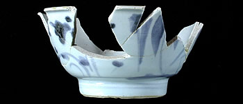
This Chinese porcelain rice bowl was found
in one of the laborer camps along the Southern Pacific railroad
within the Lower Pecos region. Chinese laborers were brought
from California in the early 1880s to build the railroad that
finally connected the west with the eastern portions of the
railroad in 1884. An archeological study of one of the railroad
worker camps found many artifacts connecting southwest Texas
with China. Photo from ANRA-NPS Archives at TARL.
|
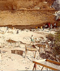
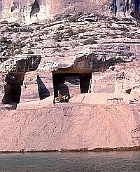
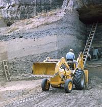
Excavations in progress at Baker
Cave, 1984. Photo from TARL archives.
|
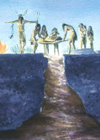
Scene showing an Early Archaic burial
ceremony at Seminole Sink as envisioned by artist Nola
Davis. Courtesy of the Texas Parks and Wildlife Department.
Original on display at Seminole Canyon State Park.
|
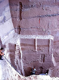
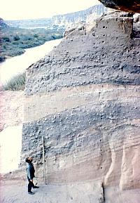
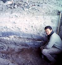
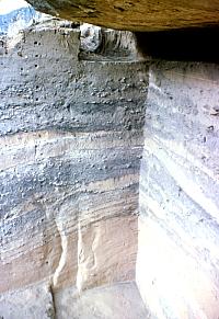
Excavations at the back of Hinds Cave. Here archeologists
have isolated a block on three sides. The profiles allowed
them to see the complex layering and guide their excavations
accordingly, layer by layer. Photo by Phil Dering. |
|
Burned Montell dart point from Bone Bed 3 at Bonfire Shelter.
This bed contained the remains of an estimated 800 buffalo,
driven off the cliff above by Late Archaic hunters. Some
think these hunters came from outside the region to the
north in the southern Plains. |
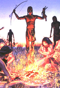
The introduction of the bow and arrow
into the Lower Pecos Canyonlands is evoked by this mural by artist
Nola Davis. Courtesy of the Texas Parks and Wildlife
Department. Original on display at Seminole Canyon State
Park.
|
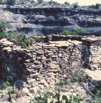
The Lower Pecos Canyonlands has an interesting
variety of historic archeological sites in addition
to its many prehistoric ones. This stone-walled structure
was a homesteaders house and is located, like many Indian
sites, near a spring within a protected canyon. Photo from ANRA-NPS Archives at TARL.
|
|