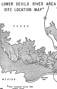
Before Amistad
 |
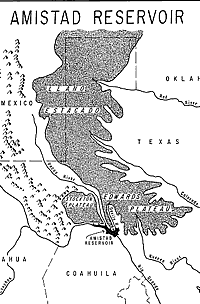
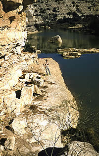
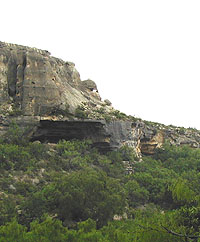
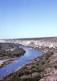
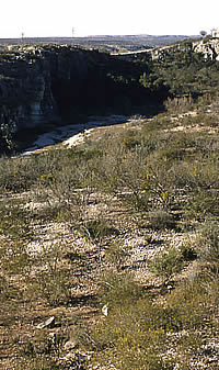
Amistad Reservoir lies just
below the limestone plateaus of central and southwest
Texas. From Dibble 1967, Figure 1. |
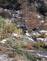
Vigorous springs flowing down
a small side canyon of the lower Devils River.
ANRA-NPS archives at TARL. |
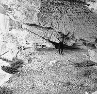
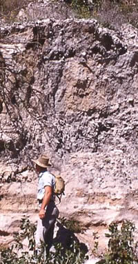
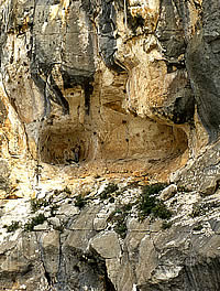
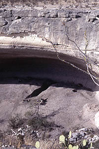
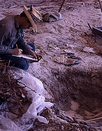
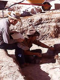
Field assistant Juan Olguin stands inside an untouched rockshelter high on a cliff overlooking the lower Pecos River.
E. B. Sayles of Gila Pueblo excavated this site in 1932 to gain insight into what he termed the Pecos River Cave Dweller culture. Sayles'
observations and understanding of the shelter's stratigraphy were sophisticated by the standards of the day, but were never published. Sayles archives at TARL. |
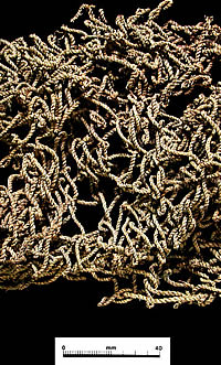
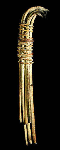
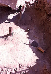
Small twine net bag from Centipede
Cave. The finding of such remarkably well preserved
perishable artifacts in the dry rockshelters of
the Lower Pecos Canyonlandsallows us to appreciate how little
remains at most open sites elsewhere in North
America. Photo from the ANRA-NPS archives at TARL,
specimen AMIS-25189. |
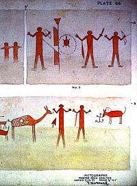
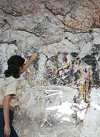
Example of Forest Kirkland's
original watercolors of pictograph panels at Painted
Rock Shelter in a small side canyon
of the Rio Grande near Comstock, Texas. Most of
these figures are of the Red Monochrome style.
Kirkland made these "copies" as he called
them, on July 13, 1937. As subsequent recorders
have learned, copying rock art is a subjective
process—what is copied depends on lighting, humidity, condition of the pictographs, and
the eye and skill of the beholder. Photo from
ANRA-NPS archives at TARL. |
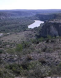
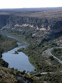
View of the Devils River,
the inspiration for "Diablo Reservoir,"
the first name given to Amistad International
Reservoir. Photo taken in 1958 during the initial
archeological reconnaissance; from ANRA-NPS archives
at TARL. |
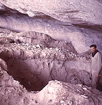
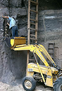
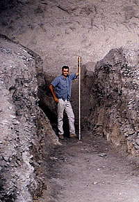
Archeologist Bill Davis inspects
a deep erosional cut into the Rio Grande terrace
during the initial 1958 reconnaissance. The charcoal-stained
dark patches just above his head and to the left
are probably the remains of baking pits used by
prehistoric peoples thousands of years ago. Photo
from ANRA-NPS archives at TARL.
|
The spectacular pictographic
panels at the Jefferson Davis site (VV124) as they appeared
in 1958 when the site was recorded. Today this site is better known as White Shaman Shelter and
is perhaps the most famous of all rock art sites
in the Lower Pecos. ANRA-NPS archives at TARL. |
|
The Amistad archeological salvage work was
never conceived of as an integrated, multi-year
research project. Instead it was organized as
a series of ad hoc annual field projects (or "seasons")...
|
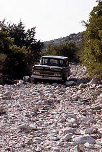
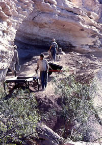
The field vehicles used during
the Amistad salvage work had to negotiate very
rough conditions. Often the archeological crews
had to carry their equipment and samples by hand
over the rocky terrain. ANRA-NPS archives at TARL. |
Rock art (pictograph) panel
at the second site (VV2) recorded during the 1958 reconnaissance.
Photo from ANRA-NPS archives at TARL. |
|
The outstanding preservation conditions and concentration
of world-class rock art sets the Lower Pecos Canyonlandsapart from
all other regions of North America.
|
Bill Davis pauses while recording
an unusual open site (VV6) consisting mainly of
10 bedrock mortar holes along a limestone ledge
overlooking California Creek, a tributary of Castle
Canyon. Wooden pestles, several of which have been found
in dry caves, were used in combination with bedrock
mortars to pulverize seeds and nuts.
(The creek had probably been damned up to create
a livestock watering hole.) Photo from ANRA-NPS
archives at TARL. |
Several well-preserved pictographs
are visible on the wall of this small overhang.
No artifacts were present on the steep "floor"
of this rockshelter (VV52), which was considered a pure
pictograph site in 1958. Today we consider all
such sites to be "archeological" sites whether
or not artifact-bearing deposits are present.
ANRA-NPS archives at TARL. |
This sizable rockshelter (site
VV66) located near the top of the canyon wall
of Pecos River (just to the left of the center
of the photo) has pictograph panels as well as
occupational debris. The pictographs were studied
by Gebhard's rock art recording team in 1958.
Photo from ANRA-NPS archives at TARL. |
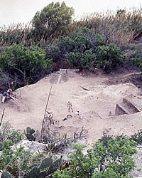
Clouds of dust rise during
the excavation of Damp Cave in the fall of 1958 under the direction of Curtis D. Tunnel.
Although the damp lower deposits of this rockshelter
gave the site its name, the upper deposits were
dry and dusty. To deal with the dusty conditions,
the archeologists built ramps just outside the
rockshelters upon which they placed sieving screens
in hopes that wind currents would carry away the
worst of the dust. Photo from ANRA-NPS archives
at TARL. |
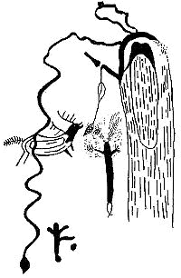
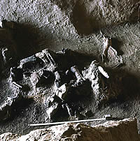
Drawing of pictographs on the
walls of Centipede Cave. From Epstein 1960, Figure
5. |
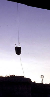
Archeologists hauling an excavation
screen up and out of the Rio Grande canyon in
1958. They have just completed work at Damp Cave,
the opening to which is barely visible in the
lower right-hand corner of the image. ANRA-NPS
archives at TARL. |
|
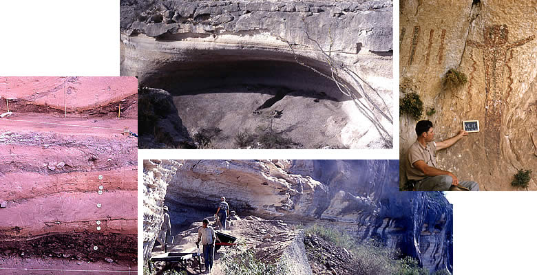
Today the waters of Amistad Reservoir cover much of the core area of the Lower Pecos Canyonlands: the lower canyons of the Pecos and Devils rivers and the Rio Grande canyon as well as the many small side canyons (minor tributaries) in the vicinity of the confluences of the three major rivers. Untold hundreds of archeological sites, including many rockshelters with dry deposits and pictograph-adorned walls, were irrevocably damaged by the fluctuating international waters. Fortunately, the reservoir area was the scene of a decade-long archeological salvage program beginning in 1958 that yielded and continues to yield many insights into the prehistory of the Lower Pecos. The "before Amistad" story of the salvage work has never really been told.
Earlier Work, Before 1958
Long before the Amistad work began, the Lower Pecos Canyonlands were known to contain Indian "caves" (rockshelters) with painted walls and thick, dry deposits of prehistoric living debris containing all manner of perishable artifacts (such as fiber sandals and wooden objects) and organic food refuse (such as animal bones and desiccated plant remains).
Archeologists began exploring the dry caves of the Lower Pecos and the Big Bend area farther to the west in the early 1930s. The 1931 excavation of Knight Cave in the Big Bend by Frank Setzler of the Smithsonian Institution of Washington was the first of many dry-cave expeditions to both areas.
In the Lower Pecos, things began with the 1932 excavations at Fate Bell Shelter in Seminole Canyon by James E. Pearce and A.T. Jackson of the University of Texas. That same year, E. B. Sayles of Gila Pueblo, a private research organization in Arizona, partially excavated three rockshelters in western Val Verde County, including Eagle Cave, as part of his ambitious archeological survey of Texas.
News of the amazing preservation conditions and the spectacular rock art spread quickly. Within a few years, archeologists and museum collectors from a variety of institutions had carried out rudimentary excavations at caves in the Lower Pecos. In 1933, the Witte Museum of San Antonio dug into the Shumla Caves and the Smithsonian Institution dug Goat and Moorehead Caves. In 1936, the Witte dug a deep trench into Eagle Cave and A.M. Woolsley of the University of Texas dug into the Horseshoe Ranch Caves. This "cave dig" period ended in 1937 with the excavation of Murrah Cave by W. C. "Curry" Holden of Texas Technical College (now Texas Tech University). The main goal of all early excavations was to amass artifact collections for study or display. Virtually all of the targeted caves yielded museum-quality perishable specimens including rabbit-fur robes, baskets, nets, sandals, atlatls, and much more.
The 1930s work, especially that carried out by the Witte Museum, called public attention to the dry caves in south and southwest Texas. San Antonio's competing newspapers touted the museum's explorations and the Witte soon put its spectacular finds on display. As a direct result, the more accessible and better-known rockshelters, such as Fate Bell Shelter in Seminole Canyon, became magnets for artifact collectors and looters, some of whom dug with landowner permission and many others who did not. By the time the Amistad salvage work began in 1958, the deposits in most of the larger rockshelters had been dug into and churned up; few of the upper deposits containing perishable materials remained intact.
Fortunately, the painted walls found in many shelters, including those whose archeological deposits had long ago been scoured away by flash floods, attracted more benign attention. A.T. Jackson was the first to recognize the importance of the region's unique rock art during the 1932 work at Fate Bell. Jackson sketched certain rock art "panels" (sections) in some of the area's rockshelters as part of what became a statewide effort culminating in his 1938 book, Picture-Writing of Texas Indians.
In 1937, a truly gifted commercial draftsman and amateur archeologist, Forrest Kirkland of Dallas, began to carefully document the remarkable pictographs (painted images) present in the Lower Pecos Canyonlands. Kirkland returned to the region several times over the next few years as part of his own statewide study. Sadly, he died in 1942 at age 50 before completing his study. Most of Kirkland's beautiful and fairly accurate watercolor drawings were not published until long after his death. The landmark 1967 volume The Rock Art of Texas Indians written by W. W. Newcomb, director of the Texas Memorial Museum, featured hundreds of Kirkland's watercolors.
After the 1930s, the Lower Pecos saw very little archeological field research until the Amistad work began in late 1950s. One notable exception is the 1947-1948 reconnaissance of the "mouth of the Pecos" region in Texas and the northern part of the adjacent Mexican state of Coahuila carried out by Herbert C. Taylor, a graduate student at UT Austin. Taylor also tested two sites in Mile and Seminole Canyons, but his main contribution was a critical review of the 1930s archeological work in the Lower Pecos Canyonlands and Big Bend regions. As he pointed out, the excavation methods used by virtually all early archeologists were very poorly suited for sorting out cultural changes through time. Consequently, the prehistoric peoples of southwestern Texas were viewed as a static, primitive culture that had persisted for a few thousand years at most.
Amistad Archeological Salvage Program, 1958-1969
The Amistad archeological salvage program began in 1958 when the planned lake was known as Diablo Reservoir and existed only on paper. By 1960, the Eisenhower administration decided that the name Amistad, Spanish for "friendship" would befit the name of an international reservoir much better than Diablo, meaning "devil" (after the Devils River). Here we will use the friendlier term throughout, even though the planned impoundment was known to most as Diablo Reservoir throughout the archeological salvage work.
Most of the federal and state laws that today protect the nation's cultural resources did not yet exist when the Amistad work began. Still, the U.S. government was increasingly aware that certain of its actions—like building new reservoirs and interstate highways—were having unintended consequences. While improved transportation systems and flood control projects were helping the nation prosper, large scale construction projects inevitably erased traces of the ancient and not-so-ancient human past such as battlefields, historic buildings, and prehistoric archeological sites.
Just after World War II, the Smithsonian Institution and the National Park Service (NPS) created what became known as the (Smithsonian) River Basin Survey program in an effort to document and excavate important archeological and historical sites within the areas all across the nation where flood-control and water-supply reservoirs were being built by the federal government. Funding was modest, as was the amount of research that was accomplished.
In Texas, examples of River Basin Survey projects included work in the area that would become Lake Texarkana in northeast Texas as well as at Canyon Lake in central Texas. During the 1950s, administration of the program shifted from the Smithsonian to the NPS and the program became known as the National Park Service Archeological Salvage Program. Field stations were established in various states, usually in association with major state universities.
In Texas the Archeological Salvage Program Field Office was located in Austin on the campus of the University of Texas. While the small staff was employed by the NPS, the program was affiliated with the university, a cooperative arrangement that harkened back to the New Deal programs (such as the Works Progress Administration or WPA) during the Great Depression in the 1930s.
In 1958, just after the initial Amistad survey was underway, the NPS began turning over its archeological salvage field offices to the universities. In Texas, this led to the creation of the Texas Archeological Salvage Project (TASP) at the University of Texas, a direct successor of the former NPS office. TASP was initially administered through the Department of Anthropology in cooperation with the Texas Memorial Museum.
The U.S. Congress passed the Reservoir Salvage Act of 1960 to give the National Park Service the proper legislative authority for its existing salvage program. The passage of this law probably explains a one-year hiatus in archeological salvage work at Amistad; 1960 was the only year from 1958 to 1969 when no fieldwork took place. After 1960, the NPS contracted with TASP for archeological services each year for work at Amistad and other planned reservoirs in Texas.
The Amistad salvage work was never conceived of as an integrated, multi-year research project. Instead it was organized as a series of ad hoc annual field projects (or "seasons") under the direction of various archeologists with varying levels of experience. Because of the way the work unfolded, there was never a single lead investigator of the Amistad archeological program, nor was there ever a comprehensive research strategy.
At the University of Texas, the TASP contracts were administered by various individuals. T. N. Campbell of the Department of Anthropology served this role initially, but soon Edward B. (Ed) Jelks was appointed as the director of TASP and was responsible for the Amistad salvage work, as well as that at other Texas reservoirs. During the early years of the Amistad work, Curtis D. Tunnell, curator of archeology at the Texas Memorial Museum, served as a general field supervisor, but individual TASP archeologists ran most of the fieldwork.
As the Amistad work progressed, Jelks was succeeded as the TASP director by Richard Ambler, Robert Alexander, and Frank Eddy. While each of these individuals had a hand in determining what was done at Amistad during certain seasons, the TASP directors were responsible for administering the entire archeological salvage program across the state.
Now let's take a look at how the Amistad salvage program unfolded. We'll focus on the major investigations and discuss each of the sites where substantial excavations took place. The story will be told in more or less chronological fashion, year-by-year. Work at the handful of sites where multiyear investigations took place will be summarized in the order the sites were first excavated. The cultural time period categorizations given are those as seen today—see Lower Pecos Culture History for reference.
Initial Reconnaissance, 1958
In the winter and early spring of 1958, John Allen Graham and William A. (Bill) Davis carried out the first archeological survey of the planned reservoir area. In about 10 weeks, the two archeologists located and recorded 188 sites. Of these, 49 had rock art, including 31 that were also considered archeological sites and 18 that were considered "pictograph sites" only—limestone overhangs or canyon walls with painted images, but no associated cultural deposits. (Today we consider all of these to be archeological sites and we view rock art sites as one broad category of archeological sites.)
Graham and Davis estimated that they covered about 70% of the proposed reservoir area. This, however, was reconnaissance-level work, meaning that they traveled fast and recorded mainly just the obvious sites, especially rockshelters. They focused mainly on the larger canyons that would be filled by the reservoir. Based on what is known today (in 2004) there were hundreds of other sites, especially open sites and small rockshelters, that went unobserved. (Some 350 new sites were recorded within the reservoir boundaries from 1994-1997 during extremely low water levels brought on by drought.) Still, the amount of work Graham and Davis accomplished in a very short amount of time is quite remarkable.
Their biggest challenge was simply that of navigating across the rough terrain and ranchland to gain access to the remote canyons where most of the sites were located. Much of the region remains remote ranchland even today. In 1958, before the reservoir and before most of the paved roads and developments that exist today, access was a major obstacle. Part of the reason the two archeologists got so much done was because Graham had grown up in Del Rio and was able to make good use of his knowledge of the area and his family connections. Permission had to be obtained from each rancher or landowner, some of whom were none too pleased with the prospect of being forced to give up part of their ranches for the lake. Nonetheless, most of them allowed the "local boy" to enter their ranches and many took Graham and Davis to the "Indian caves" they knew about. The locations of most of the larger and more obvious rockshelters with dry deposits and/or pictographs were well known to ranchers and their hired hands.
Graham and Davis concentrated on the dry rockshelters for the very good reason that these were known from the 1930s archeological work to yield perishable artifacts—sandals, basketry, rabbit sticks and the like—and their walls were often adorned with truly spectacular rock art. Today the dry cave deposits and the vivid pictographs remain the two most remarkable aspects of the cultural resources of the Lower Pecos. The outstanding preservation conditions and concentration of world-class rock art sets the Lower Pecos Canyonlands apart from all other regions of North America.
After Graham and Davis completed their fieldwork, they summarized their findings in a 1958 report and put forth general recommendations and a proposed work schedule for further work. This set of recommendations would guide much of the salvage work that followed over the next decade (view a pdf version of their complete recommendations). They defined six types of archeological sites plus the pictograph-only sites. For each site type, Graham and Davis described some of those they considered most important and most characteristic and then listed "additional" sites that were not described.
Of the 170 archeological sites that were placed into the six categories, most (74%) were rockshelters. There were 16 large rockshelters, the "most spectacular" site type and the one obviously considered to be the most important. There were 41 intermediate rockshelters and 69 small rockshelters. The categories were based on relative impressions, not on exact dimensions. For one thing, these sites are not all shaped alike. While most are true rockshelters that are wider than they are deep, there are a few that are deeper than they are wide (thus, technically, true caves). The overall dimensions of the rockshelters often includes overhang areas with steeply sloping walls or large boulders (collapsed roof blocks) that prevented deposits from forming. In general, the large rockshelters are at least 250 feet wide, relatively deep (over 60 feet), and have high ceilings, while the small rockshelters are relatively shallow (often less than 20 feet) and usually less than 40 feet in maximum dimension (anything in between was called an intermediate rockshelter).
Of the 44 non-rockshelter archeological sites, 34 were termed open surface sites and most of these were burned rock midden sites (sometimes called open midden sites). The open surface sites included some that were situated in the uplands, out of the canyons, and some that were situated on alluvial terraces (flood plains) within the canyons. There also were two special categories of terrace sites, buried terrace sites and stratified terrace sites. The eight buried terrace sites were burned rock midden sites that were mostly buried (as revealed by road cuts or erosional features). The two stratified terrace sites were buried sites that had deeply layered deposits partially exposed by erosion along the major rivers.
Rock Art Recording 1958-1959
In the fall of 1958 David S. Gebhard, an art and architectural historian who was then the director of the Roswell Museum and Art Center in New Mexico, led a small research team to begin following up on the recommendation by Graham and Davis for systematic rock art recording. The National Park Service contracted directly with Gebhard for this work. Gebhard's team, which included several photographers, visited 22 rock art sites in the Amistad area, all but two of which had been identified during the archeological reconnaissance. Thirteen sites, mainly located in and near Seminole Canyon, were chosen for careful study.
The pictographs at each of these sites were categorized, described, photographed, and drawn. Several different recording techniques were tried and it was recommended that additional rock art recording efforts use a combination of photography, tracing, and free-hand drawing. Gebhard also defined a proposed sequence of six types or styles of pictographs that he inferred had been created over a span of at least 1,000 years. Regrettably, Gebhard's main recommendation, that all rock art sites within the reservoir basin be carefully and systematically documented as part of the pre-reservoir salvage program, was never realized.
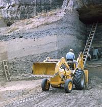
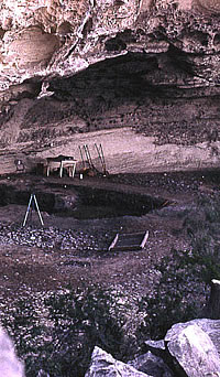
Centipede and Damp Caves, 1958
These two rockshelters were investigated in the fall of 1958 and were the first excavations undertaken as part of the Amistad salvage work. Jeremiah Epstein, an anthropology professor at UT Austin, supervised the work and wrote the resulting 1960 report; Bill Davis and Curtis Tunnell directed the excavations at Centipede and Damp Caves, respectively. The field party intended to excavate one of the large rockshelters identified during the initial reconnaissance, but were denied access by the landowner. Instead, they located and excavated two previously unrecorded rockshelters high on the canyon wall overlooking the Rio Grande.
Centipede Cave (VV191), an intermediate-sized rockshelter (44 feet wide and 37.5 feet deep), proved to be the more informative of the two shelters because its deposits were drier (hence it had perishable materials) and somewhat deeper (5 feet). Five stratigraphic zones were defined, but the deposits were found to be partially disturbed from ancient and modern intrusions. About half the shelter was excavated in 23 excavation units, most of them 5-foot squares (5-x-5 feet). Numerous artifacts of stone, bone, wood, and fiber were recovered. Judging from the recovered projectile points, the deposits at Centipede Cave dated mainly to the Middle and Late Archaic periods with some Late Prehistoric materials (i.e., arrow points). There were several pictograph panels on the walls of the shelter.
Damp Cave (VV189), was smaller (25.5 feet wide and 36 feet deep) and, as the name implies, it had relatively damp deposits with few perishable materials. Virtually the entire interior of the shelter was excavated. Of the 19 excavation units, 7 were 5-foot squares and the others were shaped irregularly to accommodate the narrow confines of the shelter. A thick burned rock midden was noted just outside the shelter and abutting the canyon wall, but was not investigated. Numerous burned rocks were found within the shelter, suggesting that plant baking was a major activity at this site. The dart points recovered indicate the deposits dated mainly to the Middle and Late Archaic periods.
All in all, the Centipede and Damp Cave excavations were something of a disappointment. Neither site had well-stratified deposits, nor did either contain particularly early deposits. The initial Amistad excavations, like most of those that followed, were done following a basic culture history approach to archeology. That is, the archeologists were preoccupied with working out the cultural sequence through time. Prehistoric cultures and time periods were identified by the distinctive artifacts, especially stone projectile points, thought to be characteristic of a given period/culture. Because of this preoccupation, the salvage archeologists focused on the recovery and description of the stone tools found in every deposit. Conversely, they spent little time and research effort on the perishable materials unique to the Amistad area.
In his 1960 report on Centipede and Damp Caves, Epstein proposed a new four-period basic chronology for the Amistad region, but it was too generalized to be of much value to later researchers. On the positive side, Epstein's detailed artifact descriptions are commendable and his report provides what may be the first essentially complete accounting of the methodology (digging and recovery methods) and the materials recovered from any archeological excavation in the region.
|
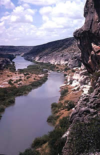
View up the winding Rio Grande.
The towering cliff on the right marks the mouth
of the Pecos River canyon. Photo from ANRA-NPS
archives at TARL. |
Small bundle of fish-hook cactus
spines tied together with plant fiber from the
upper deposits at Centipede Cave. The function
of this unusual perishable artifact is unknown.
Photo from the ANRA-NPS archives at TARL, specimen AMIS-21646. |
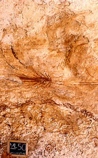
Pictograph panel at site VV50,
a rockshelter high on a cliff overlooking
the Devils River. This was one of the sites documented
by David Gebhard's rock art recording team in
1958. The pictographs visible in this image are
in the Pecos River style, which is now known to
date as early as 4500 years ago.Photo
from Amistad National Recreation Area-National
Park Service (ANRA-NPS) archives at TARL.
|
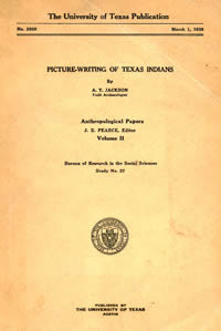
This 490-page report by A.T.
Jackson surveyed the rock art of the entire state
and included sites in the Amistad area. Jackson
wasn't much of an artist, however, and his black-and-white
renderings and quaint ideas left much to be desired. |
A Site By Any Other Name (or Number)?
Readers may wonder about the abbreviated numbers
in parentheses from time to time in this section
such as "Arenosa Shelter (VV99)." Wonder
no more. Archeological sites are always assigned
unique site numbers, and may or may not have
names.
Read
more … |
View looking down the lower
canyon of the Pecos River. Photo taken during
the initial 1958 reconnaissance; ANRA-NPS archives
at TARL. |

View of 1967 excavations in
progress at the Devil's Mouth site. In the background,
Diablo Dam is being built. In 1967, archeologist
Bill Sorrow took advantage of a bulldozer to expose
the terrace deposits more effectively than had
been possible during the 1961-1962 season. ANRA-NPS
archives at TARL. |
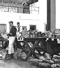
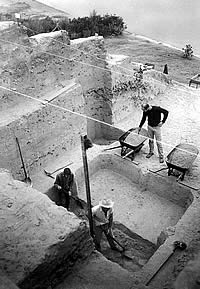
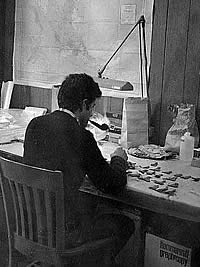
Graduate students sort artifacts
and samples from Arenosa Shelter at TARL in the
mid-1960s. From left to right are Bill Harrison,
Ron Ralph, and David Ing (click to see full image),.
TARL archives. |
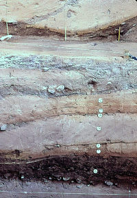
Stratigraphic diagram of the
deposits at Arenosa Shelter showing the radiocarbon
dates and estimated ages of the major cultural
layers (dark gray) on the left and the vertical
distributions of select "key markers"
(dart and arrow points) on the right. The artifacts were laid atop the chart
and photographed on a sunny day to create this
instructive graphic. The shapes
of some of the projectile points are obscured
by shadow. TARL archives. |
Ruins of what may be Feely Station, a small railroad stop and work camp on the
original route of the Southern Pacific line that connected El Paso
and San Antonio in 1883. Few historic-era archeological sites were investigated
during the Amistad salvage work. This photo was
taken near the Perry Calk site in 1967. ANRA-NPS
archives at TARL. |
View up the Devils River from
an open burned rock midden site (VV20) that Graham
and Davis recorded overlooking the river. Photo
from ANRA-NPS archives at TARL. |
View of small rockshelter (dark
hole on right) Graham and Davis recorded on a
side canyon of the Devils River. This shelter
(VV32) contained a thick deposit of burned rocks
(i.e., a midden) indicating it was probably mainly
used for plant-baking rather than for occupation.
Photo from ANRA-NPS archives at TARL. |
Kelly Cave (VV164), a rockshelter near the mouth of Mile Canyon, was tested in 1949 by geology student Charles E. Mear on behalf of the Texas Memorial Museum. At the time, the museum was searching for "Early Man" (Paleoindian) sites under the direction of E. H. Sellards. Near the bottom of the deposits, Mear encountered a layer containing Late Pleistocene animal bones, but found no evidence of human involvement. Photo by Steve Black. |
This set of small rockshelters
(collectively, they were recorded by Graham and
Davis as site VV18, a pure rock art site) is located
on a high cliff overlooking the lower Devils River.
This is one of the most spectacular site settings
in the Amistad basin. The site first documented by A.T. Jackson in the 1930s. Photo from ANRA-NPS archives
at TARL. |

Pictograph panel at VV18 during
the 1958 reconnaissance (Bill Davis holds sign board).. The site was one of the
rock art sites revisited and documented by David
Gebhard in 1958. Photo from ANRA-NPS archives
at TARL. |
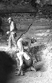
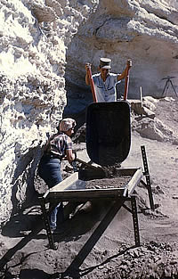
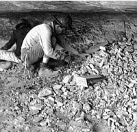
Excavations in progress at
Centipede Cave in the fall of 1958 under the field
direction of William A. Davis, the TASP archeologist
who had been part of the initial archeological
reconnaissance. This was the first site that was
excavated during the Amistad salvage work. Photo
from ANRA-NPS archives at TARL. |
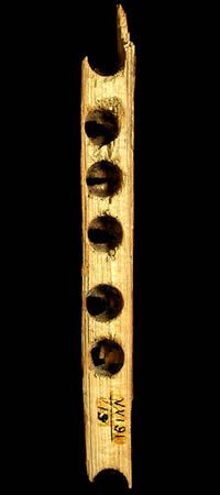
This wooden artifact from Centipede
Cave is part of a fire drill, a fire-starting
device. Photo from the ANRA-NPS archives at TARL,
specimen AMIS-25150. |
|
|
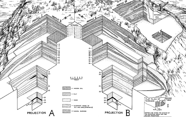
This oblique projection of the stratigraphy
of the Devil's Mouth site shows the scale and complexity of
the excavations of this site. From LeRoy Johnson's 1964 report,
Figure 5. |
View down into the excavations
at the Devil's Mouth site in 1961. This terrace
site proved very challenging because it was so
deep and contained so many layers. The archeologists
dug a series of excavation areas in different
areas of the site designed to take advantage of
the natural exposures along the plunging terrace
edge cut by the Rio Grande. ANRA-NPS archives
at TARL. |
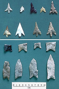
Contrasting time markers reflect over 8,000 years of prehistory at the Devil's
Mouth site. At the top are two rows of Late Prehistoric
arrow points dating to between A.D. 1000-1600.
At the bottom are two rows of Late Paleoindian
dart points dating to between 8000-7000 B.C. TARL
archives. |
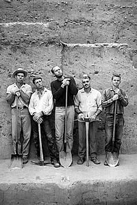
Archeological field crew at
the Devil's Mouth site in 1962. Lacking mechanical
equipment, the archeologists cut the terrace edge
back in a step-like fashion with picks and shovels. From left to right: Bill Davis, unknown, Parker Nunley, Jake Bergolofsky, and Dan Scurlock.
ANRA-NPS archives at TARL. |
Coontail Spin Rockshelter sits
high on canyon wall overlooking the Rio Grande.
Excavations took place here in 1962 under the
direction of J. Parker Nunley. Photo from ANRA-NPS
archives at TARL. |
An L-shaped set of wooden posts
exposed in the upper deposit at Coontail Spin
is thought to represent the outline of some sort
of simple structure, perhaps a windbreak, that
abuts a large boulder (roof spall) near the front
of the shelter. Photo from ANRA-NPS archives at
TARL. |
Graduate student Penny Lindsey
traces a pictograph panel at Satan Canyon onto
clear acetate during the 1963 rock art recording
work led by Terence Grieder. ANRA-NPS archives
at TARL. |

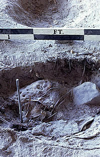
Bone Bed 2 excavation in progress
in the winter of 1964. Roy Little plots the position
of bones on a field map as Emilo Hinojosa calls
out measurements. Photo by Dave Dibble, ANRA-NPS
archives at TARL. |
|
Devil's Mouth, 1961-1962
This site is a deep, open occupation or terrace site located at the confluence of the Devils River and the Rio Grande. Brief testing of the Devil's Mouth site (VV188) in late 1959 led to extensive excavations in the fall of 1961 and early winter of 1962. LeRoy Johnson, Jr. directed this work and wrote the report published in 1964 by the Department of Anthropology at UT Austin. Devil's Mouth proved to be one of the most important sites excavated during the Amistad salvage program, rivaled only by Bonfire Shelter and Arenosa Shelter.
The work at the Devil's Mouth site proved highly informative because of its deep stratification—24 strata (layers) were defined, the lowest (and oldest) some 36 feet below the surface. The layers yielded a remarkable sequence of projectile points dating from the Late Paleoindian period (about 7-8,000 B.C.) to the Late Prehistoric and Protohistoric periods, just before the Spanish first entered the area in the 16th-century.
The deep layers at the Devil's Mouth site were formed mainly by periodic flood deposits left behind by one or both of the major rivers (Devils and Rio Grande). Between floods, prehistoric groups often camped on the terrace, leaving behind debris that formed layers within the flood deposits. Erosion and slope wash also contributed sediments to the development of the terrace deposits and to some mixing of materials of differing ages. Compared to the deposits in most of the known rockshelters, the cultural layers at Devil's Mouth were much less mixed and much easier to place in correct chronological order. Johnson's study provided the first reliable chronological sequence of projectile points, a sequence that other researchers found very helpful.
In the mid-1960s Johnson integrated the sequence of points and other stone tools found at three Amistad sites (Devil's Mouth, Centipede Cave, Coontail Spin Rockshelter) with that recovered from other sites in southwestern and central Texas for his 1966 dissertation at UCLA (an abridged version of which was published in 1967 by the Texas Memorial Museum).
Coontail Spin, Mosquito, Zopilote, and Doss, 1962
Small-scale excavations were carried out at these four sites in the fall of 1962 by two field parties. J. Parker Nunley led an excavation team, while Mark Parsons and Eddy Peterson carried out more survey and testing. Two of the sites (Coontail and Doss) had been recommended for further work by Graham and Davis. Parsons and Peterson discovered and tested Mosquito and Zopilote Caves (and certain others) while scouting ahead for suitable rockshelters for the excavation crew to turn to after finishing work at Coontail Spin. In doing this, they revisited sites in four of the major canyons visited by Graham and Davis and recorded an additional 10 sites found by searching out small side canyons and arroyos not reached during the initial reconnaissance.
Coontail Spin Rockshelter (VV82) is a very wide and relatively shallow shelter (300 by 40 feet) high on the north wall of the Rio Grande canyon. Most of the shelter's surface (floor) was sloping, and excavations were done in two relatively flat areas at either "end" (side) of the shelter. Cultural materials were found in the upper 6-7 feet and then an apparent sterile deposit was reached, but the bottom of the deepest deposits was never reached. The upper strata had abundant perishable artifacts, and all layers but the lowest contained stone tools. Unfortunately, the site's deposits were not neatly layered, as had been hoped for.
The Amistad archeologists did not yet really understand exactly how the complicated deposits encountered in the region's occupied rockshelters had formed and changed through time. Coontail Spin Rockshelter provided several clear examples of characteristic "formation processes," to borrow a useful modern archeological term. For instance, two large, deep, and partially overlapping rock-lined plant-baking pits were encountered that had obviously been dug into and displaced existing layers, thereby creating "stratigraphic mixing." Another type of "intrusive event" was a human burial. The remains of six adults and one infant were found ; they had been interred within fairly shallow pits along the back of the rockshelter, a common prehistoric burial practice in the region.
One telling feature found in the upper deposits at Coontail was an L-shaped set of wooden posts. This pattern is thought to represent some sort of simple structure, perhaps a windbreak. Dart points from the site dated mainly to the Middle and Late Archaic periods, although some scattered late Paleoindian points were found, perhaps indicating that an earlier deposit had been disturbed by later inhabitants.
Mosquito Cave (VV215) was a smaller, intermediate-sized rockshelter (100 feet wide by 20 feet deep) located on a small side canyon (arroyo) off of Presa Canyon. Two areas were excavated, the larger measuring about 15-x-20-feet. The deposits proved to be relatively shallow (less than 7-feet deep) and poorly layered. The most interesting finds were that of several lanceolate projectile points (Plainview and Angostura types) dating to the Late Paleoindian period. These, however, were found in mixed and obviously later deposits. Other artifacts dated to the Middle Archaic, Late Archaic and Late Prehistoric. Perishable artifacts were few.
Zopilote Cave (VV216) was a relatively small rockshelter (60 feet wide by 20 deep) located on a small side canyon of Seminole Canyon. Within the shelter, Parson and Peterson encountered large quanitities of scattered burned rocks and a small, oval-shaped burned rock midden (plant-baking feature). Some artifacts were found, but most were in the upper deposits and there was little indication of layering. Most of the site's artifacts dated to the Middle and Late Archaic periods.
The Doss site (VV3) was one of the few burned rock midden sites investigated during the Amistad salvage program. The site is situated on a high bluff overlooking the Devils River and is one of many burned rock midden (BRM) sites that still dot the area around the lake. Like many BRMs, the one at the Doss site was a mounded, oval-shaped accumulation of fire-cracked rock. Such accumulations result from a repeated pattern of plant baking. The Doss site was tested with two 5-foot-wide trenches that intersected to form a T. Stone tools dating to the Middle and Late Archaic were recovered, but not much was learned about how burned rock middens formed.
Rock Art Recording, 1963-1965
In the mid-1960s two groups of researchers carried out independent and somewhat competing studies of various rock art sites in the Amistad area. David Gebhard, who had become an art history professor at the University of Santa Barbara, returned to the area in 1964 to do more detailed studies of the 13 sites he had doumented in 1958-1959. His 1965 report to the National Park Service expands the descriptions and interpretations presented in his earlier, 1960 report. Gebhard continued to use and refine his six-style rock art chronology and noted that it would be necessary to reconcile his chronology with those proposed by Terence Grieder and by W.W. Newcomb.
In 1963, Terence Grieder, a professor of art history at the University of Texas, recorded and studied the pictographs at two side-by-side rockshelters in Satan Canyon, a small tributary of the Devils River. Grieder was assisted by several colleagues and students during two several-day work sessions, the results of which were reported in a 1965 report. Grieder and his students documented other rock art sites in the reservoir basin in the mid-1960s, but never published the results apart from brief mention in a 1965 article in American Antiquity. In both the article and the Satan Canyon report, Grieder's main intellectual concern seems to have been unraveling the evolution of the area's vivid rock art through time. Little progress toward that goal was realized with the Satan Canyon work as the two sites contained mostly pictographs of a single style, the Pecos River style.
Bonfire Shelter, 1963-64
Bonfire Shelter (VV218) is one the most remarkable and best-known sites excavated during the Amistad work. A separate online exhibit (see Bonfire Shelter) details much of the story of the original excavations and later work done in 1983-1984 by another group of archeologists from the University of Texas at Austin. Here is a brief recap of the original excavations.
Minor testing of the shelter in 1962 by Parsons encountered what appeared to be a massive layer of burned bison bone, amid which were Archaic dart points and other indications of human involvement. Nothing like this had been seen at other rockshelters in the region and Bonfire Shelter was recognized as a major research opportunity. An experienced field archeologist, David S. (Dave) Dibble, was recruited from Utah to run the 1963-1964 excavations. The burned bone layer proved to be the remains of the latest of at least two major bison kill episodes, one dating to the Late Archaic (ca. 800 B.C.) and a much earlier one dating to the Paleoindian era (9700 B.C. or earlier). The site remains the oldest and southernmost example known of a bison "jump" and major kill site in North America.
|
|
Devils vs. Devil's
In proper English, it ought to be the Devil's
River, but cartographers (map makers) and authorities
spell it without the apostrophe. While the Devils
River it may be, the archeologist who
named the Devil's Mouth site (Johnson) spelled
it correctly. Alas, another Amistad archeological
site is known as the Devils Rockshelter. Archeological
editors fuss over the Devils and Devil's, but
errant spellers can always claim "the Devil
made me do it." |
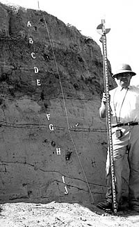
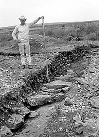
Archeologist LeRoy Johnson holds
a stadia rod beside an exposed wall at the Devil's
Mouth site in 1961. The letters mark the stratigraphic
layers identified in the upper part of this very
deep terrace site. ANRA-NPS archives at TARL. |
Screening station at Coontail
Spin Rockshelter. Photo from ANRA-NPS archives
at TARL. |
Getting archeological equipment
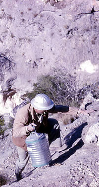
and supplies in and out of many of the rockshelters
at Amistad was no easy matter. In this photo Jake Bergolofsky hauls up drinking water to Mosquito,
a daily task. Photo from ANRA-NPS archives at
TARL. |
Excavations in progress at
Coontail Spin Rockshelter in 1962. Photo from
ANRA-NPS archives at TARL. |
|
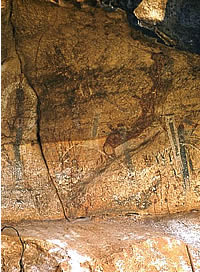
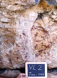
Rock art panel at site VV2
(mislabeled here) as it appeared in 1958 during
the initial reconnaissance. The pictographs shown
here have been partially obscured by minerals
deposited by moisture seeping out of cracks in
the shelter wall during wet periods. This is one of
many challenges researchers face when documenting
Amistad rock art. ANRA-NPS archives at TARL. |

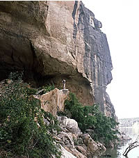
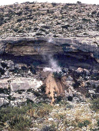
Bonfire Shelter as viewed
from the opposite canyon wall. Most of the shelter
is hidden from view behind the huge limestone
blocks that once formed a much larger projecting
roof. The only visible part of the shelter is
the light-colored curving section in the lower
right. Photo by Jack Skiles. |
|
|
|
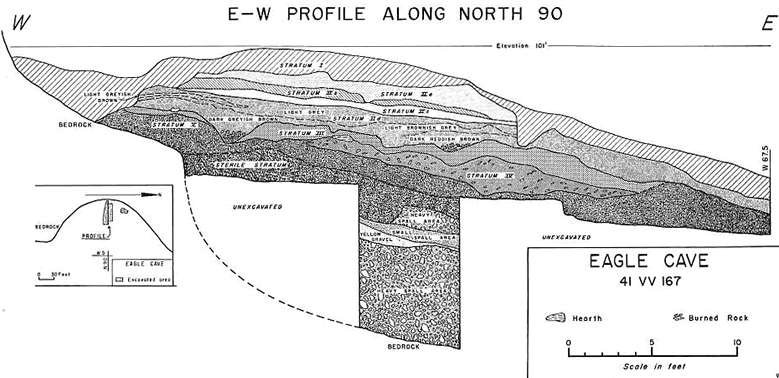
Cross-section of the stratigraphy exposed
at Eagle Cave. From 1965 report by Richard Ross, Figure 4. |
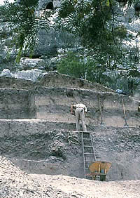
During 1963 testing at Eagle
Cave the large central trench excavated by the
Witte Museum in 1936 was cleaned out and used
to guide test excavations. Photo from ANRA-NPS
archives at TARL. |
Eagle Cave is one of the largest
dry rockshelters in the Amistad area. This photo
was taken in 1963 during testing. Photo from ANRA-NPS
archives at TARL. |
Mark Parsons standing within
a looter's pit he has partially cleaned out at
Fate Bell Shelter during 1963 testing. Photo from
ANRA-NPS archives at TARL. |
Map showing the approximate
location of the sites recorded during the 1964
survey. From Dibble and Prewitt 1967, Figure 4. |
Archeological work at Zopilote Cave was challenging because of the cramped quarters. The rocks visible in this 1962 photo covered a very large piece of unprocessed yellow ochre, perhaps cached for later use in making pictograph paint. ANRA-NPS archives at TARL. |

Plant pollen preserved in
the layers of Amistad sites gave botanists a record
of changes through time in vegetation patterns
and the climate. This mimeographed chart was used
in teaching at the University of Texas in the
late 1960s. Mott Davis collection, TARL archives. |
Soil column (monolith) being
prepared for removal at Arenosa Shelter. These
samples allow geologists and soil scientists to
study the site's sediments back in the laboratory.
The collection process begins with the excavation
of two parallel channels, leaving a narrow intervening
sediment column. Boards are then used to create
a 3-sided box to hold the column together. Finally,
the column is carefully cut free of the wall and
another board is used to cover the open side and
finish the box. Properly prepared monoliths can
be stored for decades as a near-permanent record
of the site's stratigraphy. ANRA-NPS archives
at TARL. |
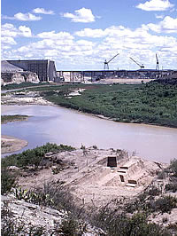
Low-water crossing of the
Pecos River by highway U.S. 90, as it appeared
in 1965. The Arenosa Shelter excavations are visible
near the center of the image. This deep terrace
site is situated just beyond the side canyon that
enters the Pecos above the banked curve of the
winding road. ANRA-NPS archives at TARL. |
Arenosa Shelter was chosen
for excavation because of its location on a low
terrace of the Pecos River. The 1965-1968 hand
and mechanical excavations there documented 49 layers alternating between periods of occupation
and major flood deposits. The earliest of these deposits date
back to over 10,000 years ago. Photo from ANRA-NPS
archives at TARL. |
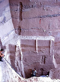
Mechanical and hand excavations
in progress at Arenosa Shelter. Heavy equipment
was needed because the deposits were over 40 feet
deep. Photo from ANRA-NPS archives at TARL. |
Archeologist Dave Dibble looks
up from the bottom of the deepest excavation pit
at Arenosa Shelter. This photo was taken in 1968
while soil sampling was underway. The narrow,
vertical gouged-out areas in the profiles are
places were samples and special sediment "monoliths"
(intact columns) were removed. Photo by E. Mott
Davis, TARL archives. |
NPS archeologist photographing
Parida Cave after Amistad Reservoir had filled.
The lake provided ready access to this site and
many others, resulting in illegal digging by artifact
collectors. Photo by Joe Labadie, ANRA-NPS
archives at TARL. |
Diablo dam under construction
in 1967. In the foreground are the deep excavation
units at the Devil's Mouth site. Photo by E. Mott
Davis, TARL archives. |
Excavations in progress at
the Nopal Terrace site in 1965. The archeologist
in charge, Bill Sorrow takes notes on the far
left. The terrace deposits visible behind him
were nicely stratified (layered), but most of
the visible cultural layers (dark bands) dated
to the Late Archaic, the best known period at
Amistad. ANRA-NPS archives at TARL. |
Michael Collins takes notes
while recording a fascinating cultural feature
at the Perry Calk site during 1967 testing. The
stone-lined pit on the right had remnants of a
second (interior) lining—a tanned bison hide.
This feature probably represents a cooking pit
used for stone boiling. Photo from ANRA-NPS archives
at TARL. |
Conejo Shelter and Cueva Quebrada.
Conejo is the larger overhang with a cloud of
dust rising up from the front center of the shelter
during the 1969 excavations. Cueva Quebrada is
within the small overhang that can be seen on the right-hand side
of the enlarged photo (Click to see.). Photo from ANRA-NPS archives at
TARL. |
Closeup photo of a small looter's
hole with exposed desiccated plants at Conejo
Shelter. The archeologists outlined and worked
around the disturbed area, and it was a convenient
location for a steel rebar used for dividing up
the site into excavation units. Photo from ANRA-NPS
archives at TARL. |
Bob Alexander analyzing perishable
plant remains (probably chewed sotol leaf bases)
from Conejo Shelter. Photo taken in 1969 at the
Texas Archeological Salvage Project offices in
Austin. TARL archives. |
Today the large samples of artifacts
and ecological materials recovered from the Amistad archeological sites, as well as the supporting documentation
(field notes, drawings, photographs, etc.), are curated at the Texas Archeological Research
Laboratory on behalf of the National Park Service.
To see over 1200 images of artifacts from the Amistad National Recreation Area, visit the National Park Service Museum Collections website.
|
|
Eagle Cave and Fate Bell Shelter, 1963
These two sites are both very large, impressive rockshelters with massive cultural deposits built up over thousands of years of intermittent prehistoric occupation. Although both sites (like Bonfire Shelter) lay above the maximum flood pool of the reservoir, it was feared that the lake would provide looters with easy access. Both rockshelters had been partially excavated in the 1930s by archeologists from the University of Texas (Fate Bell) and the Witte Museum (Eagle). The earlier excavations had left much to be desired by the standards of the 1960s. In 1963, archeologists carried out additional excavations at both sites to gain more scientifically rigorous data and to determine whether either shelter still had important research value.
Eagle Cave (VV167) lies within Mile Canyon not far from Bonfire Shelter. The 1963 work at Eagle Cave deliberately coincided with the initial work at Bonfire so that both archeological crews could share logistics. Archeologists Richard Ross and Mark Parsons carried out the Eagle work over a three-month period with the assistance of four laborers. The trench excavated by J. Walker Davenport of the Witte Museum in 1936 had been left open and was still a gaping hole three decades later with ragged and sloping walls. There was also a large pothole elsewhere in the shelter. The Eagle Cave deposits were at least 17 feet thick, so digging new pits elsewhere would have been very time-consuming and destructive. Ross and Parsons took advantage of the existing holes, cleaning them out and cutting back the edges until the original layering could be seen. They then opened up small adjacent excavation areas, which they peeled back layer by layer, using the layering exposed in the walls of the cleaned-out holes to guide their excavations.
Five major strata were defined, the oldest (and lowermost) radiocarbon dated to at least 6700 B.C. The layering, especially that within Stratum II, proved to be complicated, convoluted, and difficult to follow as many fine layers, prehistoric pits, and disturbances were present. The uppermost stratum proved to be badly disturbed, but the lower deposits at Eagle Cave were intact and the site was found to have considerable research potential. During the testing, several painted pebbles were found, including one from a relatively deep (and early) layer. (Parsons later studied these unusual artifacts and worked out a chronology of their development through time.) Nonetheless, no further fieldwork was done, in part because Eagle Cave lay above the maximum level of the planned reservoir and in part because the spectacular finds at nearby Bonfire Shelter overshadowed the Eagle Cave work.
Fate Bell Shelter (VV74) in Seminole Canyon was tested by Parsons and two laborers over a little more than a week. This site had been badly disturbed by uncontrolled digging by artifact collectors in the 1940s and 1950s, so much so that the surface of the enormous shelter was pockmarked by dozens of potholes, many intersecting one another. Parson's main task was to determine if any of the shelter's deposits remained intact. Using the Eagle Cave methodology, he cleaned out several deep potholes and, finding apparent undisturbed layering in the walls, excavated three small test pits. Based on his tests, substantial lower deposits dating back to what was considered to be Early Archaic times appeared to be undisturbed. Perishable materials including a sandal were found with these relatively early deposits.
Parsons realized that Fate Bell still had considerable research potential and recommended that additional, more extensive excavations be carried out. Other Amistad research priorities were, however, judged more pressing. Fortunately, in 1980 the site became part of Seminole Canyon State Historical Park, a 2,100-acre archeological, historical, and natural preserve. Today visitors can visit Fate Bell Shelter on the park's regularly scheduled tours.
Survey and Testing, 1964-1965
Over a period of a little more than a year, archeologists Dave Dibble, Elton R. Prewitt, and Curtis Tunnell carried out a varied program of intensive survey, hand testing, and machine testing in the proposed reservoir area. Most of the work was concentrated in the lower part of the reservoir basin within the terrain that would be inundated soon after the dam was completed. In the fall and early winter of 1964, sixty-seven new sites were located and recorded including 48 open midden sites, 6 buried midden sites, 12 small rockshelters, and a pictograph site. This work greatly expanded the number of documented burned rock midden sites as archeologists concentrated on less conspicuous areas away from the main canyons where most of the larger rockshelters were located.
In the spring of 1965, test excavations were carried out by hand and with the assistance of machinery at nine sites in the lower reservoir basin, seven of them among the newly recorded sites. The use of a backhoe/front-end loader at six of the sites, all of which were situated on potentially deep river terraces, was innovative. In the mid-1960s, the use of heavy machinery for archeological testing was unusual and somewhat controversial because some archeologists feared the machines would destroy more information than they revealed. This unfounded fear was soon allayed and today heavy machinery is used routinely in geo-archeological site testing and overburden removal. At Amistad, backhoe trenching sometimes allowed the archeologists to gain much needed access to the lower deposits at deep terrace sites.
One such site was the Devil's Mouth site, where backhoe trenching was carried out in a failed attempt to clearly trace the deep Early Archaic and Late Paleoindian layers that Johnson had recognized in the 1961-1962 excavations. Unfortunately, the machine they had proved inadequate to the task. Mechanical trenching was more successful at the other five sites, one of which merits discussion.
The Devils Rockshelter (VV264) was a small, shallow shelter located at the foot of the Rio Grande canyon wall just downstream from the Devil's Mouth site. Because the of the shelter's location, it was filled mainly by alluvial terrace deposits (flood layers) within which were artifact-bearing layers representing shelter occupations between floods. Machine trenching and the hand excavation of two 5-x-10-foot units sampled the site's nine strata. The lower layers contained stratified Early Archaic materials, the first such find at Amistad. Recognizing the site's significance, Prewitt reported the results in a 1966 article in the Texas Journal of Science.
In the fall of 1965, Dibble directed test excavations at five sites within the lower canyon of the Pecos River just above its confluence with the Rio Grande. The results at four of the sites were not encouraging, three small rockshelters and one open terrace site. The fifth site, Arenosa Shelter, proved remarkable and much of the field season was spent mapping and testing this deeply stratified site (see below). At the same time, Parsons led a small survey team that documented 11 historic sites dating to the 19th-century, a time period previously neglected by the salvage effort.
NSF Paleoecology, 1964-1966
By the early 1960s American archeologists realized that the study of prehistoric cultures was inescapably linked to ecology—the study of how plants and animals adapt to their natural surroundings and climatic conditions. Likewise, it was becoming apparent that for the Amistad region it would be the many dry caves that would provide the most important scientific information about the paleoenvironment (past changes in climatic conditions) and how those changes affected the long sequence of prehistoric human life.
The NPS-funded archeological research for the Amistad region focused mostly on the culture history of the region. This changed when Ed Jelks (TASP director) and Dee Ann Story (professor of anthropology, UT Austin), obtained a two-year grant from the National Science Foundation (NSF) to conduct new types of sampling and analyses. Their grant work focused on the analysis of ancient animal bones, fossil pollen, and preserved plant remains from archeological sites in the region. This project also resulted in the first paleoenvironmental reconstructions for the region.
The NSF-funded project was a much-needed complement to the ongoing Amistad salvage work. It was intended as a pilot study and was successful in demonstrating the vast potential for intensive studies of the paleoenvironment, ancient diets, and how ancient cultures utilized the plant and animal resources.
Jelks and Story assembled a multidisciplinary team of scientists and graduate students to explore the preserved plant remains, fossil pollen, animal bones, and present ecology of the region. That group studied collections and samples already gathered from sites and carried out new types of specialized sampling at other sites still under investigation, including the "big three": Bonfire Shelter, Devil's Mouth, and Arenosa Shelter. Their preliminary results appeared in the 1966 final report to NSF, which represented a “first” for these types of combined studies in Texas.
The importance of this first NSF-funded paleoenvironmental study cannot be over emphasized. It set in motion a chain of events that would eventually earmark the Amistad region as being one of the best-understood areas in Texas. Fossil pollen studies led to a long paleoenvironmental sequence for the region spanning more than 10,000 years and it helped explain why Bonfire Shelter contained only two major bison bone deposits 7,000 years apart. Other studies of fossil pollen, animal bones, and plant remains verified the long record of stable plant and animal usage in the region, and by the late 1960s the first studies of human coprolites (preserved human feces) provided one of the earliest, and most detailed records of ancient plant and animal food usage in the United States. Perhaps most significantly, the initial NSF study alerted archeologists and others to the critical importance and enormous potential of these new types of scientific studies. Today, in the early twenty-first century, paleoenvironmental research continues on sites and materials from the Amistad region.
Arenosa Shelter, 1965-1968
Arenosa Shelter (VV99) was a deep and spectacularly well-stratified terrace site that included deposits that were partially protected by a shallow limestone overhang (i.e., rockshelter) at the foot of the canyon wall (bluff) of the Pecos River not far above that river's confluence with the Rio Grande. The major excavations of Arenosa Shelter took place in 1965-1966, followed by minor work at the site in 1967 and 1968.
Dave Dibble directed all of the work at Arenosa Shelter and it was he who recognized the site's potential. Arenosa ranks as one of the most significant archeological sites investigated during the Amistad salvage program, a claim shared only by Bonfire Shelter and Devil's Mouth. Because the Arenosa work was done in the latter years of the pre-reservoir work, it benefited from previous studies and Dibble's increasing familiarity with the region. By all rights it should have been the crowning glory of the Amistad work. Sadly, Dibble was never able to finish a final report on Arenosa Shelter. Despite this, a tremendous amount of high quality archeological and paleoecological data was recovered from the site and some important results were published in preliminary reports and journal articles. Even today (2004) the site materials are still being analyzed as part of dissertation studies and it is likely that a great deal can still be learned about the site (view a pdf file introducing Dibble's work at Arenosa).
The Arenosa Shelter excavations documented a sequence of 49 alternating natural and cultural strata that formed over at least 9500 years and that collectively measured 41 feet (12.8 meters) thick. Due to the site's riverside location, it had been flooded many times by the Pecos River and the Rio Grande, resulting in the periodic deposition of layers of mud, sand, and gravel. Between major floods, prehistoric hunter and gatherers often camped within and in front of the shelter, leaving behind abundant evidence of plant baking, tool making, and other debris. Over time the cultural layers were separated and sealed by intervening flood deposits, creating a textbook example of ideal archeological and geological stratification (layering).
Due to the periodic flooding and alternating dry and wet conditions, the Arenosa deposits contained relatively few perishable materials. Animal bones, which are durable compared to plant remains, were quite numerous in some layers. The site's stone tools represented virtually all of the known cultural periods between Late Paleoindian and Late Prehistoric times. The beautiful and carefully documented stratified deposits were dated with 32 radiocarbon assays, providing what archeologist Michael Collins has characterized as "the best single-site chronological record" in the Amistad region and "one of the best in North America."
Javelina Bluff, 1966
This open burned rock midden site (VV11) was situated on a peninsula-shaped terrace at the confluence of the Devils River and Rough Canyon about 12 miles upstream from the Rio Grande. Burney B. McClurkan and a small crew carried out machine trenching and hand test excavations at the site in the fall of 1966. The terrace deposits were shallow; two midden layers were found within the upper three feet, separated by a thin layer of silt. Artifacts spanning Early Archaic to Late Prehistoric periods were found and the site deposits appear to have formed over a long period of time. Of note was the recovery of 12 pottery sherds dating to the Late Prehistoric period, a rare find in the Amistad region.
Parida Cave, 1967
This large rockshelter (VV187) overlooked the main Rio Grande canyon just downstream from the Pecos River confluence. Pictographs on the shelter's walls inspired the name Painted Caves Station given to a small nearby train station on the original Southern Pacific railroad in the 1880s.
Robert K. Alexander and a small crew carried out test excavations at Parida Cave in 1967. They dug various small excavation units, most of which were arranged end-on-end to form a single trench measuring 40 feet long and varying from 5 to 8 feet wide. The large size of the shelter (230 feet wide by 100 feet deep), the apparently deep deposits, the presence of perishable artifacts on the surface, and the lack of readily apparent potholes led to the hope that the site would have well-stratified and well-preserved deposits. Such was not the case.
Although a variety of interesting perishable materials were found within the uppermost deposits, most of the lower deposits were damp and of mixed age. A seep spring at the rear of the cave caused the dampness. The site deposits had been disturbed by artifact collectors, sheep, and prehistoric pit digging. Because the floor of the shelter sloped sharply downward toward the river, the deposits were somewhat mixed by gravity alone. Despite the difficulties, Alexander did a good job of documenting the complex stratigraphy exposed in the test trench—43 strata formed 5 major zones. The artifacts suggested that most of the deposits formed during the Middle and Late Archaic periods.
Return to Devil's Mouth, 1967
Archeologists returned again to this site in 1967 determined to link the deepest deposits exposed in the 1961-1962 excavations and to answer certain lingering questions about the earliest (Paleoindian-age) occupations at the site. Because of the extremely deep terrace deposits, the needed work required the use of heavy equipment; the brief attempt in 1965 to use a backhoe had made it clear more-powerful earth-moving equipment would be needed to achieve the research objectives. Unfortunately, plans for a bulldozer fell through and archeologist William M. Sorrow had to make do with a front-end loader, a machine that, like the backhoe, proved inadequate for the task. Still, the 1967 work did expand the sample of artifacts dating to the Early Archaic and Paleoindian periods and clarified some of the site's stratigraphic questions.
Nopal Terrace, 1967
While additional excavations were underway at the Devil's Mouth site, part of Sorrow's crew tested a stratified terrace site located at the mouth of a small side canyon of the Rio Grande, about 2.5 miles above the Devils River confluence. The Nopal Terrace site (VV301) had been found by the 1964 survey. During the 1967 work, machinery was used to cut back the terrace edge and clear work space for the excavation of a series of 5-x-5-foot test pits, most of which were grouped to form a small excavation block about 10-x-25 feet. Ten strata were encountered, including cultural layers and flood deposits. Cultural materials were relatively sparse and consisted only of non-perishable materials; the diagnostic projectile points dated mainly to the Late Archaic period, with a few earlier and later items. Overall, the work at the Nopal Terrace site added little to what had already been learned at other Amistad sites.
Rockshelter Testing, 1967
In the fall of 1967, Michael B. Collins and a small crew tested nine dry rockshelters in the general vicinity of the confluence of the Pecos River and the Rio Grande. The goal was to learn if any of these shelters had perishable materials dating to the earliest periods that had been defined for the Amistad area (Paleoindian, Early Archaic and the early part of the Middle Archaic). The work accomplished at each site varied; at most only a few test pits were needed to complete the evaluation. Only one especially promising site, Conejo Shelter, was tested and further work would soon be carried out there. Collins' 1969 report on the 1967 rockshelter testing reveals a keen appreciation of both the challenges and the largely untapped research potential represented by Amistad's dry caves.
During the 1967 testing, somewhat more excavation was done at the Perry Calk site (VV87), an intermediate-sized rockshelter situated on the canyon wall of the Rio Grande. Just outside the shelter was a narrow shaft cave containing some additional cultural material. The site had abundant perishable materials, but the deposits dated mainly to the Late Archaic period, a period well represented by samples from almost every previously excavated rockshelter. One fascinating culture feature was documented, a stone-lined pit within which were remnants of a second lining—a tanned bison hide. This feature is thought to be a stone boiling vat.
Conejo Shelter and Cueva Quebrada, 1967-1968
The last major excavations of the Amistad salvage work took place in two side-by-side rockshelters initially tested in 1967 by Collins. Conejo Shelter was fairly large rockshelter (170 feet wide and 60 feet deep) situated in a small side canyon off the Rio Grande a few miles above the mouth of the Pecos River. The adjacent shelter, Cueva Quebrada, was small (16 feet wide and 20 feet deep) and its walls were adorned by small pictographs.
The initial testing at Conejo Shelter (VV162) found that the shelter had mostly intact layers with perishable materials that seem to span much of the long Archaic era. Major excavations were begun in late 1967 and continued in 1968 under the direction of Bob Alexander, who wrote up the site for his 1974 dissertation at the University of Texas at Austin. The Conejo Shelter work proved to be informative both because of the nature of the site deposits and because Alexander benefited greatly from the mistakes made during earlier excavations of Amistad's dry caves.
The stratigraphy of the dry deposits in Conejo, like that in most other dry rockshelters, was very complex and difficult to unravel. Many of the layers were very thin, intermittent, sometimes convoluted, and often composed of fiber or ash. Whereas earlier excavators had excavated by artificial "levels" or by the major stratigraphic zones, Alexander took a different approach. The walls of several initial test pits were used as stratigraphic "windows" to guide the excavation of a block area that eventually covered some 16-x-20-feet. Each layer, however ephemeral, was peeled off one-by-one until the bottom of the deposits was reached. This methodology proved to be tedious and time consuming, but it succeeded in unraveling the complex and delicate stratigraphy better than the methods attempted at any other dry rockshelter.
The Conejo Shelter deposits spanned the entire Archaic sequence at Amistad. The excellent preservation of both plant remains and animal bones allowed Alexander to carry out a complicated statistical analysis of ecological change and stasis through time. He concluded that the predominate pattern was one of stability during the Archaic. One little-known footnote is that Conejo Shelter was one of the first rockshelters in North America where coprolites—preserved ancient human feces—were recognized, recovered, and (later) analyzed.
Alexander also directed the excavation of Cueva Quebrada (VV162A). There the primary focus was on Layer IV, a layer of animal bones dating to the Late Pleistocene that had been covered (and sealed) by a thick natural layer of cave dust and debris. Even though there was no convincing evidence of human involvement in the accumulation of the animal bones, the assemblage included those of numerous now-extinct Ice Age (Late Pleistocene) species including horses, camel, mountain deer, bison, and short-faced bear. Many of the bones were burned, but it is not known whether the cause of the fire was natural or cultural.
Unfortunately, Alexander never produced a final report on the Quebrada work and his field notes became separated from the artifacts and bones for many years. This led to the erroneous claim that six stone artifacts were found amid the burned layer of bone, suggesting that humans were involved in accumulation of Late Pleistocene bones. Collins later published a retraction of the stone artifact association claim; as it turned out, the items in question were actually found at Conejo Shelter and simply had been mislabeled. Paleontologist Ernest Lundelius wrote a journal article on Cueva Quebrada's very important assemblage of Ice-Age fauna.
Dam Completed 1969
With the completion of the dam in the fall of 1969, Amistad Reservoir soon began to fill and the fieldwork portion of the Amistad archeological salvage work came to a halt. TASP archeologists continued some analyses and reporting of the work for the next few years. Most of the field projects were brought to successful completion with the notable exception of the final report on Arenosa Shelter.
Today the large samples of artifacts and ecological materials recovered from the Amistad archeological sites, as well as the supporting documentation (field notes, drawings, photographs, etc.), are curated at the Texas Archeological Research Laboratory on behalf of the National Park Service. These "before Amistad" collections and records constitute an invaluable research resource that continues to yield scientific data concerning the prehistory and paleoenviroment of the Lower Pecos Canyonlands.
|
Equipment being hauled down
the cliff of Mile Canyon early one morning during
the 1963 testing at Eagle Cave. Photo from ANRA-NPS
archives at TARL. |
Mark Parsons holds stadia rod
while mapping was underway at Eagle Cave in 1963.
He stands within the partially cleaned-out trench
dug by the Witte Museum in 1936. This photo was
taken in 1963 during testing. Photo from ANRA-NPS
archives at TARL. |
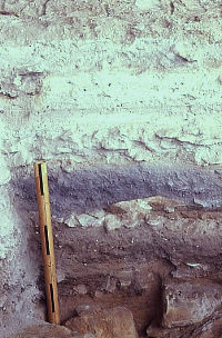
Profile of test pit at Fate
Bell Shelter. While the upper sediments just above
the improvised photographic scale (marked with
1-foot intervals) were badly churned up by looters,
the lower deposits in this area of the shelter
were still intact. Photo from ANRA-NPS archives
at TARL. |
In 1965, archeologists used
a backhoe at the Devil's Mouth site in an unsuccessful
attempt to cut deep trenches into the terrace.
The machine they had proved inadequate to the
task. ANRA-NPS archives at TARL. |
Archeologist holds stadia
rod while mapping the completed trenches at the
Doss site, a burned rock midden. The fist-sized
rocks visible in the trench walls are fire-cracked
fragments of limestone cobbles used in plant baking.
ANRA-NPS archives at TARL. |
The importance of this first NSF-funded paleoenvironmental study cannot be over emphasized. It set in motion a chain of events that would eventually earmark the Amistad region as being one of the best-understood areas in Texas. |
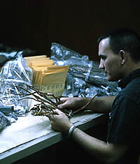
Vaughn M . Bryant studies
the plant remains from the Perry Calk site in
the TASP laboratory in 1968. As a graduate student
at UT Austin, Bryant was a key participant in
the NSF Paleoecology project and went on to become
a palynologist (pollen expert) and anthropology
professor at Texas A&M.
During the 1968 labwork,
Bryant attempted to identify and sort each plant fragment
by species, plant part (stalk, seeds, etc.), and
any evidence of human modification (burning, chewing,
cutting, etc.). Such information reveals how the
site's inhabitants used the local landscape, what
they ate, and how they used plants to make tools,
clothing, bedding, and meet many other daily needs
of hunter-gatherer life. Plant remains also reflect
the prevailing ecological and climatic conditions.
Photo from ANRA-NPS archives at TARL.
|
At Arenosa Shelter, the dark-colored
cultural layers were separated by intervening
light-colored flood deposits, creating a textbook
example of ideal archeological and geological
stratigraphy. Photo from ANRA-NPS archives at
TARL. |
The deep deposits at Arenosa
Shelter alternated between dark gray cultural
deposits and lighter, tan, flood deposits. In
the far background, the Pecos River joins the Rio
Grande. Photo from ANRA-NPS archives at TARL. |
The large burned rock midden
at the Javelina Bluff site is visible here—the
low mound of scattered white and gray limestone
rocks in the foreground of the photo. In the background
are buildings associated with a small hydro-electric
dam on the Devils River. Photo from ANRA-NPS archives
at TARL. |
Mechanical trenching underway
in 1967 at the Devil's Mouth site. Here a front-end
loader is being used to remove overburden in an
attempt to understand the stratigraphic relationships
between the deeper layers exposed in several separate
excavation blocks dug in 1962. Photo by E. Mott
Davis, TARL archives. |
Test excavations in progress
at the Nopal Terrace site in 1965. This photo
was taken from the bluff above the site. ANRA-NPS
archives at TARL. |
Testing underway at the Perry
Calk site in 1967. Photo from ANRA-NPS archives
at TARL. |
Archeologists studying a small
layer of plant fiber they have just exposed at
the Perry Calk site during 1967 testing. A great
many similar layers were present within the dry
deposits in most of the intact rockshelters at
Amistad. Photo from ANRA-NPS archives at TARL. |
View of the 1968 excavations
in progress at Conejo Shelter. Photo from ANRA-NPS
archives at TARL. |
The Late Pleistocene animal
bones exposed in the lower deposits at Cueva Quebrada
in 1968. The site's bone assemblage included those
of many now-extinct Ice Age species including
horse, camel, and mountain deer. There was no
convincing evidence of any human involvement.
The animals were probably killed or scavenged
by a predator such as the short-faced bear, whose
bones were also found in the shelter. Many of
the bones were burned, although it is not known if the fire was natural or cultural. Photo from ANRA-NPS archives
at TARL. |
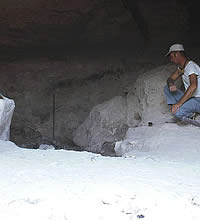
Frank Eddy, who had just become the new director of the Texas Archeological Salvage Project, peers into the
excavation units at the back of Cueva Quebrada
where deposits of Late Pleistocene animal bones
were encountered. Photo from ANRA-NPS archives
at TARL. |
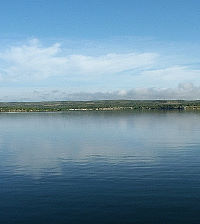
Today the fluctuating waters of Amistad Reservoir cover most of the archeological sites studied from 1959-1969. The Devil's Mouth site lies deep beneath the lake surface in the area shown here. October 2004 photo by Steve Black. |
|
|
|